Flash Flooding Heavy Rain New Jersey Hudson Valley
to Southern New England Long Island & NYC
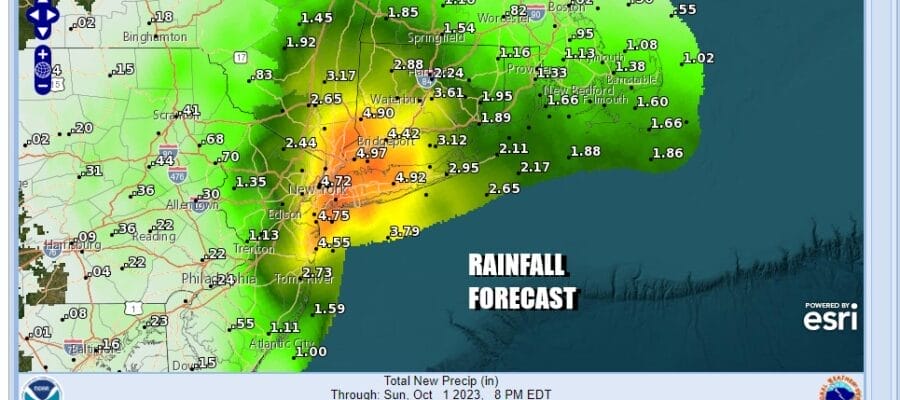
Low pressure offshore and a strong trough that extends northward into Southeastern NY is producing widespread heavy rains across much of Northern New Jersey, New York City, Long Island, the Hudson Valley and into Connecticut. Numerous flood warnings have already been issued and this is going to continue throughout Friday and into Friday night.
SATELLITE WITH LIGHTNING STRIKES
WEATHER RADAR
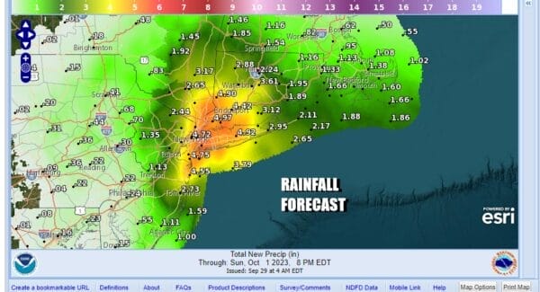
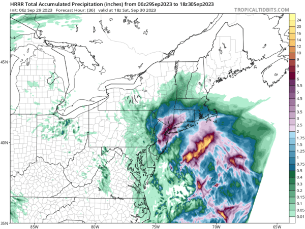
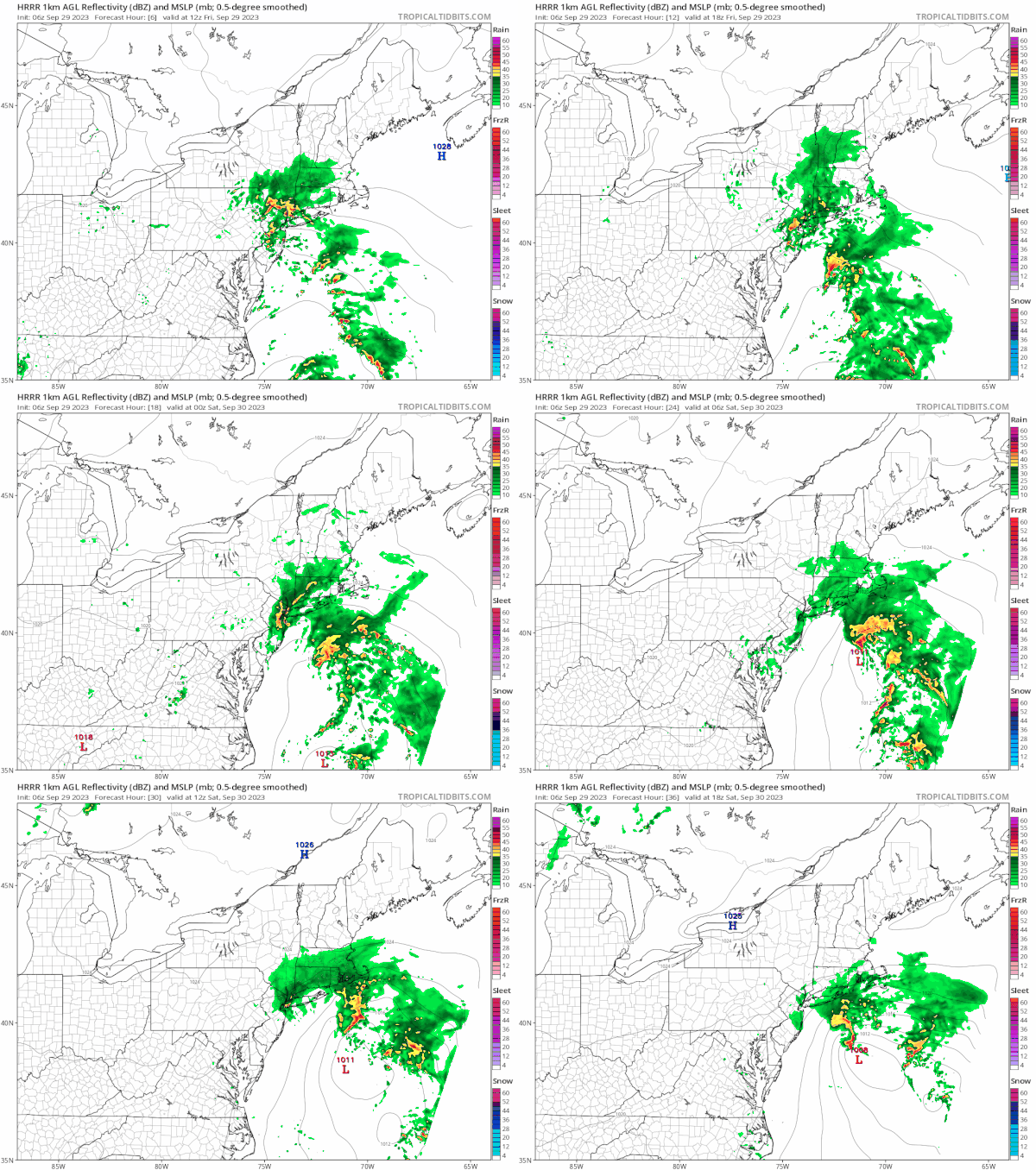
The HRRR short range model shows bands of heaving rain continuing tonight into Saturday morning. Forecast rain amounts of up to 6 inches are possible in and around NYC and Western Long Island while much of the area sees 4 inch plus rains and this will trigger off flash flooding in many areas including areas where infrastructure can normally handle heavy rainfall.
We still expect weather conditions to being to improve Saturday afternoon and much better weather is in store for Sunday as high pressure builds in from the west. We will see sunshine and temperatures in the 70s for Sunday and no rain is forecast for all of next week. Longer range the next cold front will likely arrive sometime next weekend and this will usher in a big change in the weather pattern in the Eastern US. We will speak more to this in our long range outlook later today.
BE SURE TO DOWNLOAD THE FREE METEOROLOGIST JOE CIOFFI WEATHER APP &
ANGRY BEN’S FREE WEATHER APP “THE ANGRY WEATHERMAN!
MANY THANKS TO TROPICAL TIDBITS FOR THE USE OF MAPS
Please note that with regards to any severe weather, tropical storms, or hurricanes, should a storm be threatening, please consult your local National Weather Service office or your local government officials about what action you should be taking to protect life and property.
(Amazon is an affilate of Meteorologist Joe Cioffi & earns commissions on sales.)

