
Flash Flood Watch Thunderstorms Developing
Flash Flood Watch Thunderstorms Developing
Locally Heavy Rains Possible
We are beginning to see some thunderstorms developing in the early afternoon. If you have been outside you can cut the air with a knife. Humidity levels are very high and the air is saturated with warm tropical air. We still managed to hit the upper 80s to around 90 in many areas. Now that clouds are developing everywhere temperatures won’t go much higher and thunderstorms as they develop will begin to cool things down. Dew points are in the upper 60s to some lower 70s so the atmosphere is ripe.
12 NOON TEMPERATURES
CITY           SKY/WX    TMP DP  RH WIND       PRES   REMARKS
CENTRAL PARK   MOSUNNY   86  70  58 VRB7      29.81S HX  90
LAGUARDIA APRT PTSUNNY   92  67  43 S13       29.77S HX  95
KENNEDY INTL   PTSUNNY   85  73  67 S10       29.80S HX  91
NEWARK/LIBERTY PTSUNNY   90  68  48 SW13      29.77S HX  94
BRNX BOT. GARD   N/A     90  66  45 SW7       29.78F HX  92
TETERBORO      MOSUNNY   90  67  46 S12       29.76S HX  93
$$

NYZ177-179-078>081-071700-
LONG ISLAND NEW YORK

CITY           SKY/WX    TMP DP  RH WIND       PRES   REMARKS
FARMINGDALE    SUNNY     85  73  67 S12       29.80S HX  91
ISLIP          MOSUNNY   85  73  67 S12       29.79F HX  91
SHIRLEY        SUNNY     83  74  74 S12       29.81S
RIVERHEAD        N/A     88  77  70 SW3       29.78F HX 100
WESTHAMPTON    SUNNY     80  72  76 S8        29.82F
SOUTHAMPTON      N/A     75  73  94 S9        29.77F
BRIDGEHAMPTON    N/A     81  73  78 S2        29.66F
EAST HAMPTON   FAIR      79  73  82 SW7       29.80F
MONTAUK POINT    N/A     80  74  81 VRB6      29.82S
$$

NYZ052-065-067-071700-
HUDSON VALLEY

CITY           SKY/WX    TMP DP  RH WIND       PRES   REMARKS
WHITE PLAINS   MOSUNNY   86  71  60 S10       29.80R HX  91
NEWBURGH       PTSUNNY   86  75  70 W8        29.80S HX  95
MONTGOMERY     CLOUDY    85  73  67 W7        29.78R HX  91
POUGHKEEPSIE   PTSUNNY   90  72  55 W7        29.76R HX  97
ALBANY         CLOUDY    81  70  69 S10       29.77R
$$

NJZ001-105-106-008-010-013-015-019>022-104-071700-
NEW JERSEY

CITY           SKY/WX    TMP DP  RH WIND       PRES   REMARKS
NEWARK/LIBERTY PTSUNNY   90  68  48 SW13      29.77S HX  94
TETERBORO      MOSUNNY   90  67  46 S12       29.76S HX  93
CALDWELL       MOSUNNY   90  68  48 SW8       29.79R HX  94
MORRISTOWN     PTSUNNY   88  70  55 W10       29.79S HX  92
SOMERVILLE     SUNNY     91  70  49 VRB3      29.77S HX  96
SUSSEX         MOSUNNY   89  70  53 VRB6G16   29.79R HX  94
ANDOVER          N/A     88  71  57 MISG      29.81R HX  94
TRENTON        MOSUNNY   91  68  46 W10       29.78F HX  95
MILLVILLE      SUNNY     89  74  60 VRB6      29.81S HX  98
ATLANTIC CITY  PTSUNNY   90  70  51 SW9       29.80F HX  95
WRIGHTSTOWN    NOT AVBL
TOMS RIVER     MOSUNNY   92  68  45 W6        29.80S HX  96
BELMAR         MOSUNNY   91  70  49 SW10      29.80F HX  96
$$
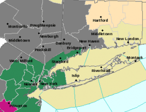
Flash Flood Watch Thunderstorms Developing Regional Radar

Flash Flood Watch Thunderstorms Developing Local Radars


Flash Flood Watch Thunderstorms Developing
Outlook for This Afternoon
Look for thunderstorm activity to increase into this evening. Not everyone will participate and rain amounts are going to vary widely. Models are all over the place and frankly they are kind of useless at this point. So we will watch and wait.
CHECK THE LATEST WARNINGS AS THEY ARE ISSUED ON THE SCROLLING FEEDS ON THE HOME PAGE
Flash Flood Watch Thunderstorms Latest Video Analysis
[brid video=”52309″ player=”6390″ title=”Thunderstorms Thursday 07072016″]
JOESTRADAMUS HURRICANE SEASON GUEST FORECAST
FiOS1 News Weather Forecast For Long Island
FiOS1 News Weather Forecast For New Jersey
FiOS1 News Weather Forecast For Hudson Valley
NATIONAL WEATHER SERVICE SNOW FORECASTS
LATEST JOESTRADAMUS ON THE LONG RANGE
Weather App

Don’t be without Meteorologist Joe Cioffi’s weather app. It is really a meteorologist app because you get my forecasts and my analysis and not some automated computer generated forecast based on the GFS model. This is why your app forecast changes every 6 hours. It is model driven with no human input at all. It gives you an icon, a temperature and no insight whatsoever.
It is a complete weather app to suit your forecast needs. All the weather information you need is right on your phone. Android or I-phone, use it to keep track of all the latest weather information and forecasts. This weather app is also free of advertising so you don’t have to worry about security issues with your device. An accurate forecast and no worries that your device is being compromised.
Use it in conjunction with my website and my facebook and twitter and you have complete weather coverage of all the latest weather and the long range outlook. The website has been redone and upgraded. Its easy to use and everything is archived so you can see how well Joe does or doesn’t do when it comes to forecasts and outlooks.
Just click on the google play button or the apple store button on the sidebar for my app which is on My Weather Concierge. Download the app for free. Subscribe to my forecasts on an ad free environment for just 99 cents a month.
Get my forecasts in the palm of your hand for less than the cost of a cup of Joe!
![]()

MENTION JOE CIOFFI AND GET A 5% DISCOUNT


