Flash Flood Watch Inland Severe Weather Risk Showers Thunderstorms Tonight

Weather in 5/Joe & Joe Weather Show Latest Podcast
Flash Flood Watch Inland Severe Weather Risk Showers Thunderstorms Tonight
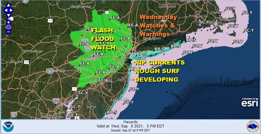
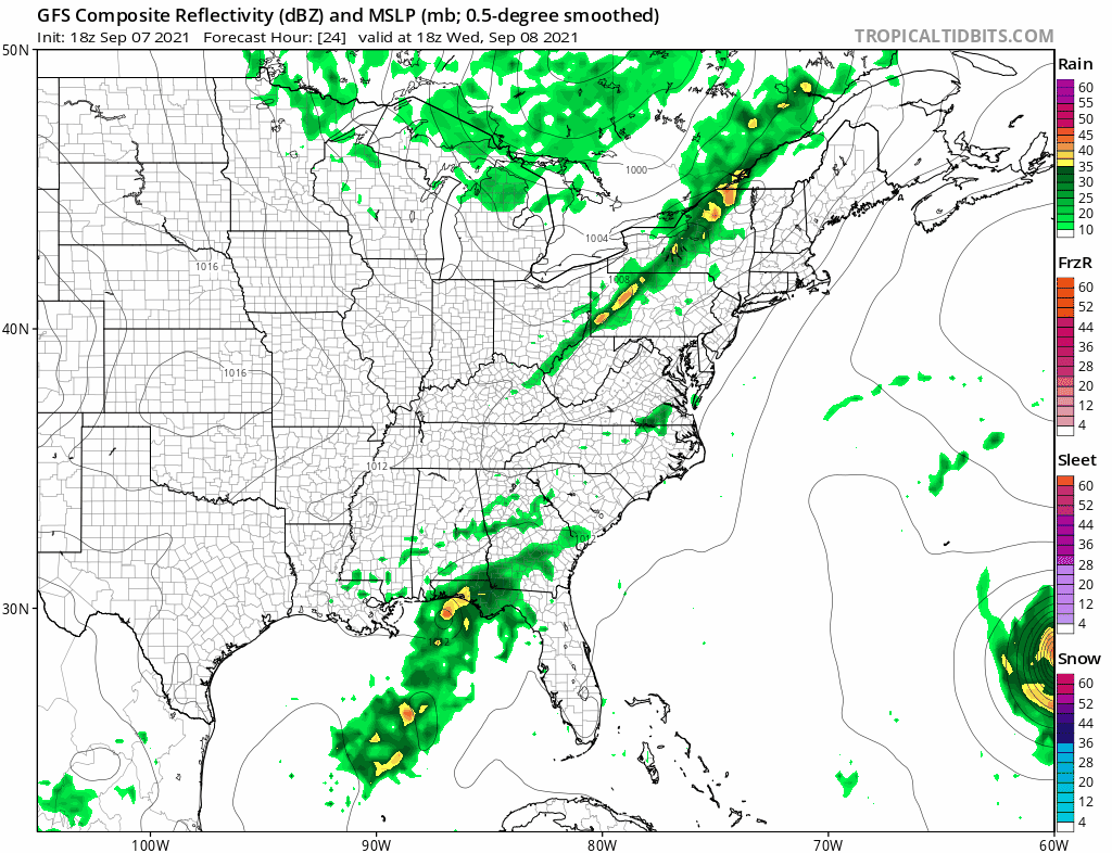
A Flash Flood Watch is in effect for Northern New Jersey, the Lower Hudson Valley east of the Hudson River, and Eastern Pennsylvania. These areas are the most vulnerable to flash flooding as rivers and streams remain very high and the ground remains very saturated. This is not going to be a widespread heavy rain where everyone is getting clobbered at the same time. The issue is that the threshold for flooding is very low and all it will take is one thunderstorm to produce as little as an inch of rain in a short period of time to trigger a flooding episode.
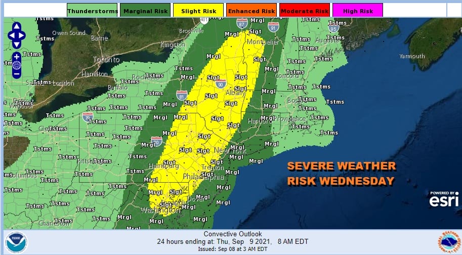
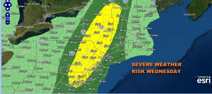
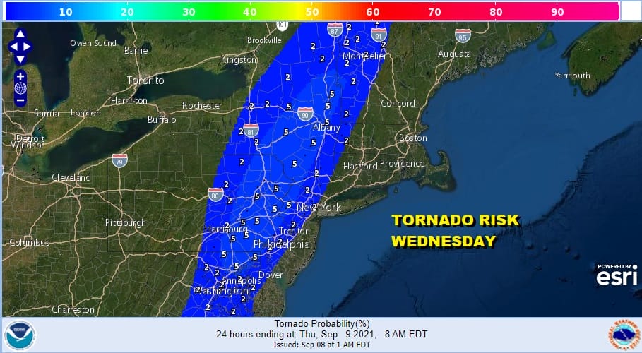
This is coming with severe weather risk which matches up with the flash flood watch area. Also matching up with these hazards is tornado risk and it is high at 5% inside the slight risk zone. The Storm Prediction Center has expanded the slight risk area southward into Northeast Virginia on the southern flank and northward into Northwestern New England on the northern flank.
Meanwhile ahead of all this today not much will happen other than a scattered shower or thunderstorm that could pop up inland this afternoon. The main action will be tonight as the front heads east. So today is a warm and more humid day with sunshine and some patchy clouds. Highs will reach into the 80s as dew points climb into the 60s. Nothing is close by on the radar so for most of you the dayside will be dry.
SATELLITE


The timing means that the front is taking longer to get here and therefore will take longer to get out of the way. Thunderstorms arrive tonight in a north south line and probably won’t arrive into Eastern Pennsylvania until 8pm and not reach the coast until midnight. This thunderstorm threat is going to be for the overnight period as opposed to the late afternoon and evening variety. The NAM loop is from 8pm tonight to 1pm Thursday.

The front slows as it reaches the coast thanks to Hurricane Larry which will be approaching Bermuda but the core passes about 150-200 miles to the east of the island. The front is waiting for the upper trough to swing into New England and pick Larry up and take it to the northeast away from the coast. Clouds will likely linger on Thursday. Some showers will probably linger over parts of Long Island and Southern New England but weather conditions could improve to the west in New Jersey and points west and southwest Thursday. Highs will be much cooler with temperatures just into the 70s.
Friday will be nice and sunny as high pressure builds in from the west and heads for the coast. Highs will be cool, just in the 70s. Humidity levels will be low into the weekend with sunshine Saturday. Highs in the mid 70s to near 80. Sunday with the high offshore and a west southwest flow sunshine will take highs into the 80s with the humidity levels coming up a bit. Overall a dry weekend is in the cards.
BE SURE TO DOWNLOAD THE FREE METEOROLOGIST JOE CIOFFI WEATHER APP &
ANGRY BEN’S FREE WEATHER APP “THE ANGRY WEATHERMAN!

MANY THANKS TO TROPICAL TIDBITS & F5 WEATHER FOR THE USE OF MAPS
Please note that with regards to any severe weather, tropical storms, or hurricanes, should a storm be threatening, please consult your local National Weather Service office or your local government officials about what action you should be taking to protect life and property.


