Fighting Low Clouds On Memorial Day Warmer Weather Begins Tuesday
Today should have turned out to be the better day of the entire holiday weekend. Instead it seems yesterday will take the prize for best day for most (but not all) as we woke up this morning to lots of low clouds and even a few showers that came in from off the ocean and moved over parts of Long Island and Southern New England. Temperatures are in the low 60s at midday and it is hard to see how we will get any kind of sunshine this afternoon judging from the satellite picture. Weak low pressure is offshore. Some breaks of sunshine are occurring over Northeastern Pennsylvania but unlike yesterday there are clouds up in New England rather than dry air. While it is not likely to rain this afternoon or evening, the gray gloom seems to want to hang on through this evening at least.
SATELLITE
REGIONAL RADAR
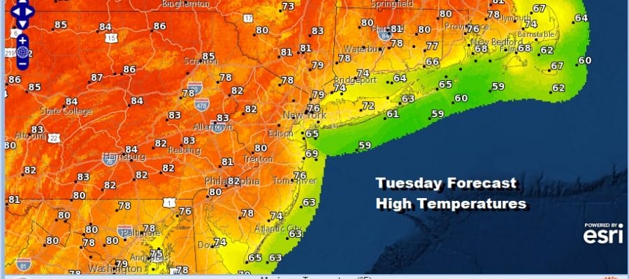
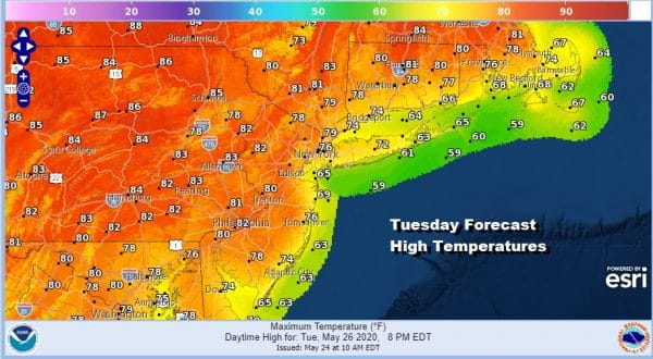
A small cluster of shower is moving into the Catskills otherwise the regional and local radars are quiet at midday. We do have a warmer weather pattern to look forward to this week beginning Tuesday when we should see some sunshine and the onshore flow is weak. The coastal low should be long gone. Highs will reach the 80s away from the ocean. Most highs along the coast will be in the 70s with 60s at the beaches.
We can safely say wash rinse repeat for Wednesday and Thursday with some sunshine both days. High again along the coast will be in the 70s with 60s at the beaches while inland and west of the coast highs should reach into the 80s.
Friday a cold front nears and with it some scattered showers and thunderstorms well inland but we may have to wait until Saturday for the front to move through. That will set us up for a good chance for showers and thunderstorms Saturday afternoon and evening.
That is a rather solid looking high behind it and there is going to be a strong upper trough swinging through the Northeast US with this front. This will likely mean some strong thunderstorms in the mix on Saturday as the front passes. That trough will likely strengthen a bit bringing rather cool air (for this time of year) next Sunday and Monday.
BE SURE TO DOWNLOAD THE FREE METEOROLOGIST JOE CIOFFI WEATHER APP &
ANGRY BEN’S FREE WEATHER APP “THE ANGRY WEATHERMAN!
MANY THANKS TO TROPICAL TIDBITS FOR THE USE OF MAPS
Please note that with regards to any severe weather, tropical storms, or hurricanes, should a storm be threatening, please consult your local National Weather Service office or your local government officials about what action you should be taking to protect life and property.


