Dry Monday Ahead of a Mostly Gloom & Doom Week
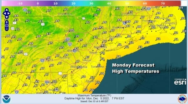
The best thing we can say about today is that it is a Monday and it will probably be the best weather day this week. Skies were clear overnight and are mostly clear overhead today and that will mean sunshine. Perhaps a few high clouds coming in from the west and south could get into the mix later today but it won’t take away from what will be a nice rain free day. Highs today after the cold start will reach the upper 40s and a few spots might even break above 50 degrees. There is nothing to concern ourselves with on the radar.
SATELLITE

WEATHER RADAR

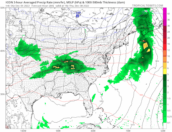
The pattern has been one of cold front after cold front for the last few weeks and that is now going to change as the last one of these fronts approaches very slowly from the west. This will bring in some clouds overnight and we look ahead to some rain or showers developing during Tuesday.
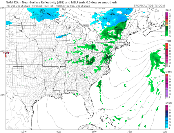
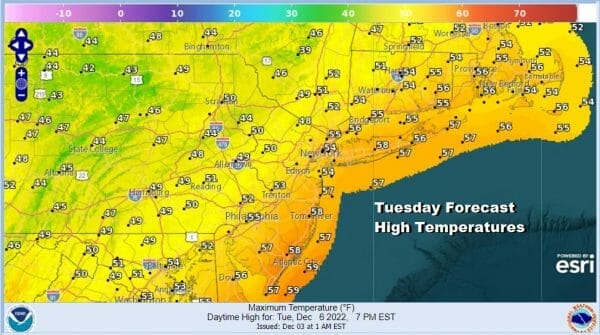
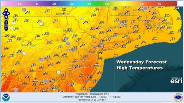
The slow movement of the front is being caused by a low south of Bermuda on the lower right of the NAM model loop. This at least allows the rain area to get enhanced a bit as the front edges closer Tuesday night into early Wednesday. It will also be on the warm side both Tuesday and Wednesday. Highs will reach the upper 50s to some lower 60s both days.
Wednesday we will likely see lots of leftover clouds around. I’m not sure we will see much clearing of skies once the front passes as the dry push from high pressure from the north is not particularly impressive. The front will stall out across the Mid Atlantic and back to the Tennessee Valley. Another wave of low pressure will develop and head northeastward to the Ohio Valley. It will be running headlong into a blocking high to the north and that should force the wave to pass to our south.
We are leaning more to the models that show a suppressed look like the ICON/European model idea of a low that basically gets forced south. For now we will go with the idea of lots of clouds Thursday and Friday and keep an eye on the low to the south in case it decides to move northeast into the blocking high to the north. The blocking pattern will be the dominating force for the next few weeks and will likely make for interesting weather developments going forward. Temperatures will be trending downward late in the week.
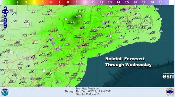
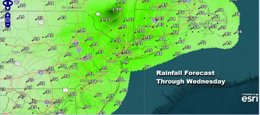
As far as rainfall goes with the cold front, we see anywhere from a half inch to an inch of total rainfall later Tuesday into Wednesday.
BE SURE TO DOWNLOAD THE FREE METEOROLOGIST JOE CIOFFI WEATHER APP &
ANGRY BEN’S FREE WEATHER APP “THE ANGRY WEATHERMAN!
MANY THANKS TO TROPICAL TIDBITS & F5 WEATHER FOR THE USE OF MAPS
Please note that with regards to any severe weather, tropical storms, or hurricanes, should a storm be threatening, please consult your local National Weather Service office or your local government officials about what action you should be taking to protect life and property.


