Cool Friday Onshore Flow Weekend Outlook Warmer Into Monday
Cool dry air has moved southward from New England thanks to high pressure building southward from Maine and a cold front that passed through yesterday. That front now sits in southern Virginia. As the day wears on the dry clear skies form NYC north and east will bleed southward so from Northern New Jersey & NYC north and east it is a partly to mostly sunny day while to the south we will see decreasing clouds and increasing sunshine as the day wears on. There are no rain issues today or tonight on the regional and local radars.
SATELLITE

REGIONAL RADAR

The big change today is in the temperatures. We hit bottom in the 50s in many areas this morning and highs this afternoon will be mostly in the 60s. The warmest spots will see highs close to 70. It will be a very nice late summer day with an autumn like feeling. Tonight is a full moon which is a harvest moon on a Friday the 13th. Given the weather today luck is on our side.

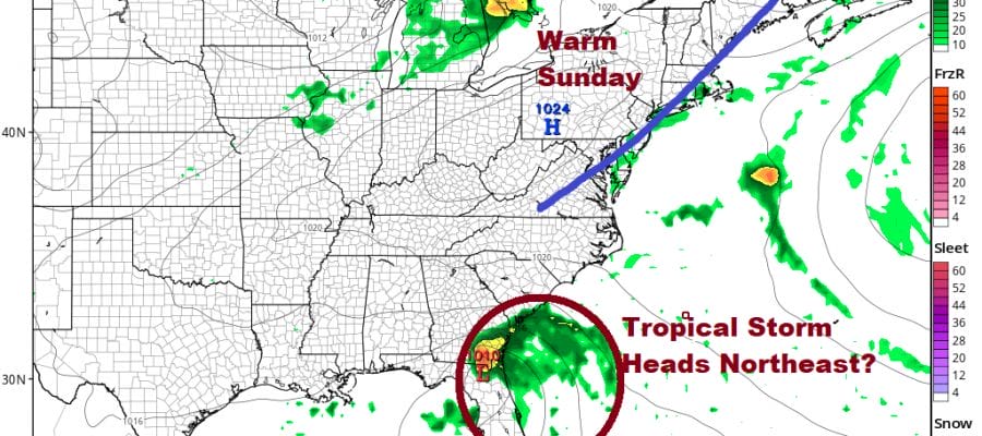
Tonight will be a clear night and a cool night with lows in the 50s to near 60. The weekend sees a repeat of what we just went through. Cold front passes, onshore flow follows & relaxes, we warm up into another cold front, onshore flow follows…wash rinse repeat. Saturday the onshore flow relaxes and winds start to turn more to the south and then southwest.
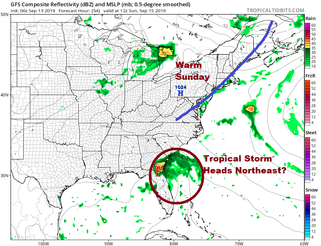
Clouds return Saturday with highs in the 70s. Watch for a shower or thunderstorm Saturday night and then sunshine warmer and more humid conditions arrive on Sunday with highs reaching into the 80s. Monday will be warm and humid with some sunshine with highs in the low to mid 80s followed by another cold front Monday evening. Then it is back to an onshore flow and cooler air on Tuesday. One common thread throughout this pattern is that we will not see very much if any rain over the next 5 days. Meanwhile to the south we will see either a tropical depression or a tropical storm somewhere near or just off the Florida east coast. We will deal with that separate with a post later today.
MANY THANKS TO TROPICAL TIDBITS FOR THE USE OF MAPS
Please note that with regards to any tropical storms or hurricanes, should a storm be threatening, please consult your local National Weather Service office or your local government officials about what action you should be taking to protect life and property.


