Coldest Morning of Autumn So Far Dry Weather Ahead No Major Storms

Weather in 5/Joe & Joe Weather Show Latest Podcast
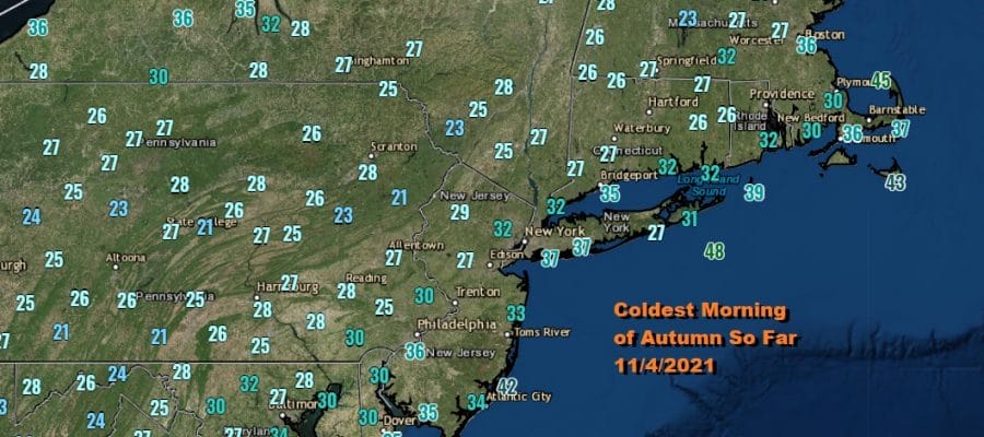
Coldest Morning of Autumn So Far Dry Weather Ahead No Major Storms
This morning was a cold one with widespread frosts and freezes across the area. It is certainly the coldest morning of the Autumn season so far and it puts an end of the growing season with the exception of the warmer urban centers which managed to stay above freezing overnight.

We are headed for the upper 40s and lower 50s with sunshine this afternoon. The satellite shows high clouds lying to our south across Southern New Jersey and points southward. This is due to the first of two waves of low pressure that will be moving off the southeast coast of the US and taking any precipitation to our south. These leaves us in a good position for the weekend which will be dry and nice.
SATELLITE

WEATHER RADAR

We are headed for another cold night tonight into Friday morning and morning lows will likely be similar to what we saw this morning. Inland areas will see lows in the 20s and warmer urban locations will hold up in the 30s. Friday looks like a nice day with sunshine taking highs to the upper 40s and lower 50s.
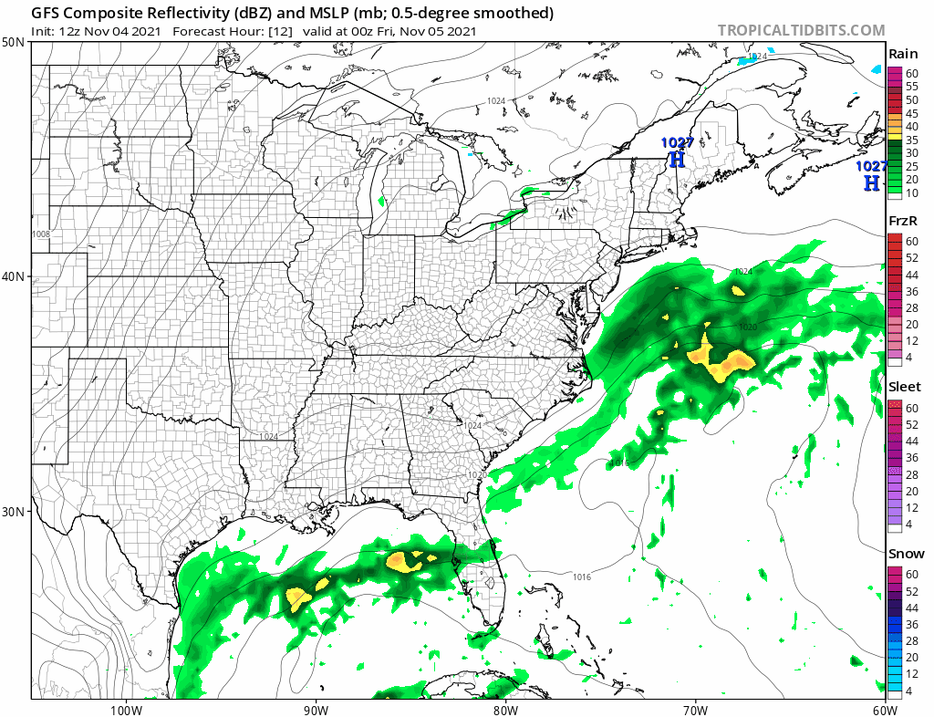
Saturday will be a nice sunny day. We will see temperatures bounce up a little higher. High pressure will be right overhead. Highs will reach the low and middle 50s. Sunday the second wave off the Southeast US coast will be moving offshore. Rain from this system will reach the coastal Carolinas north to the Delmarva Peninsula. This probably means we will have some high clouds along with some sunshine. Highs will be in the mid to upper 50s with a wind off the ocean.

Next week starts off dry. A weak ridge builds along the East Coast and that will allow temperatures to bounce a little higher. We will be back into the 60s Monday and at least low to mid 60s Tuesday so we will be a little above average until the next cold front arrives. A weak front arrives Tuesday with not much with it. A stronger front arrives late next week with some showers but that is a long ways away.
BE SURE TO DOWNLOAD THE FREE METEOROLOGIST JOE CIOFFI WEATHER APP &
ANGRY BEN’S FREE WEATHER APP “THE ANGRY WEATHERMAN!

MANY THANKS TO TROPICAL TIDBITS & F5 WEATHER FOR THE USE OF MAPS
Please note that with regards to any severe weather, tropical storms, or hurricanes, should a storm be threatening, please consult your local National Weather Service office or your local government officials about what action you should be taking to protect life and property.


