Cold Week Ahead Snow & Rain Showers Late Wednesday Into Thursday
Record Lake Effect Snow Continues Upstate NY

Cold Week Ahead Snow & Rain Showers Late Wednesday Into Thursday
Record Lake Effect Snow Continues Upstate NY
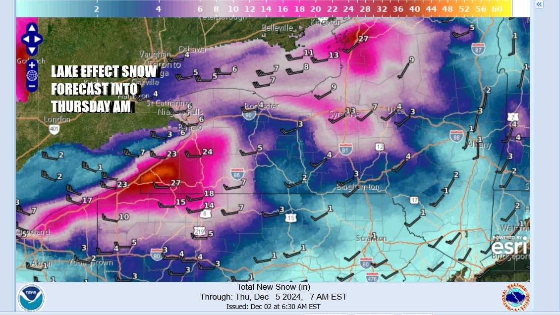
Our stretch of cold weather continues this week and we have 2 systems that will be diving southeast from Canada and passing to our north. The first will be Wednesday night into Thursday morning. The second will move through Saturday night and Sunday morning. Today sees sunshine from Maine to Florida and it is cold up and down the Eastern Seaboard. Lake effect snows continue in Northeast Ohio, Northwest PA, Southwest and North Central NY into early Tuesday. Another foot or two is possible in these areas bringing totals to over 60 to 70 inches in many locations.
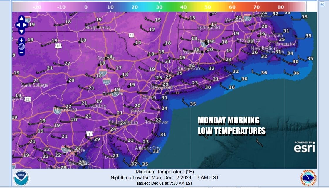
In Eastern Pennsylvania to Southern New England this morning we saw widespread lows in the teens and 20s. Daytime highs this afternoon with no worse than partly sunny skies will reach the mid and upper 30s. Some warm spots might get close to 40. Then it is back down to the teens and 20s Tuesday morning.
SATELLITE WITH LIGHTNING STRIKES

WEATHER RADAR

Tuesday dayside will be partly to mostly sunny. The core of the cold air mass in the form of high pressure will be resting overhead. After the very cold start temperatures should make it back to the upper 30s to near 40 degrees once again. Then it is down to the teens and 20s Wednesday morning for lows.

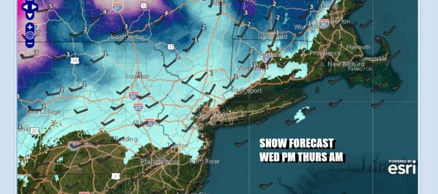
Wednesday we watch that first low pressure system moving eastward and it will be strengthening across Southeastern Canada. The low tracking to the north leaves the area with a warm front/cold front scenario where we see some snow showers develop Wednesday evening and then followed by some rain showers near the coast Wednesday night into Thursday morning. This is not going to be a big precipitation producer. Clouds Wednesday will hold temperatures down initially and then temperatures will rise to the mid and upper 30s north and west of the coast and low to mid 40s Long Island to South Jersey and those highs probably are reached during the late evening hours.

Once the fronts pass the Lake Effect snow machine fires up again Wednesday night into Thursday night while along the coast we are going to see clouds and some sun Thursday with leftover 40s for highs and then temperatures head down for Thursday night and Friday. Friday will be very cold with highs mostly in the mid to upper 30s with sunshine. Over the weekend the second diver comes through with a cold front Saturday night into Sunday morning. A quick warm up ahead of it and then a little colder behind it is what we expect with some rain and snow showers in between,
BE SURE TO DOWNLOAD THE FREE METEOROLOGIST JOE CIOFFI WEATHER APP &
ANGRY BEN’S FREE WEATHER APP “THE ANGRY WEATHERMAN!
MANY THANKS TO TROPICAL TIDBITS FOR THE USE OF MAPS
Please note that with regards to any severe weather, tropical storms, or hurricanes, should a storm be threatening, please consult your local National Weather Service office or your local government officials about what action you should be taking to protect life and property.


