Cold Rain Coast Winter Weather Advisories Winter Storm Warnings Well Inland, Week Ahead Outlook

Cold Rain Coast Winter Weather Advisories Winter Storm Warnings Well Inland, Week Ahead Outlook
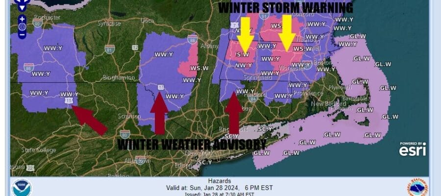
The 4th weather system in a week is with us on this Sunday making for a miserable day of rain and cold temperatures in the 30s along the coast. Inland we have elevated areas that area under various Winter Weather Advisories and Winter Storm Warnings but these conditions are generally for areas north of Route 84 in New York State and New England. This is going to be an elevation driven snowfall.
For most folks today from Eastern Pennsylvania to Southern New England this will be a rain event. Areas just inland of the coast might see some sleet or wet snow flakes mix in from time to time. Areas that see accumulation in the Lower Hudson Valley south of Route 84 are likely to see it only on the coldest of surfaces and not on roads. Then we get into the elevated areas 750 to 1000 ft or higher where we will likely see several inches of accumulation. Areas under Winter Storm Warnings will likely see 4 to 8 inches of heavy wet snow.
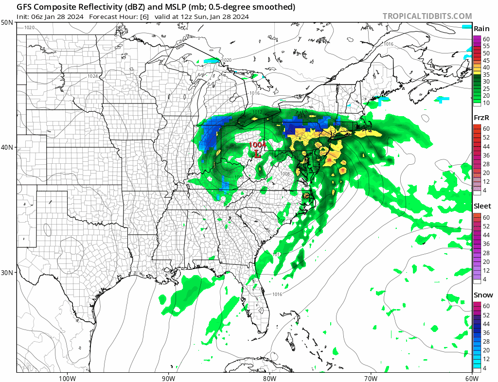
WEATHER RADAR

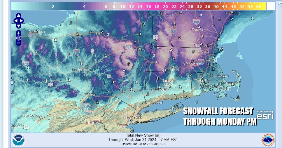
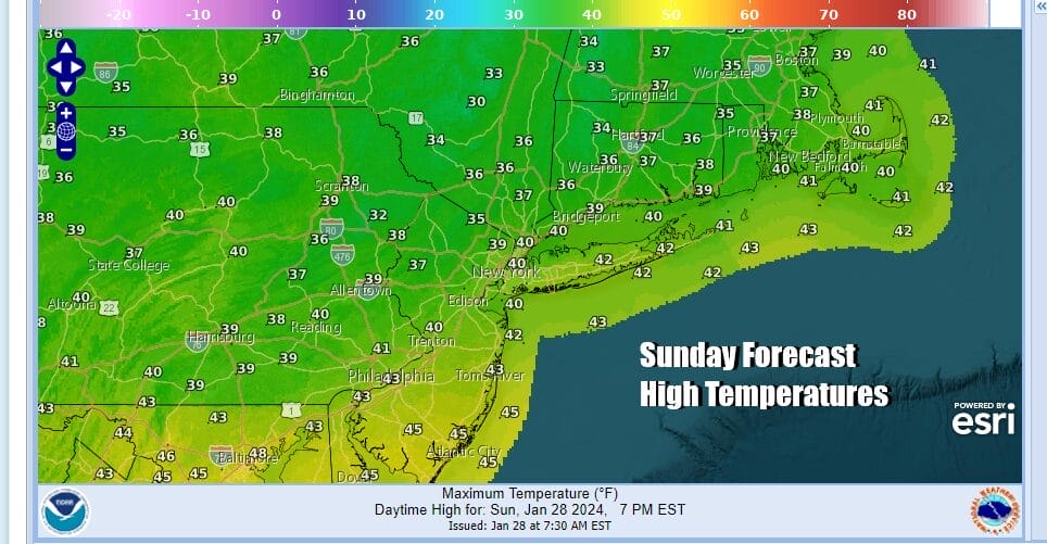
Radars are loaded up with patches of moderate rain and on the northern flank we have sleet and wet snow. Rainfall amounts will be on the order of a half inch to as much as 1 inch in some places. Temperatures today area likely to hold in the 30s except for perhaps area in South Jersey and Southeastern Pennsylvania where highs will be in the lower 40s.
We likely to see a bit of a dry slot in the rain moving northward up the coast this afternoon and then rain coast and snow inland will redevelop though I think the heaviest precipitation will be during the day Sunday and lighter rain and snow will tonight into Monday morning. Low pressure will move to the east Monday with precipitation ending and leftover clouds to follow. Most highs Monday will be in the mid 30s to around 40 degrees.
Tuesday will be a chilly day as high pressure holds in New England as low pressure and an area of snow and rain move southeast from Ohio to the Mid Atlantic states. We are looking and clouds around Tuesday with highs mostly in the 30s. This low is going to move east and offshore and of no consequence really other than some light snow or rain moving over parts of Maryland, Virginia, and North Carolina. Later this week we will see a cold front move through the Eastern US with a cold air mass coming in this weekend. However from the standpoint of storm systems, it looks to be rather quiet once today’s storm system is done.
BE SURE TO DOWNLOAD THE FREE METEOROLOGIST JOE CIOFFI WEATHER APP &
ANGRY BEN’S FREE WEATHER APP “THE ANGRY WEATHERMAN!
MANY THANKS TO TROPICAL TIDBITS FOR THE USE OF MAPS
Please note that with regards to any severe weather, tropical storms, or hurricanes, should a storm be threatening, please consult your local National Weather Service office or your local government officials about what action you should be taking to protect life and property.
(Amazon is an affilate of Meteorologist Joe Cioffi & earns commissions on sales.)


