Cold Air & Gusty Winds Moving In

Cold Air & Gusty Winds Moving In
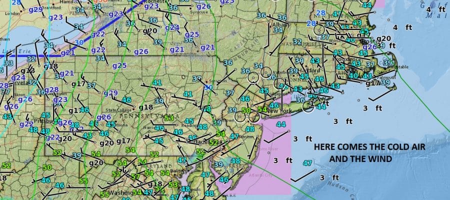
Judging from the surface map tonight we have a cold front about to move through with gusty northwest winds developing behind it and temperatures that will fall into the 30s tonight and probably stay in the 30s all day long on Wednesday. High pressure is driving southeastward from Canada. You see see the push of dry air on the satellite loop moving across the Midwest and heading into the Northeast. No precipitation is around except for some well north in Upstate NY tonight so the wind shift to the northwest comes through dry.
SATELLITE LOOP

REGIONAL RADAR

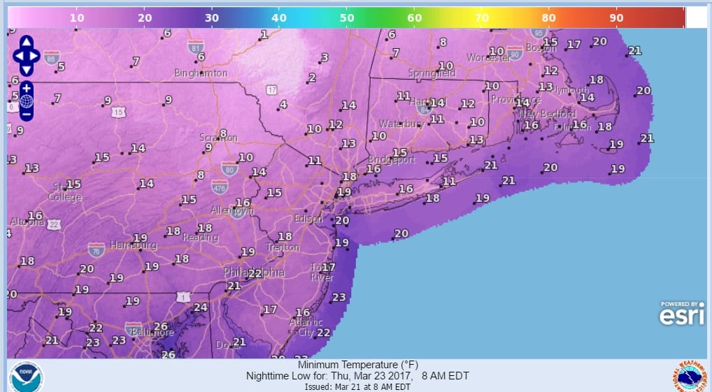
Wednesday and Thursday will be bright sunny days with minimal cloud cover but temperatures and wind will be the story Wednesday. Winds will make the 30s to near 40 feel like the 20s. Then Wednesday night into Thursday morning will be the coldest time with lows Thursday morning in the teens to lower 20s.
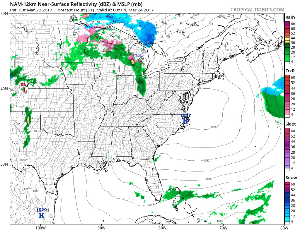
The high pressure cell moves off the Middle Atlantic Coast and the warm up begins but it appears that some precipitation will occur as we transition to warmer air. However the NAM model and others show much of it is light and goes by to our north. I’m not too concerned about anything frozen or freezing for inland areas as the southern end of the precipitation shield is light.
Friday should see temperatures move up through the 40s and into the 50s as the warm front approaches and move through. Saturday’s challenge is a cold front moving southward as another high builds down from Southeastern Canada and New England. Where the front winds up on Saturday will determine temperatures which will be 40s and 50s to the north of it and 60s & 70s to the south.

It looks like a chilly rain follows that on Sunday into Monday as low pressure moves from the Southern Plains to the Ohio Valley and redevelops to our south off the coast. The marine influence will keep temperatures just in the low to mid 40s Sunday and possibly Monday as well.
 GET JOE A CIGAR IF YOU LIKE

SNOW REMOVAL COMPANIES FOR YOUR WINTER NEEDS
LONG ISLAND ROCKLAND COUNTY Connecticut

![]()

ROCKLAND COUNTY TRI STATE SNOW REMOVAL JOHNSTOWN PA


FiOS1 News Weather Forecast For Long Island
FiOS1 News Weather Forecast For New Jersey
FiOS1 News Weather Forecast For Hudson Valley
NATIONAL WEATHER SERVICE SNOW FORECASTS
LATEST JOESTRADAMUS ON THE LONG RANGE
Weather App

Don’t be without Meteorologist Joe Cioffi’s weather app. It is really a meteorologist app because you get my forecasts and my analysis and not some automated computer generated forecast based on the GFS model. This is why your app forecast changes every 6 hours. It is model driven with no human input at all. It gives you an icon, a temperature and no insight whatsoever.
It is a complete weather app to suit your forecast needs. All the weather information you need is right on your phone. Android or I-phone, use it to keep track of all the latest weather information and forecasts. This weather app is also free of advertising so you don’t have to worry about security issues with your device. An accurate forecast and no worries that your device is being compromised.
Use it in conjunction with my website and my facebook and twitter and you have complete weather coverage of all the latest weather and the long range outlook. The website has been redone and upgraded. Its easy to use and everything is archived so you can see how well Joe does or doesn’t do when it comes to forecasts and outlooks.
Just click on the google play button or the apple store button on the sidebar for my app which is on My Weather Concierge. Download the app for free. Subscribe to my forecasts on an ad free environment for just 99 cents a month.
Get my forecasts in the palm of your hand for less than the cost of a cup of Joe!


