
Clouds Increase Overnight Downpours On & Off Next Several Days
Clouds Increase Overnight
Downpours On & Off Next Several Days
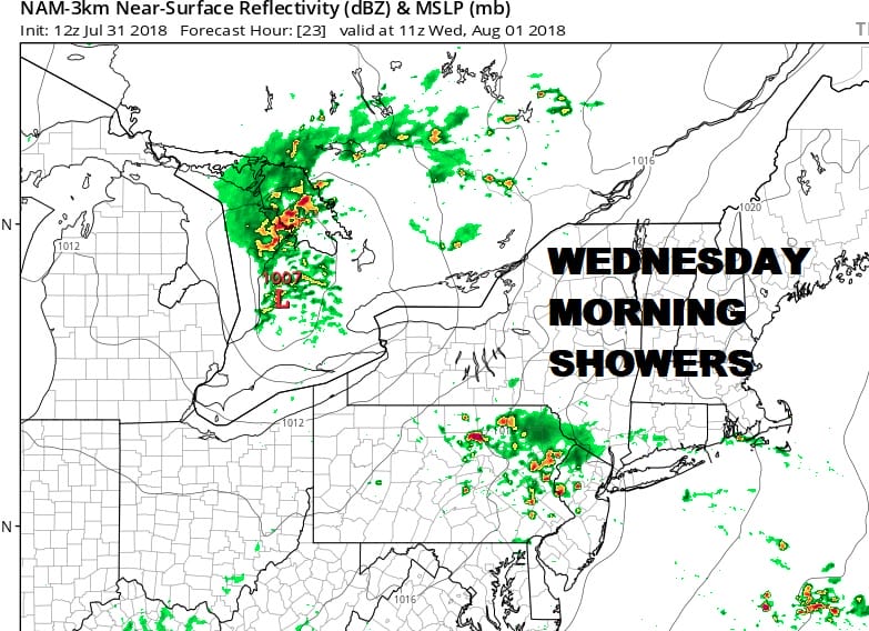
Just enough dry air came in from the northeast today to allow for at least some sunshine though clouds are close by and they will be increasing tonight. The tropical moisture flow takes hold over the next several days but unlike last week, the southerly flow is a bit stronger further west which means yes there will be downpours but there will also be dry stretches as well with some sun, and very warm and humid conditions as well. Some showers will arrive during the early morning hours on Wednesday from south to north. These don’t appear to be especially heavy.
EASTERN SATELLITE

REGIONAL RADAR

There isn’t much on the radars nearby at the moment though we are seeing an increase activity well to the south and west of us. How much of this holds together overnight is questionable. My suspicion is the bulk will pass to the west and north of the coast and will move in and out rather quickly. Local radars are showing some blips here and there but nothing to worry about for the evening commute.
LOCAL RADAR NEW YORK CITY

LOCAL RADAR PHILADELPHIA


Temperatures Wednesday will be in the 80s with higher humidity. Thursday through Saturday will be warm and humid with some passing showers or downpours. Highs will be in the 80s each day. We are still on track for some hot temperatures Sunday and Monday with some sunshine and the risk for a thunderstorm. Sunday and Monday highs will reach into the 90s. The next cold front isn’t due until a week from today with a better chance for thunderstorms and a bit of a break from the heat and humidity to follow.
Please note that with regards to any tropical storms or hurricanes, should a storm be threatening, please consult your local National Weather Service office or your local government officials about what action you should be taking to protect life and property.
 GET JOE A CIGAR IF YOU LIKE

LATEST JOESTRADAMUS ON THE LONG RANGE


