Christmas Eve Long Shot Chance Freezing Precipitation

Christmas Eve Long Shot Chance Freezing Precipitation
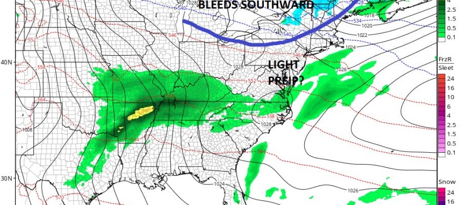
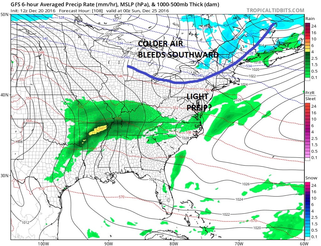
Weather models for the last couple of days have been showing an area of precipitation moving out of the Ohio Valley and moving east. At the same time a cold front will be dropping southward from Eastern Canada. The GFS model weakens the area of precipitation before it gets here. This would be for areas just inland of the coast from New York City west, north, and northeast including the Hudson Valley, Northwest New Jersey, Northeast Pennsylvania and Connecticut.
FREEZING PRECIPITATION CHRISTMAS EVE?
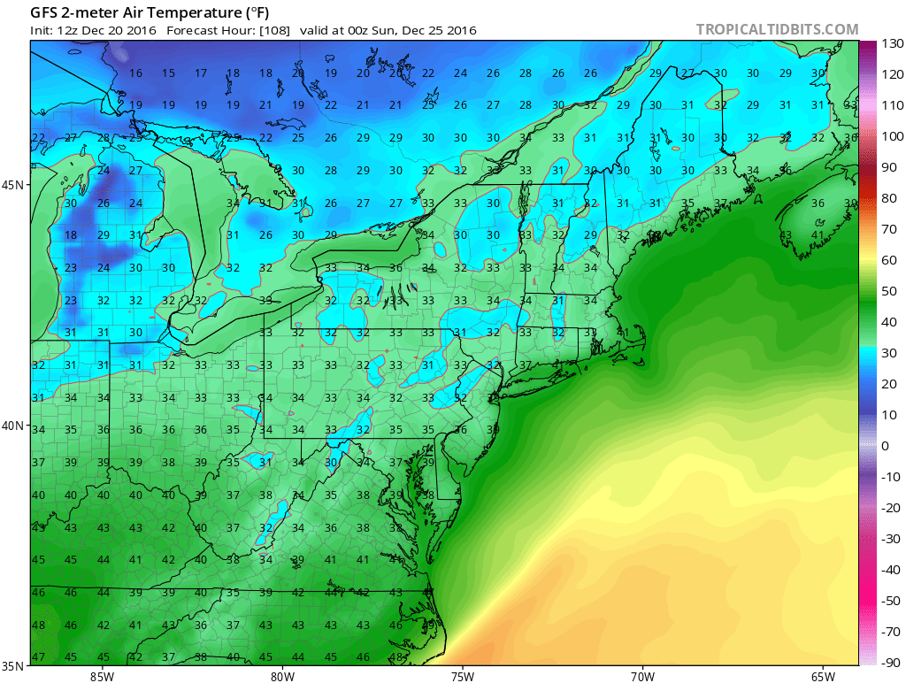
The European model is the most bullish with this and has been for several runs. It actually generates a quarter to a half inch of liquid and forecasts a quarter of an inch of ice for Saturday night. Being that it is the only model showing precipitation (the Canadian shows some showers earlier in the day) we rate this a long shot chance at this point. However I thought it was worth mentioning at this stage of the game. This would be a freezing rain issue and not a snow issue. If this happens it would be for late Saturday afternoon into Saturday night. This is a Christmas Eve issue and there are no issues for Christmas day . We will see what the late afternoon weather model run has to say about this. Again for now we think this is a long shot possibility.
MANY THANKS TO TROPICAL TIDBITS FOR THE WONDERFUL USE OF THE MAPS
SNOW REMOVAL COMPANIES FOR YOUR WINTER NEEDS
LONG ISLAND ROCKLAND COUNTY Connecticut

![]()


JOHNSTOWN PA
COLOSIMO LAWNCARE

FiOS1 News Weather Forecast For Long Island
FiOS1 News Weather Forecast For New Jersey
FiOS1 News Weather Forecast For Hudson Valley
NATIONAL WEATHER SERVICE SNOW FORECASTS
LATEST JOESTRADAMUS ON THE LONG RANGE
Weather App

Don’t be without Meteorologist Joe Cioffi’s weather app. It is really a meteorologist app because you get my forecasts and my analysis and not some automated computer generated forecast based on the GFS model. This is why your app forecast changes every 6 hours. It is model driven with no human input at all. It gives you an icon, a temperature and no insight whatsoever.
It is a complete weather app to suit your forecast needs. All the weather information you need is right on your phone. Android or I-phone, use it to keep track of all the latest weather information and forecasts. This weather app is also free of advertising so you don’t have to worry about security issues with your device. An accurate forecast and no worries that your device is being compromised.
Use it in conjunction with my website and my facebook and twitter and you have complete weather coverage of all the latest weather and the long range outlook. The website has been redone and upgraded. Its easy to use and everything is archived so you can see how well Joe does or doesn’t do when it comes to forecasts and outlooks.
Just click on the google play button or the apple store button on the sidebar for my app which is on My Weather Concierge. Download the app for free. Subscribe to my forecasts on an ad free environment for just 99 cents a month.
Get my forecasts in the palm of your hand for less than the cost of a cup of Joe!
![]()
