Christmas Eve Christmas Day Dry Rain Arrives Boxing Day

Christmas Eve Christmas Day Dry Rain Arrives Boxing Day
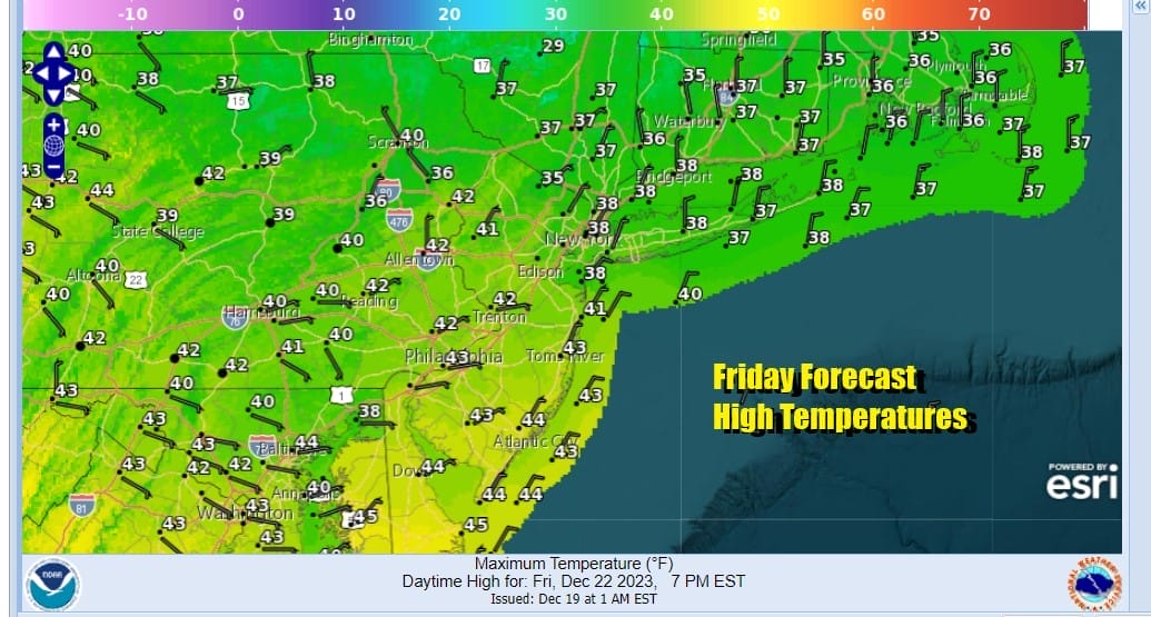
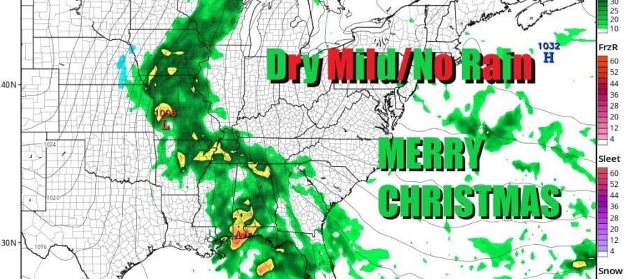
We continue to move along in a dry weather pattern overall as Christmas Eve and Christmas Day approach. Today is the first full day of winter and with that we have near average temperatures for the date. Highs today across Eastern Pennsylvania to Southern New England will be in the upper 30s and lower 40s and skies should be no worse than partly sunny. Radars are nice and quiet and we don’t see any precipitation issues anywhere in the Northeast or Northern Mid Atlantic. If you are travelling today ahead of the Christmas holidays, we see no issues through all of the East Coast west to the Mississippi Valley.
SATELLITE WITH LIGHTNING STRIKES

WEATHER RADAR

Mostl lows tonight will be in the 20s inland and lower 30s warmer urban locations. Saturday we will see sunshine and some high clouds as a warm front heads across the Great Lakes and passes to our north. Highs Saturday will be in the low to middle 40s.

Saturday night into Sunday morning as the warm front goes by we will see clouds and the chance that there could be a few scattered rain showers. Rain will not amount to much and not everyone will see showers from this. Once we get past the morning hours of Christmas Eve, we should go partly sunny with highs in the mid to upper 40s. A few warm spots could reach 50 across South Jersey and points south.
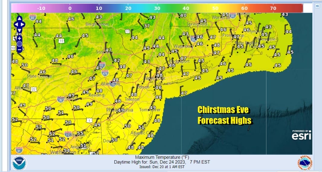
There will be no weather related travel issues either Christmas Eve or Christmas Day. The mild temperatures continue Monday as we will see sunshine and clouds and highs will be in the upper 40s and lower 50s. As far as a White Christmas goes, this is a rather an unusual Christmas in that the vast majority of the US will see a “brown” snowless Christmas with little in the way of snow cover anywhere in the US except for perhaps the Central and Northern Rockies.

The next storm system will bring much needed rain up and down the Mississippi Valley Sunday and that cold front will be pushing eastward Monday into the Ohio Valley and the Gulf States and then spreading rain into the East Coast Tuesday, Boxing Day. Some showers will run out ahead but the main area of rain comes later Tuesday night and Wednesday as the front nears and a wave develops on the front. This looks like a system that could produce an inch or so of rain (plus or minus a quarter inch) and we are not looking at another adventure with a major storm. Longer term we do see the pattern across North America changing as we head toward the last days of December and the start of January though the specifics that far ahead are unknown at this stage. The new pattern will be a colder one but not necessarily a stormy one There is much to work out in the long range but we do see winter type weather moving into the US and the East, certainly colder but snow does not necessarily follow along.
BE SURE TO DOWNLOAD THE FREE METEOROLOGIST JOE CIOFFI WEATHER APP &
ANGRY BEN’S FREE WEATHER APP “THE ANGRY WEATHERMAN!
MANY THANKS TO TROPICAL TIDBITS FOR THE USE OF MAPS
Please note that with regards to any severe weather, tropical storms, or hurricanes, should a storm be threatening, please consult your local National Weather Service office or your local government officials about what action you should be taking to protect life and property.
(Amazon is an affilate of Meteorologist Joe Cioffi & earns commissions on sales.)


