Chillly Morning, Cool Afternoons Through Thursday. Self Destruct Sunshine Today

Chilly Morning, Cool Afternoons Through Thursday. Self Destruct Sunshine Today
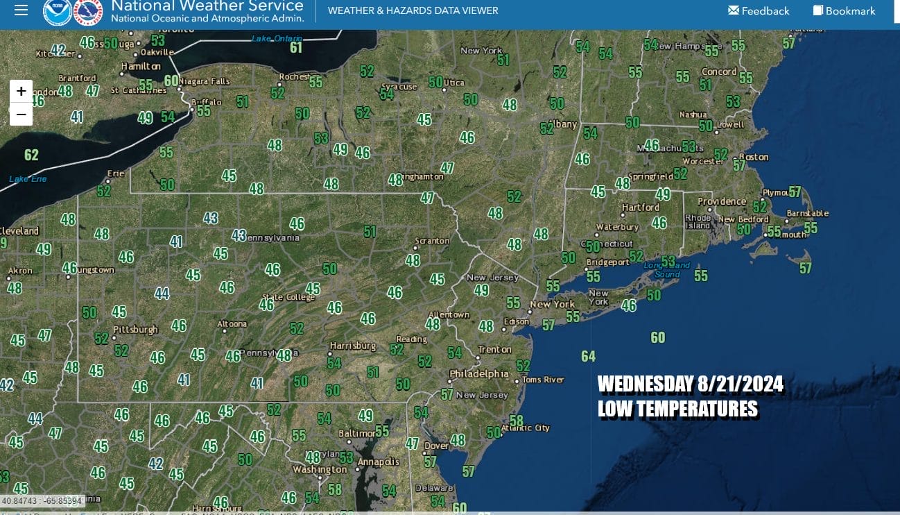
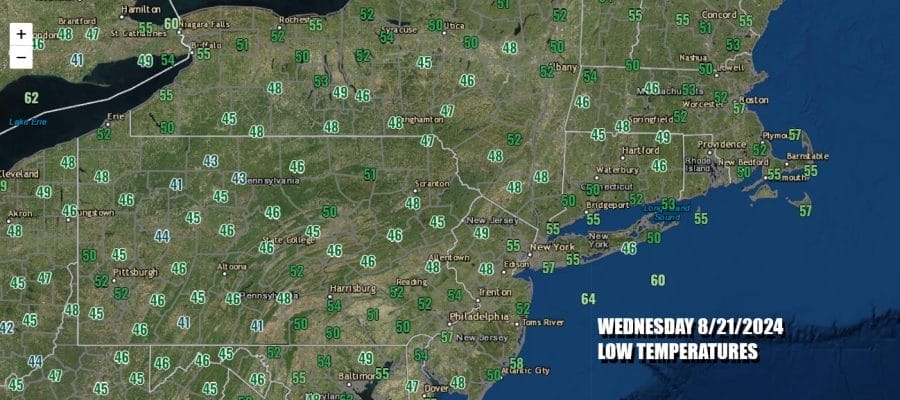
it is a cool start to the day across the Northeast. Morning lows were in the 40s and 50s and this includes the warmer urban areas of New York City and Philadelphia which haven’t been this cool in the morning since back in June. Today we have a strong upper low dropping into Northeastern NY and that is going to create a rather cold unstable atmosphere to some extent.
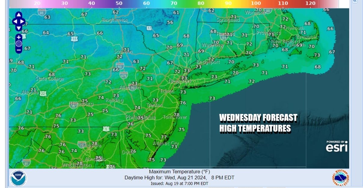
This upper low is also bringing the core of the cool air mass overhead today and tonight. We will see sunshine self destruct to some degree with clouds developing. North of Route 84 in Upstate NY there will probably be some instability showers or perhaps even what we call a “low top” thunderstorm but they should be scattered in nature. Everywhere else it is a mix of sun and clouds. After the chilly start, temperatures will only make it back to the upper 60s and a few low 70s!
SATELLITE WITH LIGHTNING STRIKES

WEATHER RADAR

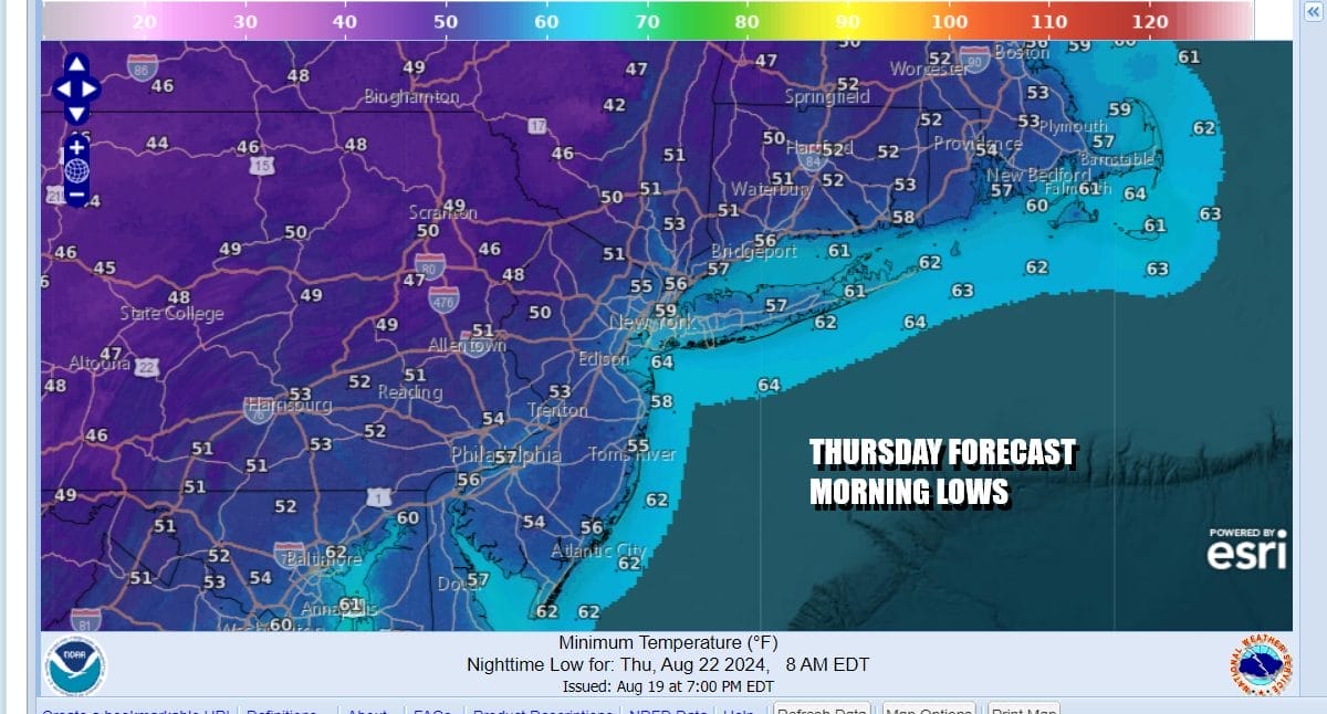
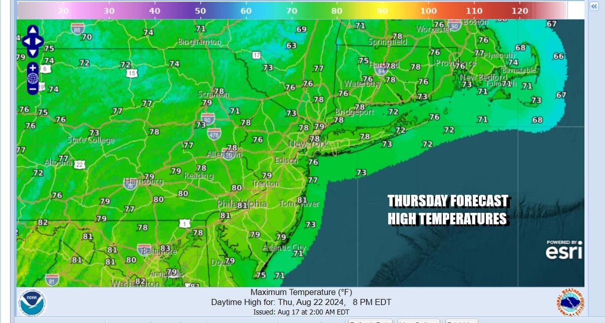
The upper low will begin to slowly lift out to the Northeast tonight and Thursday. This leaves us with another rather chilly night ahead with clear skies. By Thursday morning we will see temperatures bottoming once again the 50s along the coast and in warmer urban areas while inland areas will see lows once again in the chilly 40s.
Moving along Thursday will be a mostly sunny day as the upper low will have moved into Maine and Atlantic Canada. Humidity levels remain very low and we will see highs reaching the low and middle 70s Thursday afternoon. High pressure will be settling overhead in the Northeast and Mid Atlantic states so radars should be nice and quiet with no shower issues.
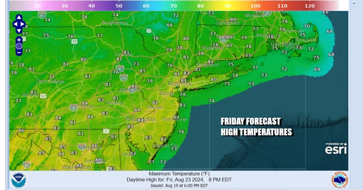
We are in a good spot for Friday and the weekend. The high moves offshore and winds turn more west and southwest and that means temperatures will start to rise a bit. Humidity levels will be slow in rise however as there is a general lack of tropical air feeding into the US from the Southwest Atlantic or the Gulf of Mexico. Sunshine Friday will take highs to the mid 70s to around 80 degrees.
We see no weather issues at this time over the weekend. It will start to turn a little more humid but it should remain rather comfortable. Sunshine is forecast for both Saturday and Sunday. Saturday highs will be in the low to mid 80s. Sunday highs will likely push to the mid to upper 80s. No rain is forecast through the daytime Sunday. A disturbance moving over the top of a ridge in the Eastern US could bring a shower or thunderstorm Sunday night but it will be widely scattered, if they happen at all. Warm and more humid weather will start next week with perhaps an increasing chance for showers mid week.
BE SURE TO DOWNLOAD THE FREE METEOROLOGIST JOE CIOFFI WEATHER APP &
ANGRY BEN’S FREE WEATHER APP “THE ANGRY WEATHERMAN!
MANY THANKS TO TROPICAL TIDBITS FOR THE USE OF MAPS
Please note that with regards to any severe weather, tropical storms, or hurricanes, should a storm be threatening, please consult your local National Weather Service office or your local government officials about what action you should be taking to protect life and property.
(Amazon is an affilate of Meteorologist Joe Cioffi & earns commissions on sales.)


