Changeable Skies Shower Risk Today
Nice Sunday Before Gloom Doom & Rain Settle In Next Week

Weather in 5/Joe & Joe Weather Show Latest Podcast
Changeable Skies Shower Risk Today
Nice Sunday Before Gloom Doom & Rain Settle In Next Week

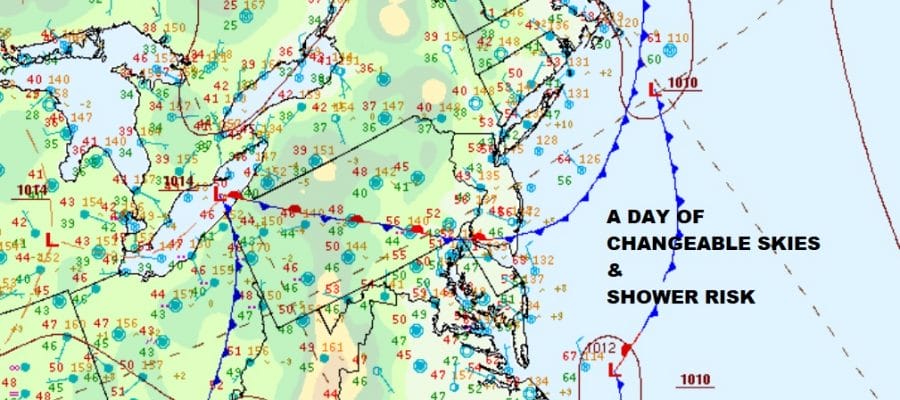
The weekend begins with a Saturday that isn’t exactly clear cut as far as the forecast is concerned. The surface map above shows what I would regard as a mess. Weak weather systems are running around and whenever that happens it creates changeable conditions from cloudy to occasionally partly sunny skies. Also in the mix showing up on the radar are some scattered showers. On the regional radar there is a larger area of light rain in Western Pennsylvania moving eastward but this should weaken as the day progresses.

This makes forecasting high temperatures a bit of challenge but for the most part, highs will be in the low to mid 60s except where clouds dominate like they will do in Northeastern Pennsylvania to the Hudson Valley and Southern New England where highs will probably not get out of the 50s. Watch for a passing shower or two though they should be scattered in nature and not everyone will see one.
SATELLITE

WEATHER RADAR

Once the next front passes this evening skies should clear out later today with most lows in the mid 40s to lower 60s. This sets us up for a decent day on Sunday. We should start with sunshine and then deal with some arriving high clouds from west to east during the afternoon. Highs will be mostly in a range of 60 to 65. The dayside Sunday should be rain free.
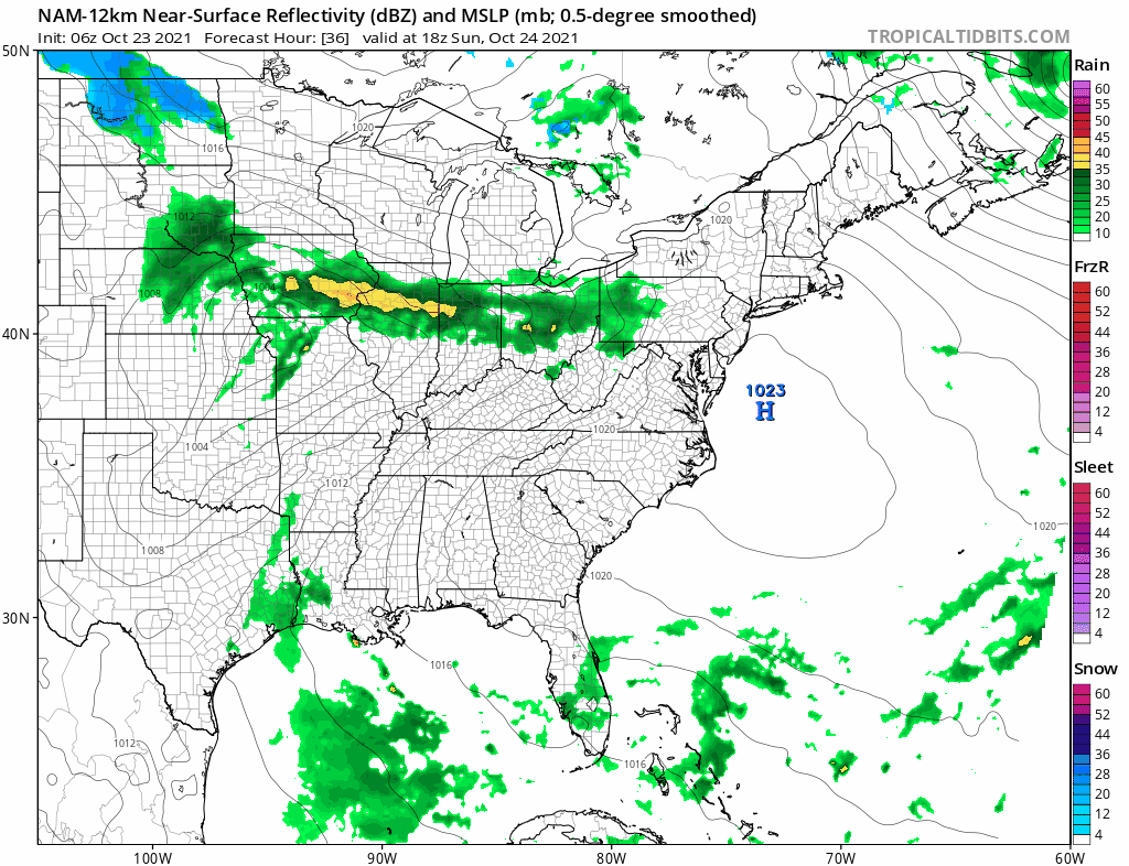
Looking at the latest NAM model we have what appears to be a warm front pushing northward Sunday evening and overnight and north of Route 78 in NJ and PA we will watch for some showers during the overnight hours into Monday morning. Monday should be a quiet day with lots of clouds and highs in the 60s. The warm front stalls to the north and then drops southward again Monday evening.
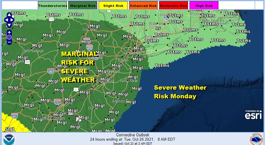
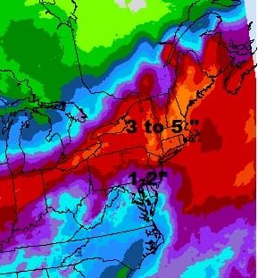
That sets up for thunderstorms and the storm prediction center has a marginal risk for severe weather reaching up from the south into Pennsylvania and New Jersey, cutting off around NYC. Then we see low pressure moving across the Midwest to move southeast and wind up near the NJ coast on Tuesday. Rain develops later Monday night into Tuesday afternoon and some of that rain cold be heavy in areas north and east of the low track.
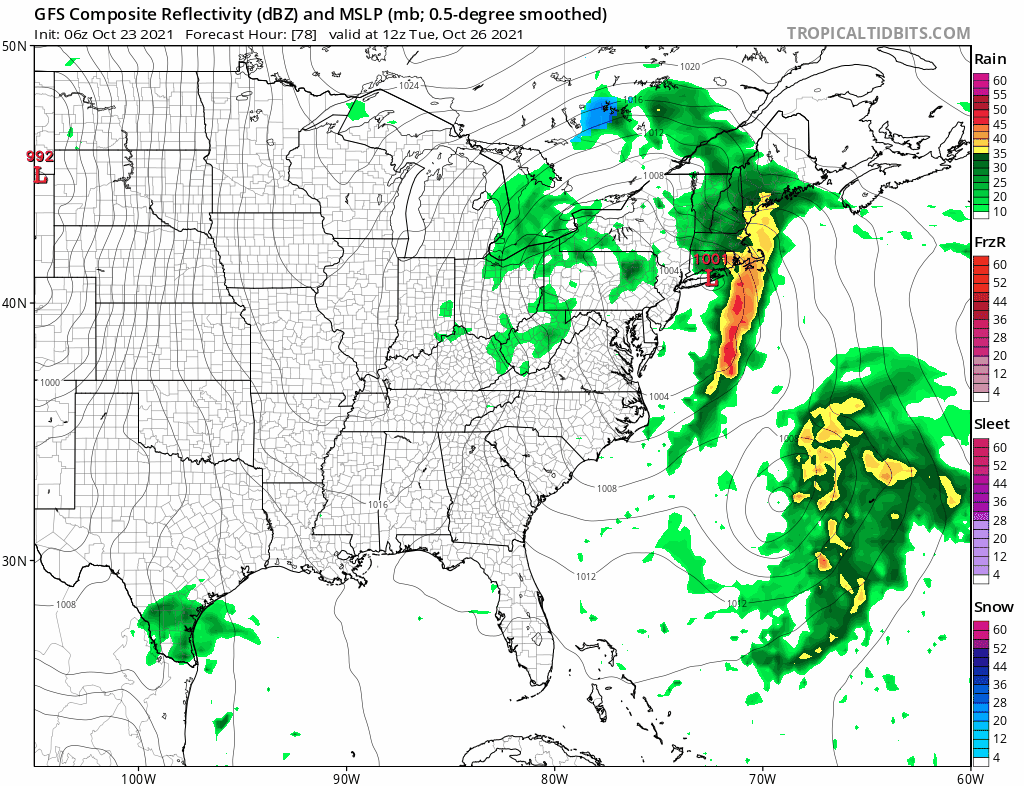
The blocky pattern over the North Atlantic and North America slows the first system down which powers a second storm moving east later this week and bringing another round of heavy rain later Thursday and and Friday. Rainfall totals this week could be on the order of several inches or more especially in New England where both storms will have a larger impact.
Whether we see improvement this weekend will depend on the block and whether the late week storm system can move out of the way. It will pull down chilly air from Eastern Canada making for a rather cool Autumn weekend for Halloween. Whether it is a dry weekend or not remains to be seen.
BE SURE TO DOWNLOAD THE FREE METEOROLOGIST JOE CIOFFI WEATHER APP &
ANGRY BEN’S FREE WEATHER APP “THE ANGRY WEATHERMAN!

MANY THANKS TO TROPICAL TIDBITS & F5 WEATHER FOR THE USE OF MAPS
Please note that with regards to any severe weather, tropical storms, or hurricanes, should a storm be threatening, please consult your local National Weather Service office or your local government officials about what action you should be taking to protect life and property.


