Another Round Of Rain Mostly Along Coast To Southern New England
Weather Slowly Improves Sunday

Weather in 5/Joe & Joe Weather Show Latest Podcast
Another Round Of Rain Mostly Along Coast To Southern New England
Weather Slowly Improves Sunday
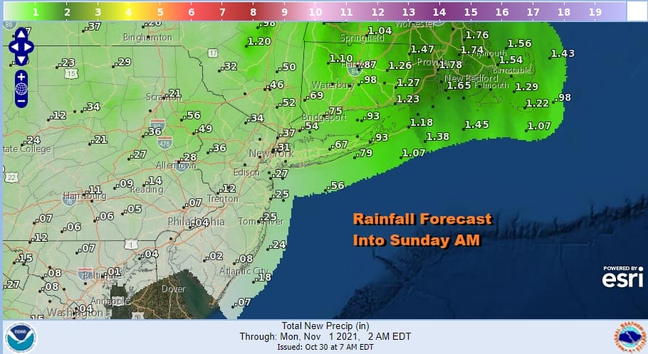
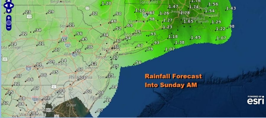
Overnight rains have moved to the northwest and the frontal boundary has shifted to the coastline. We still have some more work to do today as another wave develops on the front and rain moves up the coast. Inland areas from Western New Jersey westward probably will miss out on the rain so in those areas other than some scattered light showers, the day will be a cloudy one. However along the coast and going north and east of NYC another round of rain is likely this afternoon and tonight though the heaviest rain will be in New England.
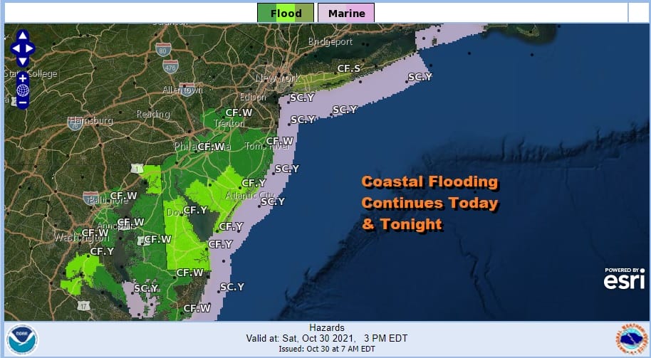
Meanwhile we have another day of higher than normal tides to deal with from Long Island south to Chesapeake Bay. Coastal Flood Warnings are in effect from the Central New Jersey coast southward to Virginia where moderate coastal flooding is forecast again at high tide today and tonight.
SATELLITE

WEATHER RADAR

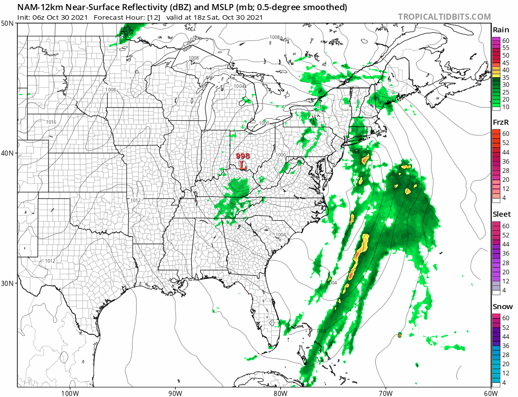
A look at the regional radar shows a cluster of rain developing off the Delaware coast and that rain is moving northward. To the west we have scattered showers on the radar and that will likely continue on and off today. The back edge of the coastal rain shield will skim the coastline of New Jersey with steadier rains going north and east of NYC into Long Island and New England. Temperatures today will be in the 60s
Rain will start to come to an end from south to north as well as from west to east overnight and weather conditions should start to improve Sunday. We will call it decreasing clouds with perhaps sunshine developing from west to east as the day wears on. A northwest breeze helps the cause and highs will be in the low to mid 60s.

The week ahead we will see a stair step decline in temperatures as each day passes. Cold air from Canada (relative to the time of year) will be spreading cold air into the Eastern US. This is the first time this fall that we have an upper air pattern where the flow is connected from Northern Canada southward. Much of the time this week will be dry. A weak cold front passes later Tuesday and again on Thursday with not much weather and that will re-enforce the chill. Highs Monday will be in the upper 50s and lower 60s. Tuesday we take it down a notch to low and mid 50s for highs. Wednesday and Thursday highs will be in the upper 40s in cool spots and lower 50s everywhere else. We should see some sunshine each day. Thursday night into Friday low pressure moves across the Southern States and takes a turn northeastward. Both the European and the GFS are very similar with this but the European has a colder more vigorous look too it. It could set up for a cold rain Thursday night into Friday and it also could bring the first wet snow flakes to some areas well inland and with elevation. We will discuss the further over the weekend.
BE SURE TO DOWNLOAD THE FREE METEOROLOGIST JOE CIOFFI WEATHER APP &
ANGRY BEN’S FREE WEATHER APP “THE ANGRY WEATHERMAN!

MANY THANKS TO TROPICAL TIDBITS & F5 WEATHER FOR THE USE OF MAPS
Please note that with regards to any severe weather, tropical storms, or hurricanes, should a storm be threatening, please consult your local National Weather Service office or your local government officials about what action you should be taking to protect life and property.


