Another Day of Sunshine Before Clouds Return
Showery Rains Saturday Dry Sunday

Another Day of Sunshine Before Clouds Return
Showery Rains Saturday Dry Sunday

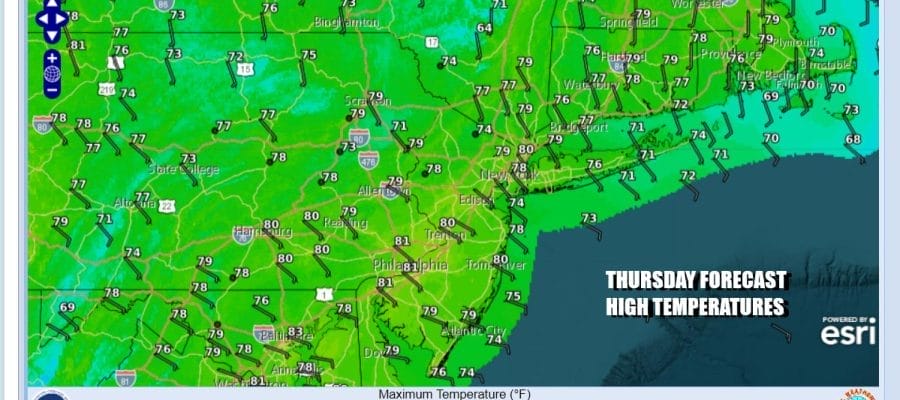
Today is the 4th day in a row of blue skies and sunshine but it is likely the last day of this current stretch. September often times provides spectacular weather days and these last for days have indeed been exceptional. We have mostly cloud free conditions on the satellite loops and radars remain nice and quiet so look for lots of sunshine today. Winds will be turning onshore and that will keep temperatures mostly in the 70s. Some warm spots well inland might approach 80 while along the coast, lower 70s will be commonplace.
SATELLITE WITH LIGHTNING STRIKES

WEATHER RADAR

Over the next several days an old frontal boundary that extends from the Gulf Coast northeastward out over the Southwest Atlantic will produce a series of waves of low pressure. These waves will carry showers and downpours across much of the South and Southeast US over the next couple of days. These waves of low pressure will be uncoupled with an approaching cold front swinging from the Great Lakes and Ohio Valley.

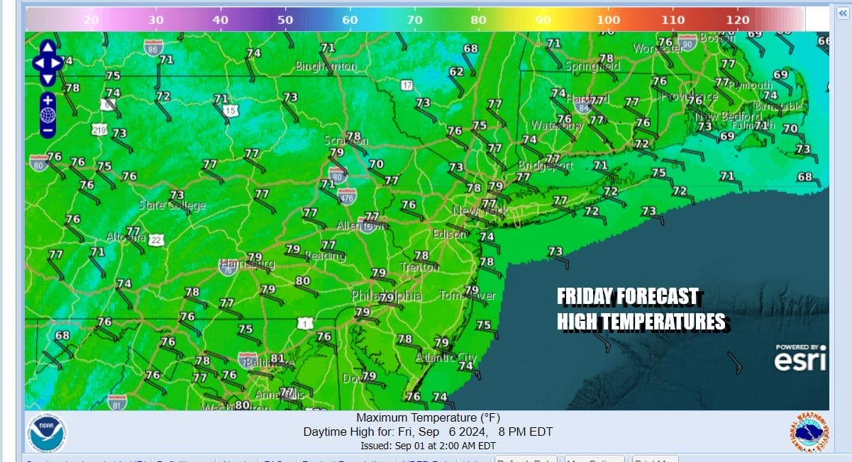
Ahead of this weather front, the onshore flow will strengthen somewhat bringing in clouds tonight from off the ocean as well as some high clouds from southern moisture. Most lows tonight will be in the 50s inland and low to mid 60s along the coast. Friday we will likely see clouds around especially along the coast. There might be some breaks of sunshine as you head north and northeast of NYC into New England. There could also be some spotty light rain or drizzle around. Highs will be in the 70s.
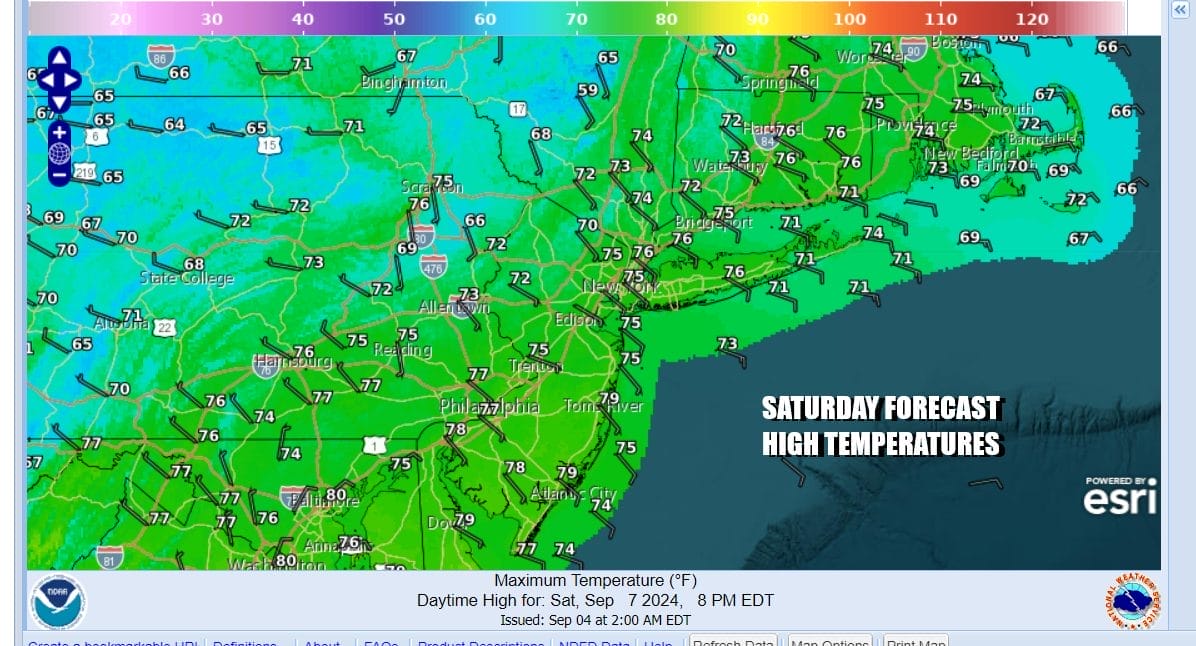
This cold front will not be much of big deal for Saturday. We probably will see showery rains and maybe an isolated thunderstorm. The best chances will be in the afternoon into Saturday night. Temperatures Saturday will likely be mostly in the 70s as winds turn more southeast and south. Rainfall amounts will generally be under a half inch and in many areas under a quarter of an inch.
This weather front will move right along and pass to the east and offshore. This should lead to improving weather conditions Sunday. Perhaps there could be some leftover clouds early in the day but we should see increasing amounts of sunshine. Sunday highs will be in the 60s. September is known for being one of the drier months of the year and that will likely play out next week. It is possible we could go through all of next week with not a drop of rain. The tropics remain very quiet in the Atlantic Basin and we do not see much in the way of tropical cyclone formation for at least the next 5 days.
BE SURE TO DOWNLOAD THE FREE METEOROLOGIST JOE CIOFFI WEATHER APP &
ANGRY BEN’S FREE WEATHER APP “THE ANGRY WEATHERMAN!
MANY THANKS TO TROPICAL TIDBITS FOR THE USE OF MAPS
Please note that with regards to any severe weather, tropical storms, or hurricanes, should a storm be threatening, please consult your local National Weather Service office or your local government officials about what action you should be taking to protect life and property.
(Amazon is an affilate of Meteorologist Joe Cioffi & earns commissions on sales.)


