Another Day of Smoked Filled Skies Upper Air Pattern Holds Through Friday

Another Day of Smoked Filled Skies Upper Air Pattern Holds Through Friday
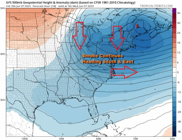
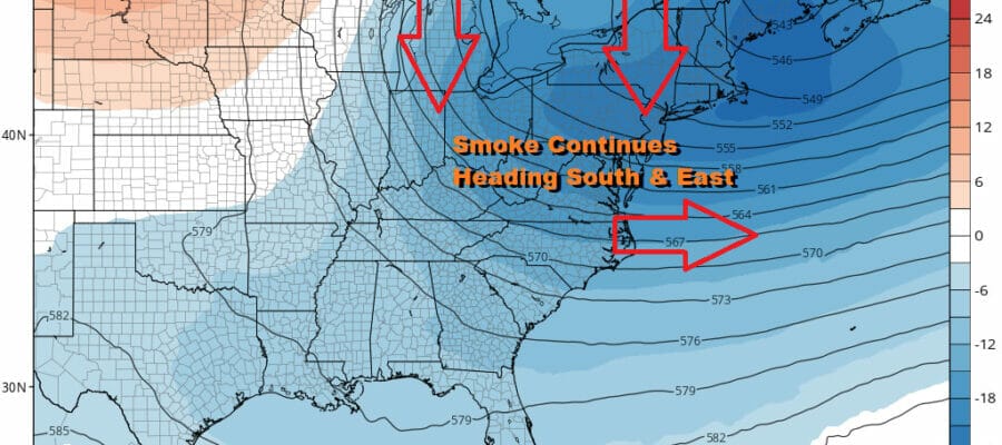
Smoke filled skies have become the norm across the Northeast and Mid Atlantic states back to the Great Lakes. Wildfires in Northern Canada continue to rage. Coupled with the unusually cool pattern in the Eastern US, smoked filled skies will continue at least through Friday. It has gotten worse over the last few days as the haze it produces reduces visibility and dims any sunshine. The upper air storm in the Eastern US doesn’t pull out until Sunday and the fires will continue to burn for weeks if not months unless the dry weather pattern across Northern Canada changes.
Yesterday’s cold front has moved offshore and south and we will see sunshine through hazy smokey skies today. Temperatures will top out in the 70s. The atmosphere is showing a bit of stability today so we are not going to put in for the chance for showers. The upper air storm over New Brunswick just spins and spins and we have another shortwave trough heading here for Thursday. Meanwhile tonight we should have partially clear skies with most lows in the upper 40s to mid 50s.
SATELLITE

WEATHER RADAR

Thursday we will probably start with some sunshine but we will likely see some instability clouds develop especially inland. Another trough will be dropping southward from Eastern Canada and Upstate NY and that could trigger off some scattered showers and thunderstorms. They should be spread out so it is no guarantee that everyone will see a shower or storm. In fact many of you probably won’t see much.
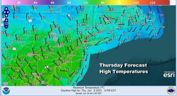
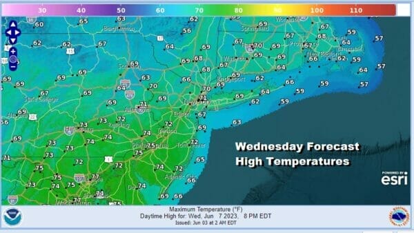
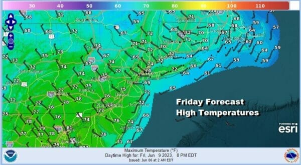
Thursday highs across much of Eastern Pennsylvania will be in the upper 60s to lower 70s. This short wave passes and that will be followed by yet another one for Friday. That means we see a repeat performance of sun and clouds and the risk for scattered showers or a thunderstorm. Highs again will be in the upper 60s to lower 70s. Smokey sky conditions will continue making for hazy skies and rather odd color sunrises and sunsets.
The upper air storm in Eastern Canada will begin to slowly pull away to the east Saturday but there still will be enough of a northwest flow to keep us in smokey sunshine. Temperatures will begin to move a little higher Saturday and highs will reach the upper 70s to some lower 80s inland but it will be cooler along the shore. We will throw in the chance for a scattered shower or thunderstorm Saturday afternoon but the chances are low.

Weather systems will start to move along Sunday and into next week and the upper flow will turn southwest. This should reduce the smokey haze. Sunday will also be a very warm day with sunshine and highs reaching the mid to upper 80s. A warm front cold front combination will head our way with the warm front moving through Sunday night. There could be a few showers or a thunderstorm with that. Then Monday the cold front approaches with a higher chance for showers and thunderstorms. Monday highs will be in the 70s to around 80 degrees. Next week brings a more progressive west to east pattern meaning weather systems will be moving along in the flow and not getting stuck in any one place. Look for more variability day to day and there will be opportunities for showers along the way.
BE SURE TO DOWNLOAD THE FREE METEOROLOGIST JOE CIOFFI WEATHER APP &
ANGRY BEN’S FREE WEATHER APP “THE ANGRY WEATHERMAN!
MANY THANKS TO TROPICAL TIDBITS FOR THE USE OF MAPS
Please note that with regards to any severe weather, tropical storms, or hurricanes, should a storm be threatening, please consult your local National Weather Service office or your local government officials about what action you should be taking to protect life and property.
(Amazon is an affilate of Meteorologist Joe Cioffi & earns commissions on sales.)


