
Another Day of Record Highs Possible Big Changes Ahead This Week
Tropics Could Have A Say Late Week
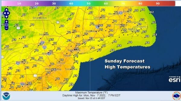
It is another day of near record highs in the Eastern Pennsylvania to Southern New England. A number of records were set yesterday in the Northeast and Northern Mid Atlantic including Newark NJ which got to 79 and Islip NY which hit 74. We do have a rather solid launching pad from which temperatures could make mid to upper 70s again this afternoon with partly sunny skies. There will be some clouds coming in later today as a cold front approaches. There are some scattered showers on the radar in Eastern Pennsylvania but most of those showers will likely fall apart as they move east so we are not going to mention anything more than a passing shower or two in areas well inland like westernmost New Jersey, Eastern Pennsylvania and northeast from there into the Catskills on the NY side.
SATELLITE

WEATHER RADAR

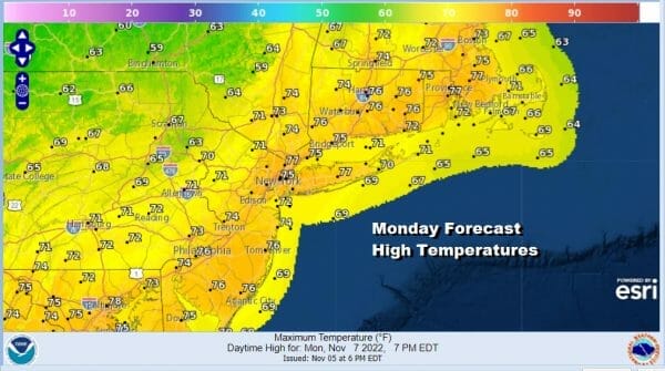
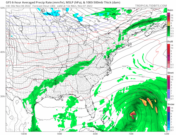
The new week will bring about important changes and we may have to deal with a tropical system moving up the East Coast late in the week. Let’s take it step by step beginning with Monday when a cold front moves through. This will be the last very warm day with partly sunny skies and highs in the 70s.
Cooler air begins to arrive Monday night as skies clear. A very large high is going to be building into New England this week. The air mass is a cool one that at least brings temperatures back down to average for this time of year. This will mean lows in the 40s at night with 30s in cool spots inland. Tuesday highs will be just in the 50s with a freshening northeast wind and sunshine.
While the Northeast gets cooler and remains dry through at least Thursday and probably into Friday, to the south off the Florida east coast, we have developing low pressure that is going to be forced westward underneath the strong high to the north. This low is forecast to develop into a subtropical or tropical storm as it heads for South Florida. With the large high to the north and the upcoming full moon, we will likely see a rather large area of gales develop from the coastal Carolinas to Florida along with heavy rains. We will have to see once the low develops what exactly we are dealing with here and whether this strengthens to a hurricane.
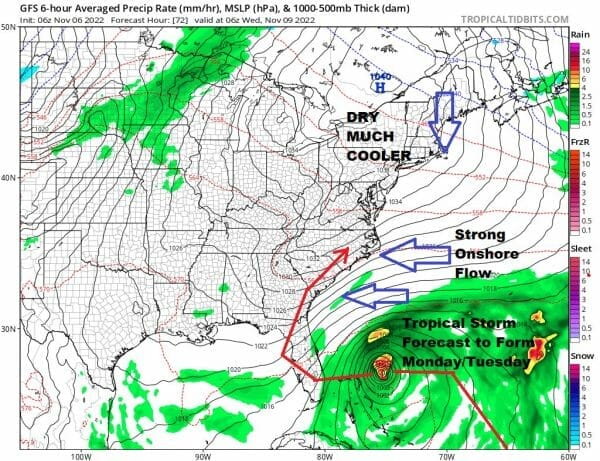
Wednesday and Thursday will remain dry in our area with some sunshine and highs in the 50s. Models all want to bring this system up the East Coast with rain and wind Friday night into Saturday. It is difficult to say what exactly we have here and whether we will be dealing with something more tropical in nature or post tropical in nature. It may not matter in terms of weather it produces. We will likely see wind and rain either way. Longer range the pattern across North America is turning colder and it will be a colder than normal weather pattern that is going to be around for awhile. Enjoy your warm Sunday.
BE SURE TO DOWNLOAD THE FREE METEOROLOGIST JOE CIOFFI WEATHER APP &
ANGRY BEN’S FREE WEATHER APP “THE ANGRY WEATHERMAN!
MANY THANKS TO TROPICAL TIDBITS & F5 WEATHER FOR THE USE OF MAPS
Please note that with regards to any severe weather, tropical storms, or hurricanes, should a storm be threatening, please consult your local National Weather Service office or your local government officials about what action you should be taking to protect life and property.


