

Afternoon Thunderstorms Severe Weather Possible
Beautiful Friday Warm Sunny Weekend
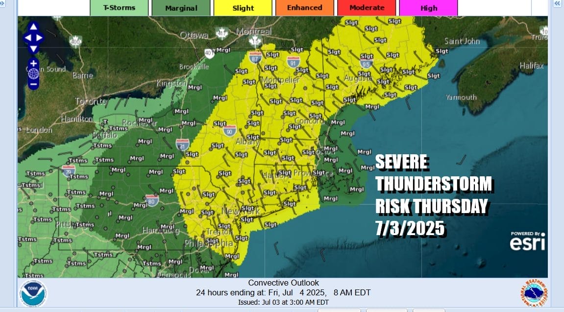
We are one day away from the Independence day holiday weekend, though some of you may have already started it making it a 4 or 5 day weekend. Those of you using this as a getaway day should take note of the fact that the Storm Prediction Center is indicating a large geographic area of severe thunderstorm risk that extends from Eastern Pennsylvania and New Jersey northeastward to include just about all of New England.
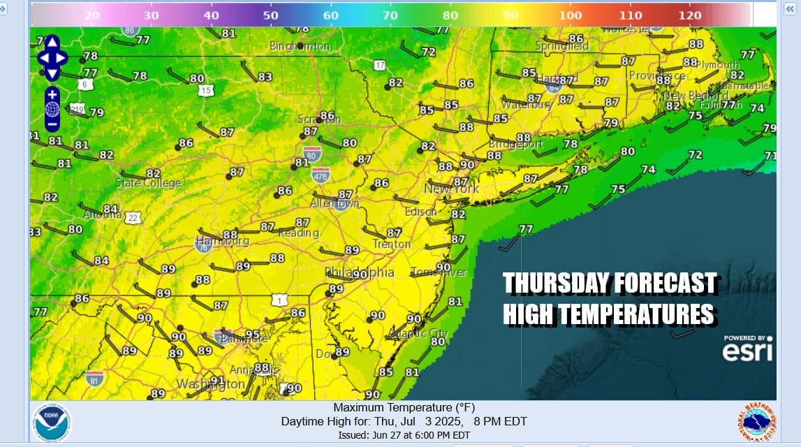
Ahead of any thunderstorms we will see sunshine and ample daytime heating taking temperatures to the mid and upper 80s this afternoon. Some hot spots could see highs around or even just over 90 degrees. The upper atmosphere will be cold and very unstable so expect scattered thunderstorms to develop going into the evening hours. The risks are damaging winds of 55 mph or higher and the possibility there could be some hail in the mix. These storms will be moving through rather quickly limiting the amount of rain .
SATELLITE WITH LIGHTNING STRIKES

WEATHER RADAR

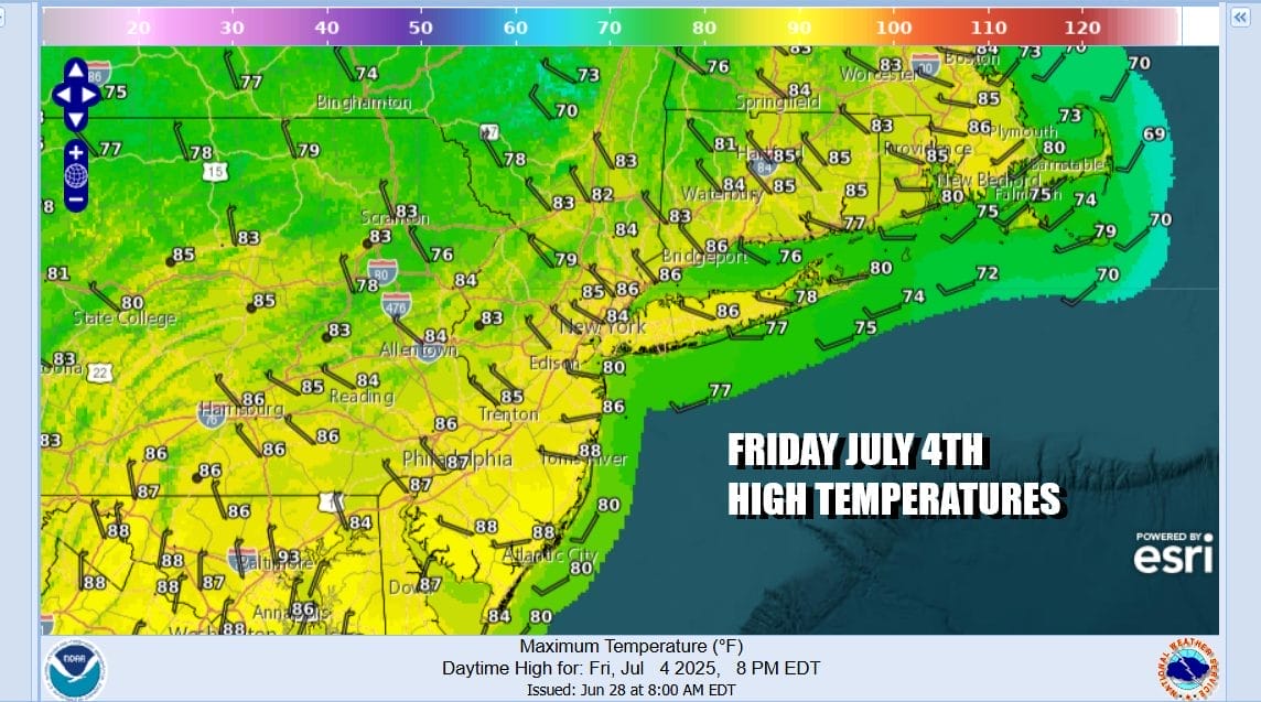
Once the front and associated upper trough swing through thunderstorms will come to an end later this evening and skies will clear overnight with lows mostly in the 60s. Friday will be almost perfect with blue skies, sunshine, low humidity, and temperatures that will top mostly between 80 and 85 degrees. No showers or thunderstorms are forecast and skies should be clear Friday night for any fireworks shows.
Over the weekend high pressure will be to our south and with a west to southwest wind, it will warm up and also gradually turn more humid especially for Sunday. No showers or thunderstorms are forecast for the weekend. Saturday we will have plenty of sunshine. Highs will be in the mid to upper 80s. Sunday we will have sunshine very warm to hot and humid conditions. Highs will be in the upper 80s to lower 90s. Temperatures both days will be a little cooler along shore locations with local sea breezes. If you are extending the holiday weekend into Monday, we see it being very warm to hot but no shower or thunderstorm activity is expected until perhaps later Tuesday.
BE SURE TO DOWNLOAD THE FREE METEOROLOGIST JOE CIOFFI WEATHER APP &
ANGRY BEN’S FREE WEATHER APP “THE ANGRY WEATHERMAN!
MANY THANKS TO TROPICAL TIDBITS FOR THE USE OF MAPS
Please note that with regards to any severe weather, tropical storms, or hurricanes, should a storm be threatening, please consult your local National Weather Service office or your local government officials about what action you should be taking to protect life and property.


