A Mostly Dry Week Ahead With Little Rain & A Good Deal of Sunshine

A Mostly Dry Week Ahead With Little Rain & A Good Deal of Sunshine
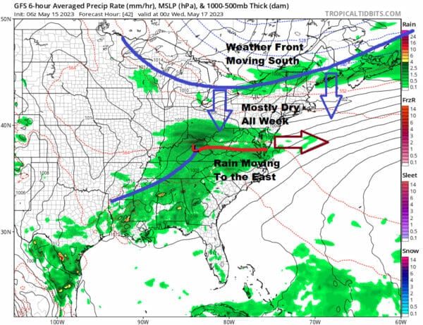
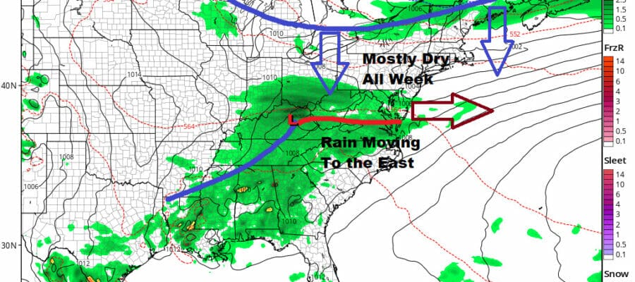
A case could be made that this week might be the best weather week in the spring season so far. For nice weather lovers the chances for rain are minimal as we have a weak cold front for Tuesday night into Wednesday dropping down from the north and low pressure with rain passing well to the south at the same time. This leaves us in a sweet spot in between
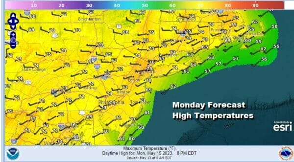
We will likely miss any showers from the fron to the north as that is weak and heads southeastward, and the rain to the south might clip areas across the Mid Atlantic to maybe Southern New Jersey with some rain at the same time Tuesday night into Wednesday morning. So this leaves us with mostly nice weather this week and certainly today we will see a fair amount of sunshine Highs will reach the lower 70s in most places.
SATELLITE

WEATHER RADAR

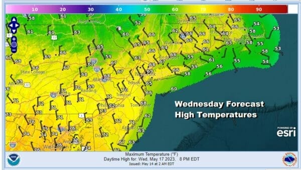
It’s all about the northwest flow in the upper atmosphere which shows up well on the satellite loop. It’s hard to get rain in a northwest flow and that will hold into at least midweek. Radars are quiet locally though showers are showing up in Virginia. Skies should be mainly clear tonight with lows mostly in the 50s. Tuesday we should warm up on a west wind and sunshine with highs reaching into the 80s in many places. The front passes Tuesday night with maybe a shower. Low pressure passes to the south as well. Then it is back to sunshine and cool Wednesday with most highs just in the 60s.
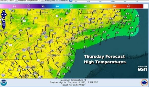
High pressure moves offshore but rather than warm up, the high is going to position itself just southeast of Cape Cod. This sets us up for an unfavorable wind direction for truly warmer temperatures so in spite of sunshine, highs Thursday will only be in the mid 60s to around 70 and that includes even areas inland.
Friday could see temperatures go a little higher but again the southeast to south wind will hold temperatures back and highs will reach the upper 60s to lower 70s. Skies should be no worse than partly sunny to finish off the week.

The weekend could finally bring the chance for some showers or maybe even a thunderstorm or two later Saturday into Saturday night as a cold front finally breaks through the traffic jam and the flow aloft starts to move weather systems from west to east. Saturday highs will be in the 70s. As long as the front keeps moving and I think it should, then we will see some sun return Sunday with highs again mostly in the 70s.
BE SURE TO DOWNLOAD THE FREE METEOROLOGIST JOE CIOFFI WEATHER APP &
ANGRY BEN’S FREE WEATHER APP “THE ANGRY WEATHERMAN!
MANY THANKS TO TROPICAL TIDBITS FOR THE USE OF MAPS
Please note that with regards to any severe weather, tropical storms, or hurricanes, should a storm be threatening, please consult your local National Weather Service office or your local government officials about what action you should be taking to protect life and property.
(Amazon is an affilate of Meteorologist Joe Cioffi & earns commissions on sales.)


