
A Little Wet Snow Tonight In Some Inland Areas Week Ahead Sees Rain Late Week
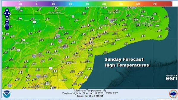
We have chilled off overnight but many warmer urban areas have still not gone below freezing so far in 2023. Today it will be chilly but temperatures are still going to finish a little above average. We will start the day with sunshine and later in the afternoon and evening we will likely see some clouds increasing from the west. Temperatures today will top out mostly in the lower 40s.
SATELLITE

WEATHER RADAR

Weak low pressure is coming out of the Plains and moving eastward. With it comes a small area of precipitation that is rather underwhelming. We are talking about a tenth of an inch or less. This area will also be weakening as it moves eastward. Inland areas could see some wet snow that maybe, maybe, leaves a coating to an inch on colder surfaces and mostly in elevated areas.

Other than what little precipitation we get overnight it will be a cloudy night with lows in the 30s. Monday we will see some morning clouds with some leftover precipitation and then weather conditions will improve Monday afternoon with clouds and some sunshine. Highs will be into the 40s.

Not much will be happening weather wise Tuesday and Wednesday. There is absolutely no real cold air anywhere and by “real cold air” I mean cold air from Canada. It isn’t just the Eastern US that we have little in the way of cold air but most of the United States is lacking any cold air.

Tuesday and Wednesday should be two days of sunshine. There might be a few clouds around at some point Tuesday night into Wednesday morning as a weak disturbance moves through. Tuesday and Wednesday highs will be in the low to middle 40s.

Late in the week we have low pressure again coming out of the Plains and heading into the Ohio Valley. This is going to be a glorified cold front for the most part as we see the low move into Western PA/Western NY and probably redevelop somewhere nearby to our south. This will bring a windswept rain late Thursday into early Friday. Temperatures Thursday will be in the 40s. Friday we will see upper 40s and lower 50s. Rain should come to and end Friday morning with improvement into next weekend. There is little in the way of colder air behind this storm as the warm snow free January pattern continues for Eastern Pennsylvania to Southern New England.
BE SURE TO DOWNLOAD THE FREE METEOROLOGIST JOE CIOFFI WEATHER APP &
ANGRY BEN’S FREE WEATHER APP “THE ANGRY WEATHERMAN!
MANY THANKS TO TROPICAL TIDBITS & F5 WEATHER FOR THE USE OF MAPS
Please note that with regards to any severe weather, tropical storms, or hurricanes, should a storm be threatening, please consult your local National Weather Service office or your local government officials about what action you should be taking to protect life and property.


