A Few Showers Saint Patrick’s Day Ahead of Colder Weekend Quiet Next Week
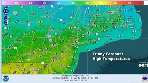
Saint Patrick’s Day is one of those holidays that has seen everything from cold and snow to warm and very springlike. Today we have the warm part as temperatures will be topping out in the 50s to around 60 degrees in some places. We have a cold front coming through today and we can see showers showing up on the radar. However the front will be weakening as the day wears on so my belief is that most of the day will be dry. Some areas could see some breaks of sunshine in the mix as well. Watch for some passing showers with the best chances late in the day and into the first part of tonight.
SATELLITE

WEATHER RADAR

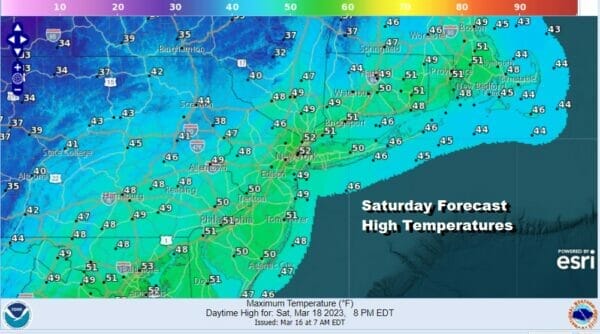
The front will pass through tonight and it will slow down once it is offshore. This slow down however is temporary and that will likely leave us in clouds overnight into Saturday morning. Lows will be in the 30s to around 40 degrees. Saturday morning the front resumes its move to the east so leftover clouds will give way to sunshine and a gusty wind. Most highs will be in the upper 40s to near 50 degrees.
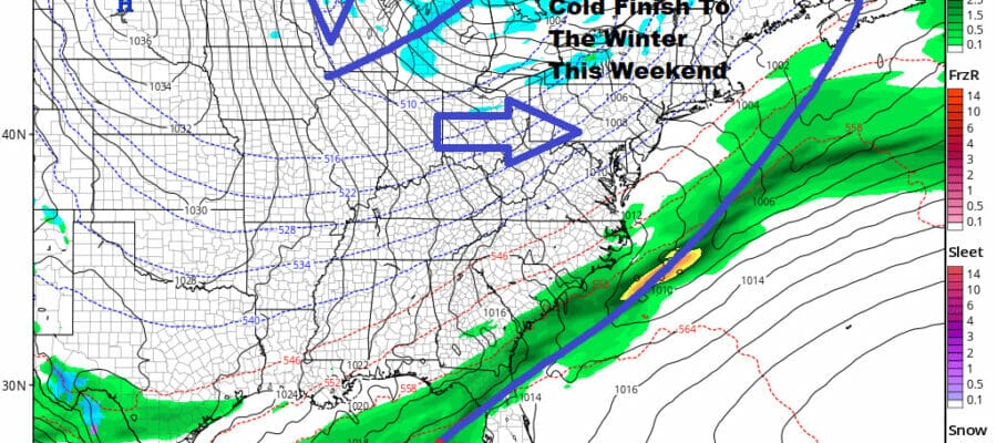
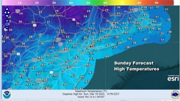
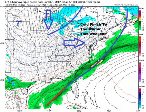
A cold high is dropping southeast from Canada and will spread cold air up and down the East Coast. Saturday night skies will be clear and by Sunday morning, lows will be in the 20s to around 30. Sunday will be a sunny day but it will be cold with a gusty northwest wind. Highs will be in the upper 30s and lower 40s which is about 10 degrees below average.
Looking ahead to next week, it appears to be rather quiet probably right into Friday. There is a low that will develop in the Gulf of Mexico. That low will will eventually reform off the Southeast US coast later Tuesday into early Wednesday. However the upper flow is west to east and this system is going to develop mostly offshore and take a track straight to the east.
 No weather threats means that next week will be dry. Cold air will begin to abate Monday as will the wind. We will see some sunshine. Highs will be closer to average as the reach the upper 40s to around or just over 50 degrees. Tuesday and Wednesday highs will be in the mid to upper 50s with no worse than partly sunny skies both days. Thursday a high in New England will mean slightly lower temperatures in the upper 40s to lower 50s but it will still be dry. The next cold front from a storm heading to the Great Lkes will arrive later next Friday but it will be similar to the system we have today where we have warmer temperatures but not much in the way of shower risk. There may be a more important weather system that will bring rain for later next weekend.
BE SURE TO DOWNLOAD THE FREE METEOROLOGIST JOE CIOFFI WEATHER APP &
ANGRY BEN’S FREE WEATHER APP “THE ANGRY WEATHERMAN!
MANY THANKS TO TROPICAL TIDBITS & F5 WEATHER FOR THE USE OF MAPS
Please note that with regards to any severe weather, tropical storms, or hurricanes, should a storm be threatening, please consult your local National Weather Service office or your local government officials about what action you should be taking to protect life and property.


