Mostly Quiet Weather Next 5 Days Shower Risk Friday Colder Dry Weekend
Our coastal storm is visible on the upper right of the satellite loop below and it is now pulling away to the east. This should allow winds to ease somewhat today though it will still be somewhat on the breezy side at times. Clouds from the next weather system are starting to appear on the upper left of the satellite view but they don’t seem to be amounting to much today so we should see partly to mostly sunny skies. High pressure is moving off the Atlantic seaboard and we will see winds go to the west today. That should allow temperatures to climb up into the 50s for highs. There isn’t much on the radar to worry about so enjoy the day.
SATELLITE

WEATHER RADAR

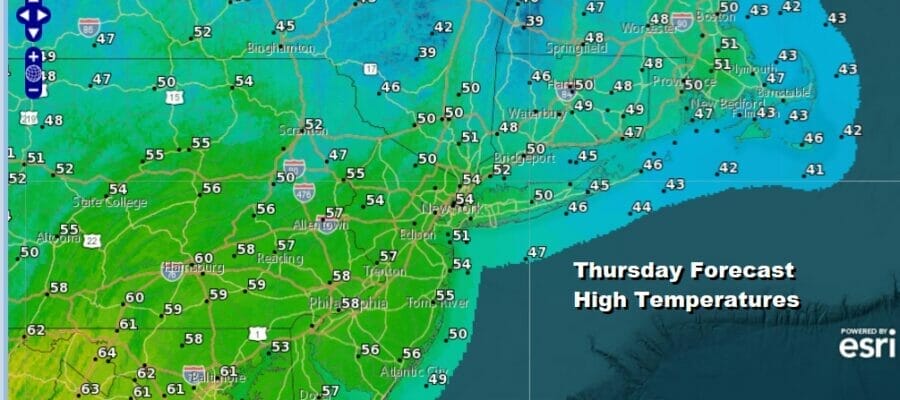
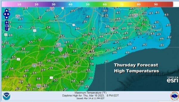
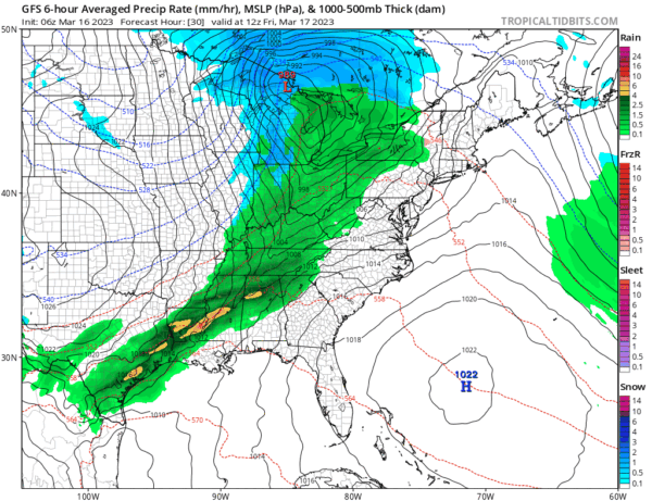
Tonight won’t be as cold with most lows in the mid 30s to lower 50s. Friday we have a cold front that will be approaching from a storm over the Great Lakes but the moisture with this front will be limited as it moves through later in the day. We will throw in the chance for a scattered shower or two on a day where we will have a mix of sun and clouds. Highs will be in the mid 50s with some lower 60s across South Jersey and Southeastern Pennsylvania.
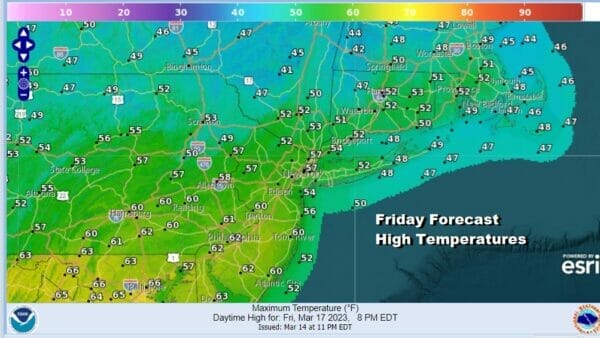
The front will move offshore Friday and temporarily stall along the Carolina coast. Clouds will be around Saturday morning. An area of rain will be to our south and it appears that this rain will stay to the south and east of us Friday night into Saturday morning.
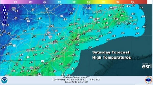
Cold high pressure from Canada will move southeastward and gradually build into the Eastern US over the weekend and that high will settle in the Southeast US for the start of next week. While there may be some leftover clouds in the morning Saturday we should see developing sunshine, a gusty wind and temperatures in the upper 40s to lower 50s.
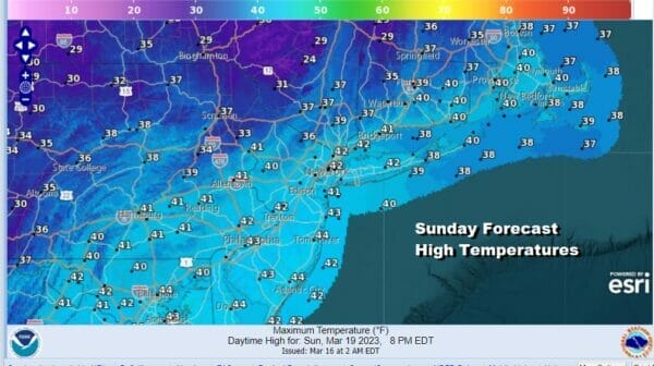
By Sunday morning we will see temperatures bottomiing in the mid 20s to lower 30s. Sunday will be a cold day with sunshine but temperatures are going to have a tough time rising as the core of this cold air mass moves overhead. Highs Sunday will be in the upper 30s and lower 40s.
Much if not all of next week could turn out to be dry. Low pressure will develop in the Gulf of Mexico and head for the Southeast US Coast. It appears this storm rather than move northward will more than likely slide eastward and remain offshore. Monday and Tuesday we should see sunshine both days with highs in the 40s to near 50 Monday and reaching into the 50s Tuesday. Assuming the midweek low is not an issue, the next chance for any precipitation won’t come until next week.
BE SURE TO DOWNLOAD THE FREE METEOROLOGIST JOE CIOFFI WEATHER APP &
ANGRY BEN’S FREE WEATHER APP “THE ANGRY WEATHERMAN!
MANY THANKS TO TROPICAL TIDBITS & F5 WEATHER FOR THE USE OF MAPS
Please note that with regards to any severe weather, tropical storms, or hurricanes, should a storm be threatening, please consult your local National Weather Service office or your local government officials about what action you should be taking to protect life and property.


