
A Cold Weekend & Major Carolina Coastal Storm Highlight Weekend
The satellite picture has on the edge of clouds but those clouds are shifting southeastward today and we should see a decent amount of sunshine for most of the area. It will also complete the dead cat bounce higher in temperatures from the cold air mass of the past two days. Highs will reach the upper 40s and lower 30s. We do unfortunately have a cold front approaching and moving through this evening. The front has very little weather with it. We will simply see a wind shift tonight to the north and temperatures head south by Saturday morning, likely under a clear skies. No issues are showing up on the regional or local radars.
SATELLITE

REGIONAL RADAR

Rain has reached the Carolinas and Southeast Virginia however and this is due to a coastal storm that is developing off the Carolina coastline. This is actually going to strengthen into a major coastal storm over the weekend. All sorts of warnings are up mainly focused around high wind warnings, coastal flooding, and storm warnings for the coastal waters.
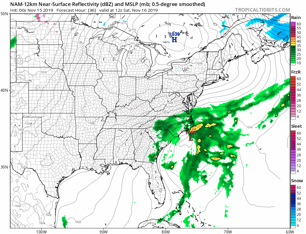
This wrapped up low will stall out off the North Carolina coast on Saturday and actually do a bit of a loop as it lies underneath high pressure which is sitting over Upstate NY & New England. This will create breezy and cold conditions for us over the weekend with some sunshine on Saturday. The cloud line will lie somewhere over Southern New Jersey and points southward. It will be cold Saturday again with highs just in the 30s.
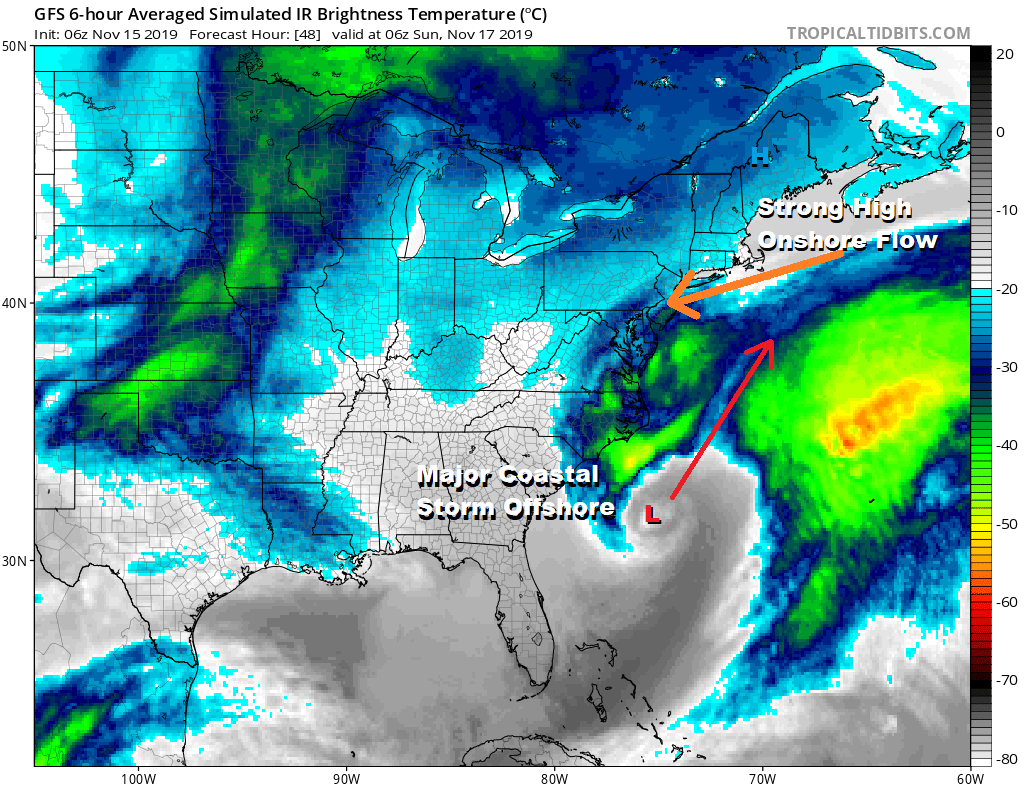
Saturday is definitely the better of the two weekend days. The storm offshore and onshore flow on Sunday will put us in cloudy raw breezy conditions with some rain developing from south to north as the day wears on. Highs will just be in the upper 30s and lower 40s at best. Winds along the coast will pick up to 20 to 35 mph with higher gusts. Gale and storm warnings are already posted. Rain will last into at least part of Monday and there will be more rain to the east across New England and south from Southern New Jersey southward. North and west of these areas the rain will at some point sharply cut off. Once the low pulls away weather conditions should improve on Tuesday. It looks to be a chilly quiet week ahead with temperatures hovering close to a bit below average. After Sunday/Monday the next chance for rain or showers will come late next week.
BE SURE TO DOWNLOAD THE FREE METEOROLOGIST JOE CIOFFI WEATHER APP &
ANGRY BEN’S FREE WEATHER APP “THE ANGRY WEATHERMAN!
MANY THANKS TO TROPICAL TIDBITS FOR THE USE OF MAPS
Please note that with regards to any severe weather, tropical storms, or hurricanes, should a storm be threatening, please consult your local National Weather Service office or your local government officials about what action you should be taking to protect life and property.


