Easter Sunday Warm Temperatures

Easter Sunday Warm Temperatures
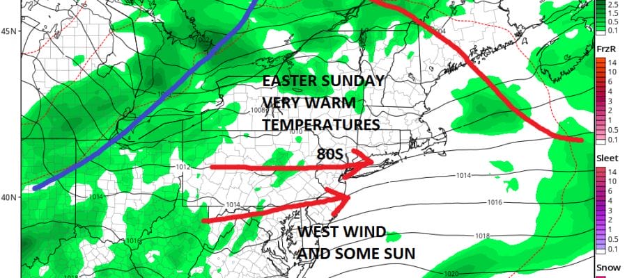
The temperatures of the last 2 days will be taking a break as cooler air moves in through Saturday. There will however be a trip back to the land of 80 degree temperatures (away from the ocean) on Easter Sunday. The process will begin on Saturday with arriving clouds and there will be some passing showers Saturday night. Temperatures Saturday will be on the cool side in the upper 50s and lower 60s but then we make the transition to warm air on Sunday as the warm front goes by and the wind goes west southwest.
EASTER SUNDAY 2PM FORECAST TEMPERATURES
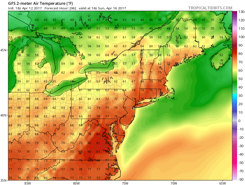
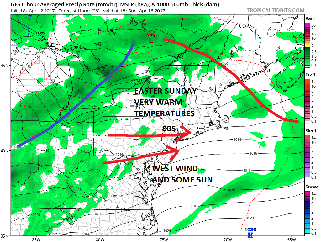
What is interesting about Sunday is that the wind will be west and the gradient is rather tight so temperatures could wind up higher if there is enough sunshine. Late in the day that cold front to the northwest will roll through with a shower or thunderstorm. Then as we move into next week it looks like cool air returns for a couple of days. Then weather models seem to want to take a storm up to the western Great Lakes which could mean another warmup though it may come with some rain. That rain could hold off until Thursday as the next cold front approaches.
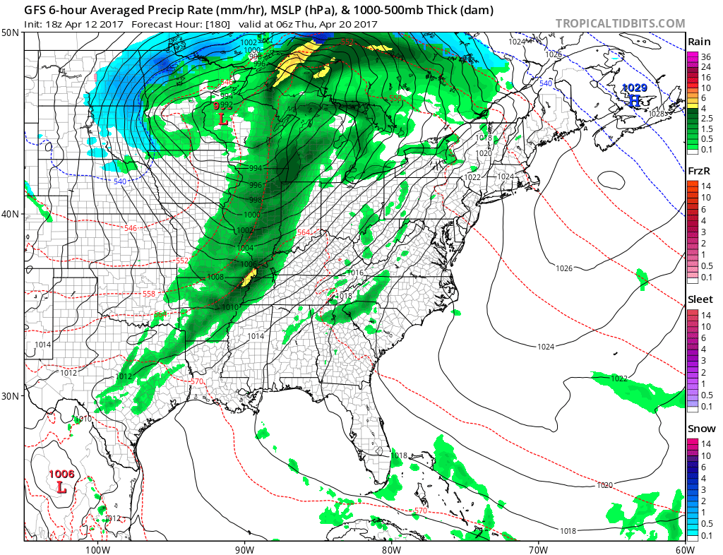
Beyond next week the pattern looks to get blocky again for the last quarter of the month and that could mean for some more chances for rain along with cooler than average temperatures. This will depend on the block and whether that east coast ridge pokes its nose northward again.
MANY THANKS TO TROPICAL TIDBITS FOR THE WONDERFUL USE OF THE MAPS

GET JOE A CIGAR IF YOU LIKE!
LANDSCAPE COMPANIES FOR YOUR SPRING SUMMER FALL NEEDS
LONG ISLAND ROCKLAND COUNTY Connecticut

![]()

ROCKLAND COUNTY TRI STATE SNOW REMOVAL JOHNSTOWN PA


FiOS1 News Weather Forecast For Long Island
FiOS1 News Weather Forecast For New Jersey
FiOS1 News Weather Forecast For Hudson Valley
NATIONAL WEATHER SERVICE SNOW FORECASTS
LATEST JOESTRADAMUS ON THE LONG RANGE
Weather App

Don’t be without Meteorologist Joe Cioffi’s weather app. It is really a meteorologist app because you get my forecasts and my analysis and not some automated computer generated forecast based on the GFS model. This is why your app forecast changes every 6 hours. It is model driven with no human input at all. It gives you an icon, a temperature and no insight whatsoever.
It is a complete weather app to suit your forecast needs. All the weather information you need is right on your phone. Android or I-phone, use it to keep track of all the latest weather information and forecasts. This weather app is also free of advertising so you don’t have to worry about security issues with your device. An accurate forecast and no worries that your device is being compromised.
Use it in conjunction with my website and my facebook and twitter and you have complete weather coverage of all the latest weather and the long range outlook. The website has been redone and upgraded. Its easy to use and everything is archived so you can see how well Joe does or doesn’t do when it comes to forecasts and outlooks.
Just click on the google play button or the apple store button on the sidebar for my app which is on My Weather Concierge. Download the app for free. Subscribe to my forecasts on an ad free environment for just 99 cents a month.
Get my forecasts in the palm of your hand for less than the cost of a cup of Joe!
![]()
