Winter Weather Advisory Snow Sleet Rain
High Wind Watch Sunday Night & Monday

Winter Weather Advisory Snow Sleet Rain
High Wind Watch Sunday Night & Monday
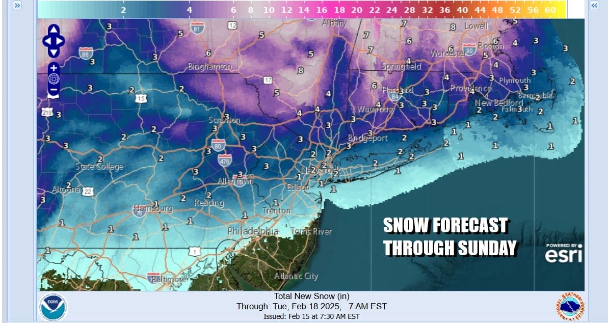
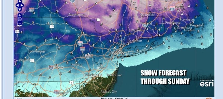
A major storm is set to develop as low pressure moves up the Appalachians and into Western NY and eventually into Northeastern New England. This is going to produce all sorts of precipitation and precipitation types and we may even throw in a thunderstorm or two in the mix for Sunday. Winter Weather Advisories are posted for this afternoon into tonight. For Eastern Pennsylvania to Southern New England we will see anywhere from a coating to an inch of snow on the southern flank to about Interstate 80 in New Jersey to NYC and Long Island, Up to several inches will accumulate to the north in the Hudson Valley and a bit more than that across Connecticut and points further north.
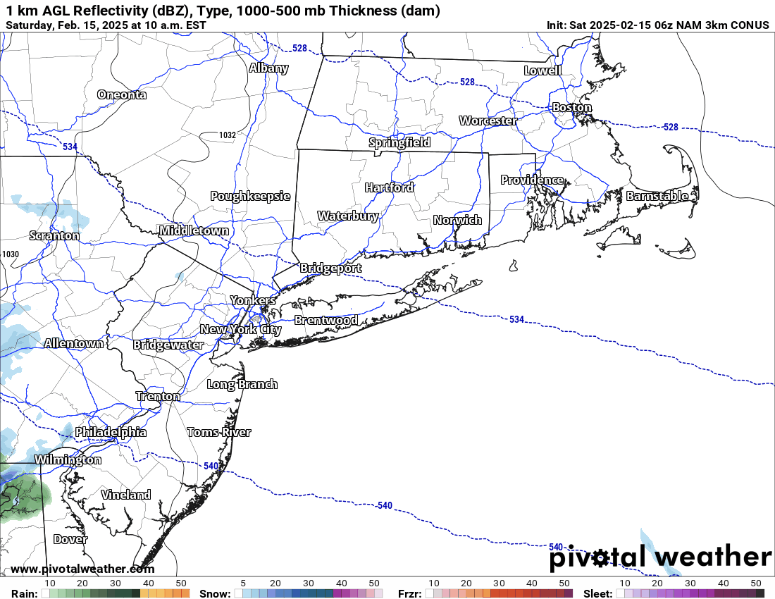
We can watch the progress of the NAM model for this afternoon as snow spreads from west to east across Central and Northern New Jersey and into Long Island followed by a change to rain this evening from southwest to northeast. An area of sleet and freezing rain will develop across inland areas tonight but there seems to be so much warm air surging northward that the amount of icing could be limited. We will need to monitor the progress of the radar and temperatures tonight to determine the extent of any icing.
SATELLITE WITH LIGHTNING STRIKES

WEATHER RADAR

The storm is going to be intensifying rather rapidly tonight into Sunday as it tracks to the west across Western NY. A trailing could front is likely to set off heavy downpours and perhaps a thunderstorm or two as the front passes through Sunday morning into midday. Temperatures today will be slowly climbing through the 30s and we will see temperatures reach the 40s and 50s Sunday morning over many areas.

Once the front passes an exceptionally tight pressure gradient develops as the surface low continues to strengthen. High Wind Watches are posted for Sunday evening into Monday and westerly winds will be blowing 25 to 35 mph with gusts to 50 and 60 mph possible. We will be drying out and turning much colder Sunday night with Monday morning lows in the 20s, teens well inland. Monday will be cold with some sunshine. Highs will only be in the upper 20s to lower 30s.

Attention next week then turns to Wednesday night into early Friday as models continue to show a major East Coast storm developing and potentially bringing heavy snow from Virginia to New England. There is still lots of uncertainty about the track of this potential winter storm but the ingredients seem to be there for a big snowstorm. Much needs to be resolved as some models are further east with the low track which would result in a storm with less impact. This system will also bring snow to the Ohio Valley and the Appalachians as the low initially moves east across the Gulf States and then makes its way to off the coast of Southern New England and east of New Jersey Thursday night. We will be focusing our attention on this storm once the weekend storm system has played through.
BE SURE TO DOWNLOAD THE FREE METEOROLOGIST JOE CIOFFI WEATHER APP &
ANGRY BEN’S FREE WEATHER APP “THE ANGRY WEATHERMAN!
MANY THANKS TO TROPICAL TIDBITS FOR THE USE OF MAPS
Please note that with regards to any severe weather, tropical storms, or hurricanes, should a storm be threatening, please consult your local National Weather Service office or your local government officials about what action you should be taking to protect life and property.


