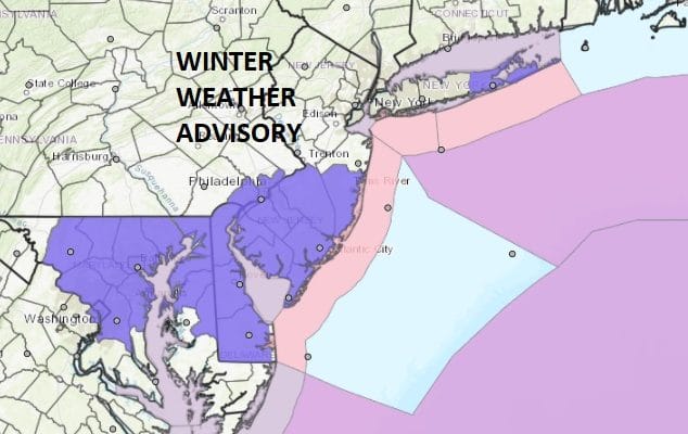
Winter Weather Advisory New Jersey South RT 195 Eastern Long Island

GET JOE A CIGAR IF YOU LIKE
Winter Weather Advisory New Jersey South RT 195
Eastern Long Island
We have Winter Weather Advisories up this morning for Central & Southern New Jersey south of Route 195 and for Eastern Long Island. I would have thought they would have been a bit further north than that but we will see what happens later.
NAM MODEL FORECAST 1PM-7PM WINTER WEATHER
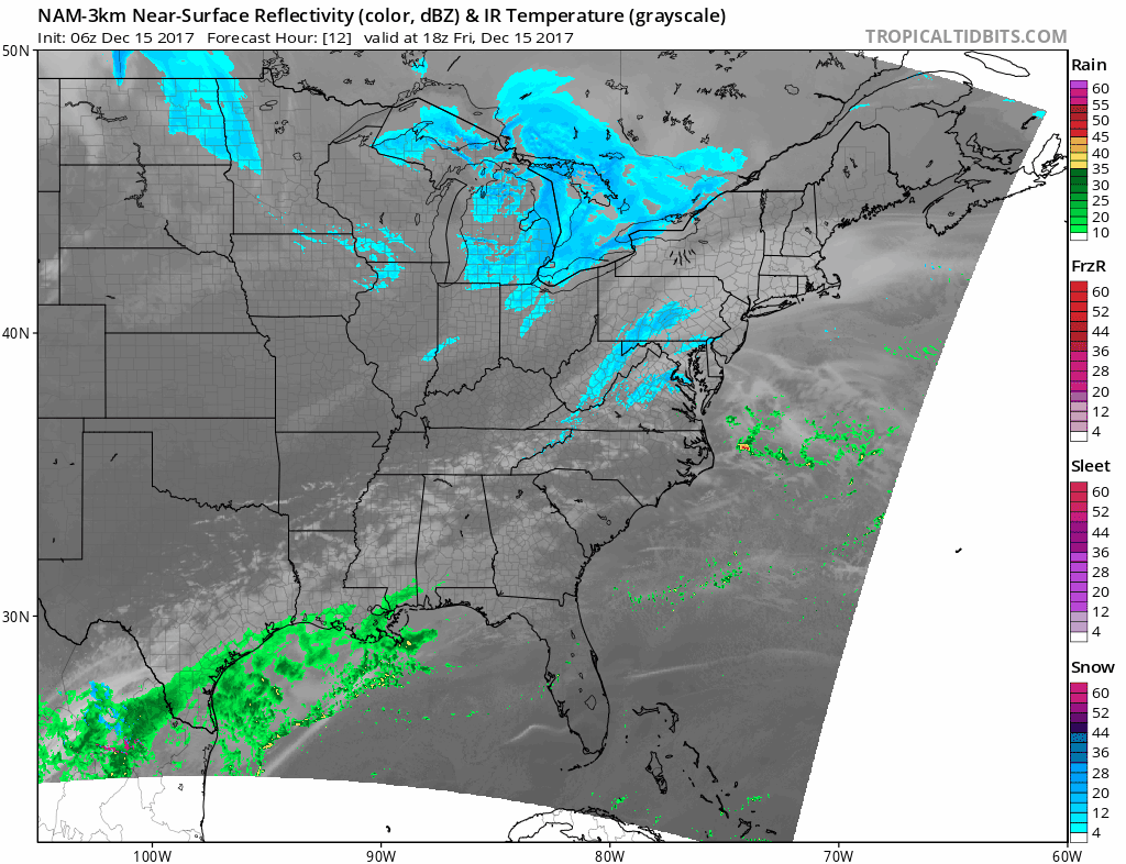
Some of the overnight night model runs got a tad more aggressive with precipitation with this developing low just offshore. This is all literally developing right over us. Look for snow to break out this afternoon after 1pm and it should be ending by 7 or 8pm so this is another 6 to 8 hour event much like the Wednesday night Thursday morning snowfall was with a similar outcome though the maximum amounts will be a little further south this time. This of course will be coming for the evening rush hour on a Friday going during the Christmas season which will not make fun driving for sure so do be cautious. Temperatures this morning have bottomed in the teens and even some single digits and highs today will only be in the 20s which will mean the snow will be rather fluffy in nature.


Nothing is on the radar as of yet as the mechanism for this system has yet to swing around to the East. Systems that develop this way can be problematic in 2 ways. Either they develop faster than modeled which means more snow or they develop slower which would mean less snow. Either way we are going to see some snow and this will be the third accumulating snow fall in the last 6 days which is unheard of for the first half of December.
No issues for the weekend at the moment with clouds and some sunshine and temperatures in the 30s to near 40 both days for highs. There is the risk for a wintry mix in some areas Sunday night into Monday morning as a warm front sets up to our south.
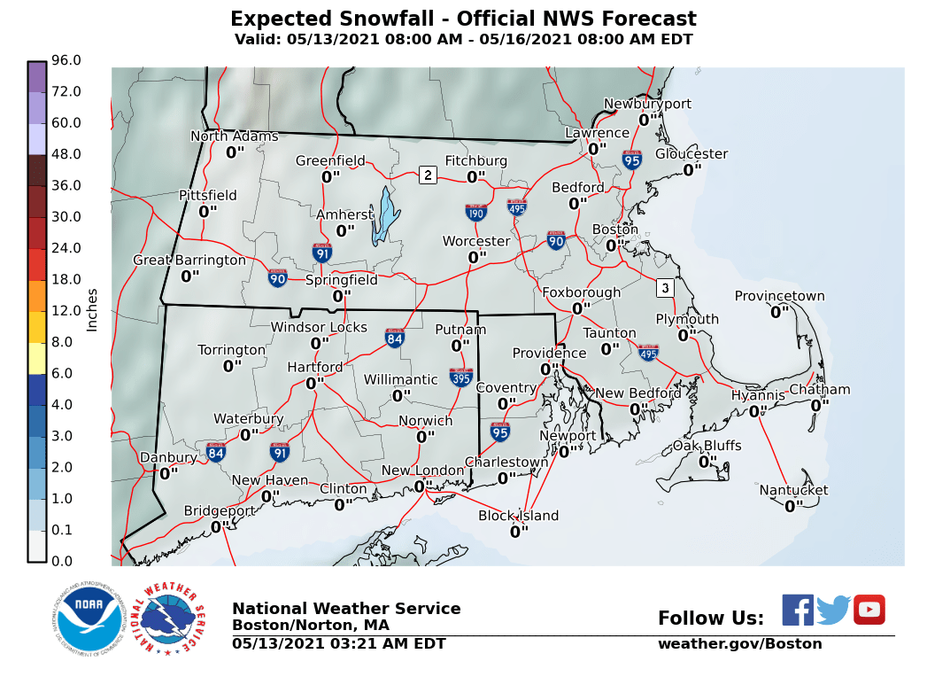
The maps below are the National Weather Service forecast snow maps with the most likely snowfall prediction.