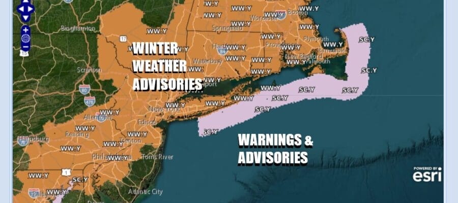

Winter Weather Advisories Into Tonight Eastern Pennsylvania, Much of New Jersey, Southeast New York,
Connecticut, Long Island
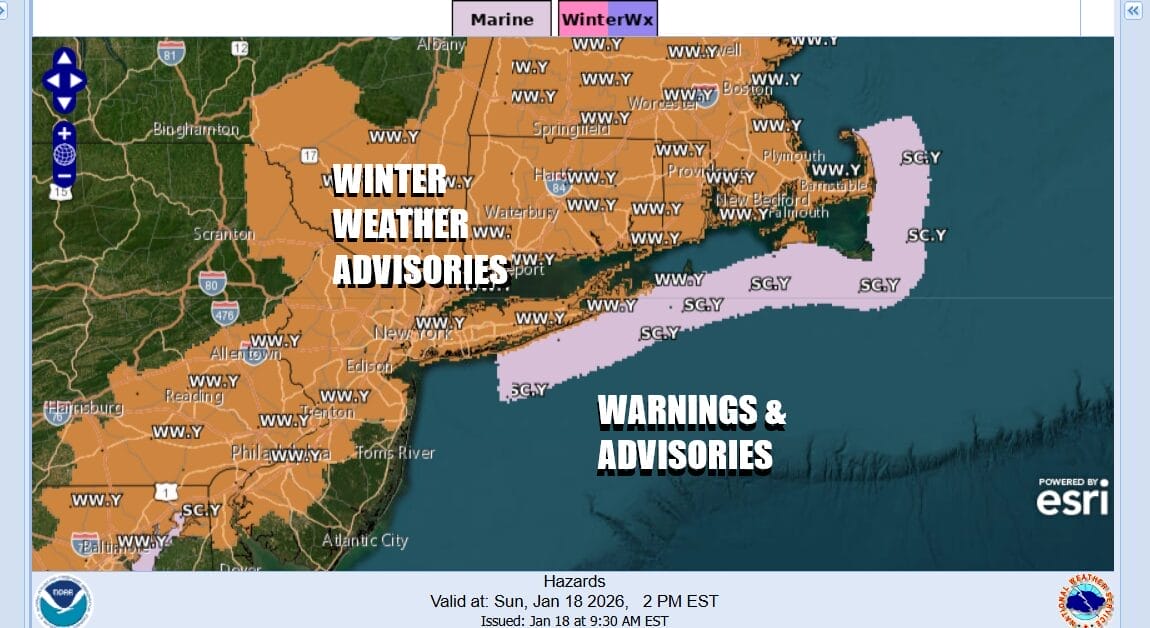
We are into day 2 of winter weather across much of the coastal plain and inland areas from Southeast New England to the coastal Mid Atlantic. Winter Weather Advisories for today and into tonight as a cold front moves offshore this morning and a developing wave to the south heads up the East Coast. This low will get only so far north before it begins to shift to the east but there is enough here for a snowfall of 2 to 4 inches in general across Eastern Pennsylvania to Southern New England and that includes Philadelphia, New York City, Long Island, and southern areas of the Lower Hudson Valley/Northern New Jersey. The further north you go, the less you will get.
SATELLITE WITH LIGHTNING STRIKES

WEATHER RADAR

Radars are showing precipitation moving northeastward from the Mid Atlantic states and snow will redevelop late this afternoon and continue into the first part of tonight. Then it ends from west to east plus or minus a couple of hours of midnight. When it is all said and done, the HRRR model snow forecast shows a reasonable forecast for additional accumulations on the order of 2 to 4 inches for much of New Jersey to Southern New England including New York City and Long Island.
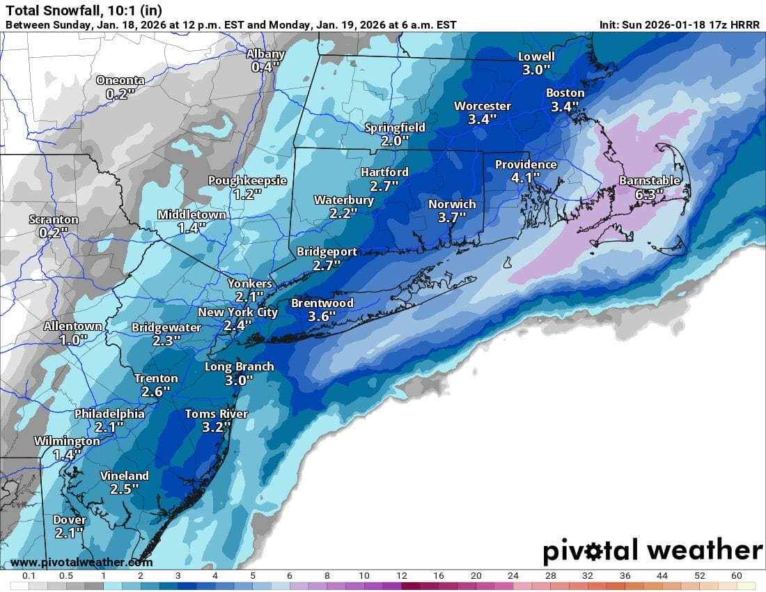
Once snow resumes falling, temperatures will drop back to freezing and then by Monday morning, lows will be in the upper teens to mid 20s. The week ahead will feature very cold weather coming into the Eastern US and it will be with us pretty much all week and through next weekend. Monday highs will be in the low to mid 30s with some sunshine. Arctic air arrives and by Tuesday morning lows will be in the low to mid teens. Tuesday will be very cold with ineffective sunshine. Highs will just be barely back into the 20s in most places.
BE SURE TO DOWNLOAD THE FREE METEOROLOGIST JOE CIOFFI WEATHER APP &
ANGRY BEN’S FREE WEATHER APP “THE ANGRY WEATHERMAN!
MANY THANKS TO TROPICAL TIDBITS FOR THE USE OF MAPS
Please note that with regards to any severe weather, tropical storms, or hurricanes, should a storm be threatening, please consult your local National Weather Service office or your local government officials about what action you should be taking to protect life and property.


