Week Ahead Reasonable Temperatures & Humidity Little Rain In the Forecast

Week Ahead Reasonable Temperatures & Humidity Little Rain In the Forecast

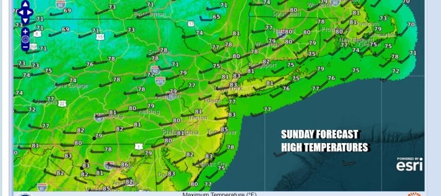
Northwest winds in the upper atmosphere have control over our weather here in the Northeast & Northern Mid Atlantic states. For Eastern Pennsylvania to Southern New England this means little to no rain for the week ahead. Temperatures and humidity levels will be reasonable for this time of year. We do not see any return to heat and humidity (90 degrees or higher) anytime soon. Sunshine will be the story today. Dew points have dropped into the 50s and will stay there all day. High temperatures this afternoon will be mostly in the lower 80s. Radars are quiet for the most part and should remain so.
SATELLITE WITH LIGHTNING STRIKES

WEATHER RADAR

Tonight will be quiet and calm under mainly clear skies. Morning lows Monday will be in the mid to upper 60s along the coast and in warmer urban centers while areas inland will bottom in the upper 50s to lower 60s. In a northwest flow you have upper troughs moving through from time to time. and they can produce clouds and perhaps even a passing shower or thunderstorm but that should happen north in the Upstate NY and New England.
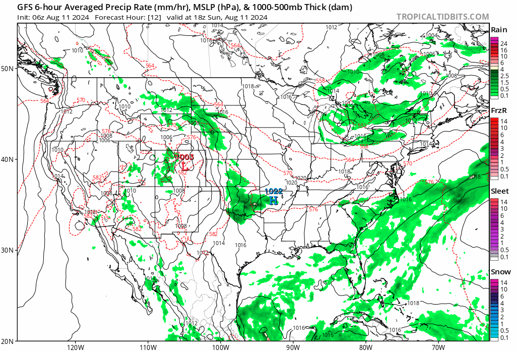
Late in the week and into next weekend you can see what will probably be a hurricane on the lower right of the GFS loop. The upper flow shows a trough extending Nova Scotia southwestward to offshore the Mid Atlantic states. As along as that remains the case, any tropical system will be steered northeastward and offshore. At least that seems to be the most likely outcome at this early stage.
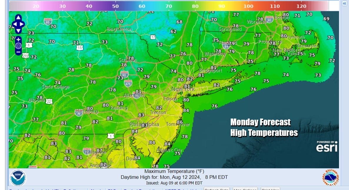
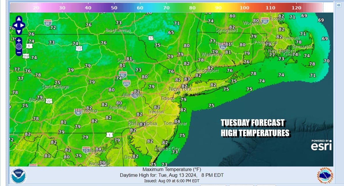
Back to day to day weather, Monday will be a mostly to partly sunny day as one of those upper troughs moves through. We are leaving the chance for a passing shower or thunderstorm out of the forecast. Highs will reach the low and a few middle 80s. Humidity levels will remain reasonable. Tuesday brings a slightly cooler shot of air so we will have sunshine with highs in the upper 70s and lower 80s.
The rest of the work week, Wednesday through Friday look to be dry and sunny for the most part with daytime highs mostly in the lower 80s and nighttime lows in the 60s with 50s in cool spots. The next chance for any rain or showers might come along next weekend as low pressure and a cold front move eastward from the Great Lakes and Ohio Valley.
BE SURE TO DOWNLOAD THE FREE METEOROLOGIST JOE CIOFFI WEATHER APP &
ANGRY BEN’S FREE WEATHER APP “THE ANGRY WEATHERMAN!
MANY THANKS TO TROPICAL TIDBITS FOR THE USE OF MAPS
Please note that with regards to any severe weather, tropical storms, or hurricanes, should a storm be threatening, please consult your local National Weather Service office or your local government officials about what action you should be taking to protect life and property.
(Amazon is an affilate of Meteorologist Joe Cioffi & earns commissions on sales.)


