Weather Conditions Slowly Improve, Nice Weather Sunday & Monday,
Dry Through Wednesday

Weather Conditions Slowly Improve, Nice Weather Sunday & Monday,
Dry Through Wednesday
Snow totals are coming in and this was quite the surprise for folks in a band across Eastern Pennsylvania and Central New Jersey. In a narrow area between Route 78 and Route 195 in New Jersey and back into Pennsylvania we had 6 to 12 inches of snow. The northern edge of that heavy snow band reached Staten Island and the south shore areas of Brooklyn and Queens in NYC. Talk about out performance! Low pressure offshore is now moving away and we still have the upper trough to get through so look for patches of snow showers into this afternoon.
SATELLITE WITH LIGHTNING STRIKES

WEATHER RADAR

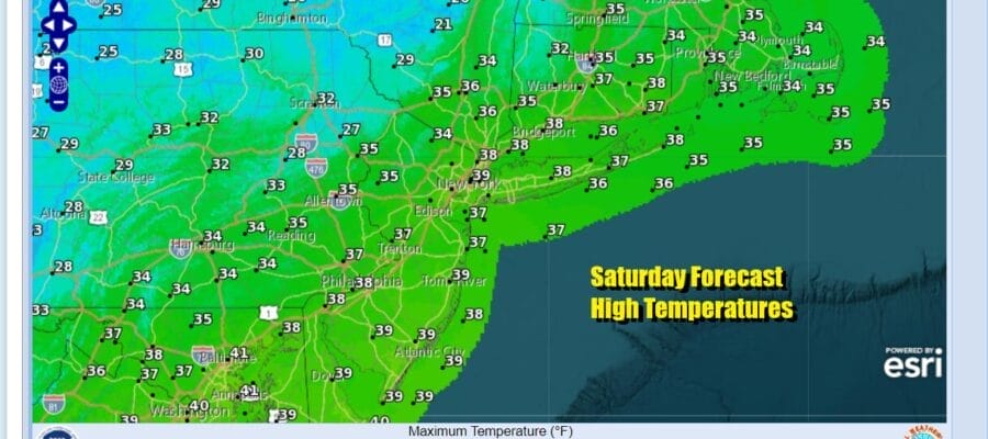
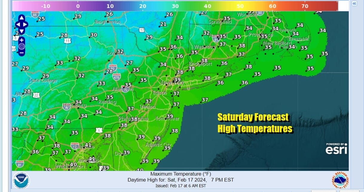
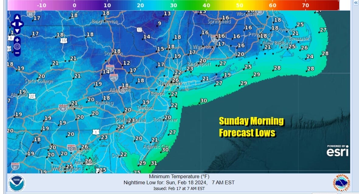
Little additional accumulation will occur from these snow showers. Then we will see decreasing clouds and some sunshine developing this afternoon. Highs will reach the mid and upper 30s. Then skies will clear out tonight and temperatures by Sunday morning will bottom in the teens in most inland areas. Along the coast and in warmer urban locations, most lows will be in a range of 20 to 25 degrees.
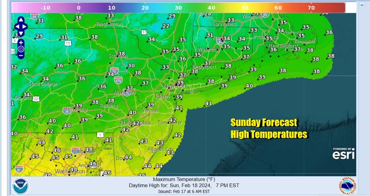
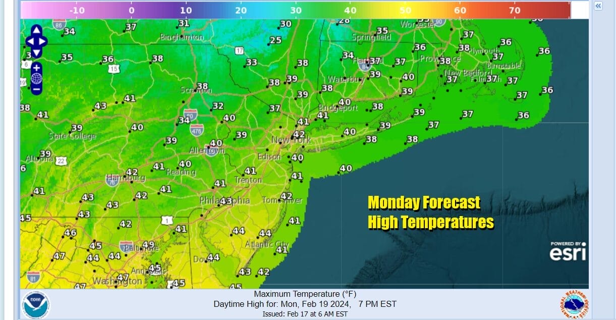
The rest of the Presidents Day holiday weekend will go off without any issues other than some passing clouds around. Sunday we will see sunshine.Temperatures Sunday afternoon will reach the upper 30s to some lower 40s. Monday we are looking at another nice day with some sunshine and highs reaching into the lower 40s in most places.
The first part of next week will be on the quiet side and that means dry weather through Wednesday with moderating temperatures. Tuesday we will see sunshine and highs in the 40s area wide. Wednesday we will also see some sunshine with highs reaching the mid 40s to around or just over 50 in some places. Then we turn our attention to two storm systems that will be heading eastward. One is for Thursday. The second is for next weekend.

The first low comes from a storm that is going to be moving into California this weekend. There isn’t a lot to it and that will be moving through with the chance for showers Thursday. However we do have indications of a stronger system that will be diving southeastward from Canada and heading to the East Coast next weekend. Weather models all seem to be pointing this system out so there is agreement there that something may be in the cards next weekend. We may also be dealing with another situation where cold air is marginal but the chance for snow will be considered as the low redevelops and strengthens offshore. This system will be the focus of attention in the weather world for the week ahead.
BE SURE TO DOWNLOAD THE FREE METEOROLOGIST JOE CIOFFI WEATHER APP &
ANGRY BEN’S FREE WEATHER APP “THE ANGRY WEATHERMAN!
MANY THANKS TO TROPICAL TIDBITS FOR THE USE OF MAPS
Please note that with regards to any severe weather, tropical storms, or hurricanes, should a storm be threatening, please consult your local National Weather Service office or your local government officials about what action you should be taking to protect life and property.
(Amazon is an affilate of Meteorologist Joe Cioffi & earns commissions on sales.)


