
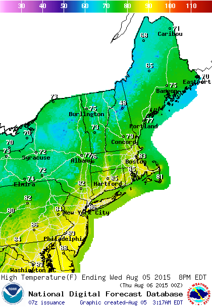
We are slowly cooling down over the next few days for several reasons. First off High pressure is building in from the north and will hold firm into the weekend. The second is that by Friday the flow will be more northeast which will bring the ocean into play as far as temperatures are concerned. The only issue with this will be whether we see cloud cover that will develop in some areas during the overnight hours and that could take some time to burn off in some areas.
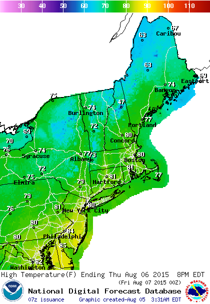

The other issue regarding Friday into Saturday is with regard to low pressure that will form on the stalled cold front to the south. All models now keep rain out of the vast majority of the area. The only exception to this is for South Jersey where some rain gets in for a little while on Friday but it is gone for the weekend. So overall today looks good. Sunshine with just a few passing clouds. It will be warm with temperatures in the mid 80s to near 90. No thunderstorms are forecast right through the weekend!