Very Cold Into Friday Morning Showers Saturday
Chance For Snow Late Sunday

Very Cold Into Friday Morning Showers Saturday
Chance For Snow Late Sunday
Cold air is overhead today and we bottomed out in the upper teens and low 20s. We will have another day of gusty northwest winds but skies should be no worse than partly sunny. Temperatures won’t be rising much as highs will reach the upper 20s and lower 30s this afternoon. Radars are still showing some lake effect snow going on in parts of Upstate NY and some scattered snow showers in Northern New England. Other than that, radars should be on the quiet side today. Tonight will be another clear cold night with lows Thursday morning in the upper teens to mid 20s.
SATELLITE WITH LIGHTNING STRIKES

WEATHER RADAR

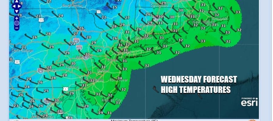
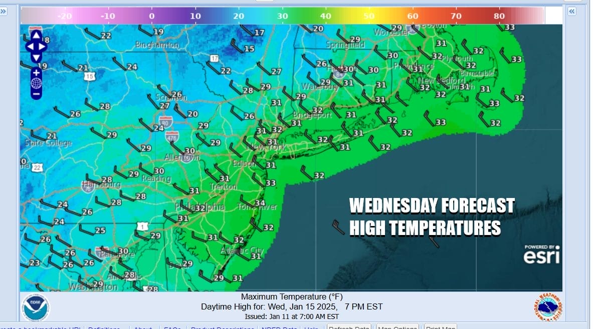
Thursday will be cold with sunshine giving way to arriving clouds. An upper trough now dropping into the Northern Plains will move east across the Great Lakes and Northeast during Thursday into Thursday night. This trough might set off some snow showers late Thursday into Thursday night. It might be enough to whiten the ground in some spots but not in others. Temperatures Thursday will top in the upper 20s and lower 30s.
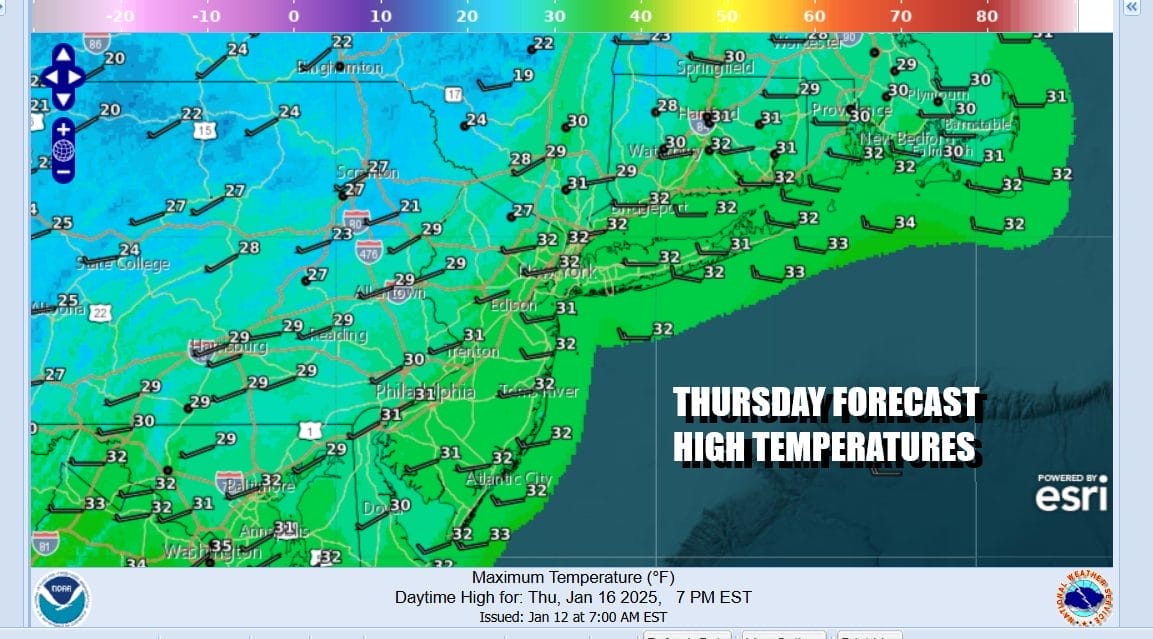
After another cold night Thursday night into Friday morning with lows in the upper teens to mid 20s, temperatures will start to moderate some as the core of the cold air mass moves offshore and winds turn more southwest. Sunshine is forecast Friday with highs reaching the mid to upper 30s.

Over the weekend the atmosphere is setting up for some changes as an arctic front approaches. Ahead of this we will see clouds, warmer temperatures, and a few rain showers Saturday afternoon into the evening. The rain should not amount to much as moisture is limited. Saturday highs will be in the low to mid 40s. The front will stall as it waits for another wave of low pressure to develop in the Southeast US. This system is not forecast to strengthen much as it lifts northeastward up the coast. Clouds will return Sunday with highs in the upper 30s to near 40. Late in the day Sunday night into early Monday morning, colder air will start to filter southeast and a period of snow is possible. This is not going to be a big deal but there might be enough moisture for an inch or two, maybe a bit more to the east as the wave goes by. By Monday morning, temperatures will be in the teens to lower 20s. Once the low departs very cold arctic air from a large bitter cold air mass will begin to spread into most of the US east of the Rockies. including the deep south. This cold air mass will be around for much if not all of next week. We are looking for highs in the 20s Monday. Tuesday will be very cold as we start the day in the single digits to low teens and many areas will not see temperatures rise above 20 Tuesday afternoon. Later next week we will be watching for the possibility of another southern storm system that could develop in the Gulf of Mexico but there is much uncertainty about this in the long range.
BE SURE TO DOWNLOAD THE FREE METEOROLOGIST JOE CIOFFI WEATHER APP &
ANGRY BEN’S FREE WEATHER APP “THE ANGRY WEATHERMAN!
MANY THANKS TO TROPICAL TIDBITS FOR THE USE OF MAPS
Please note that with regards to any severe weather, tropical storms, or hurricanes, should a storm be threatening, please consult your local National Weather Service office or your local government officials about what action you should be taking to protect life and property.


