
Temperatures Begin To Bounce Slowly Higher Next Few Days
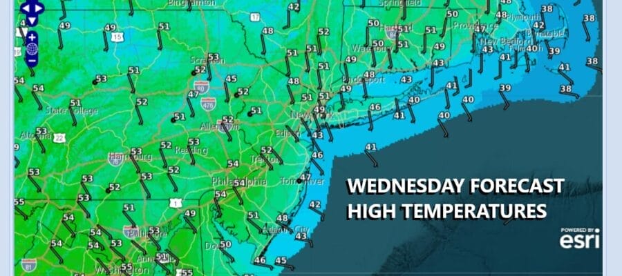
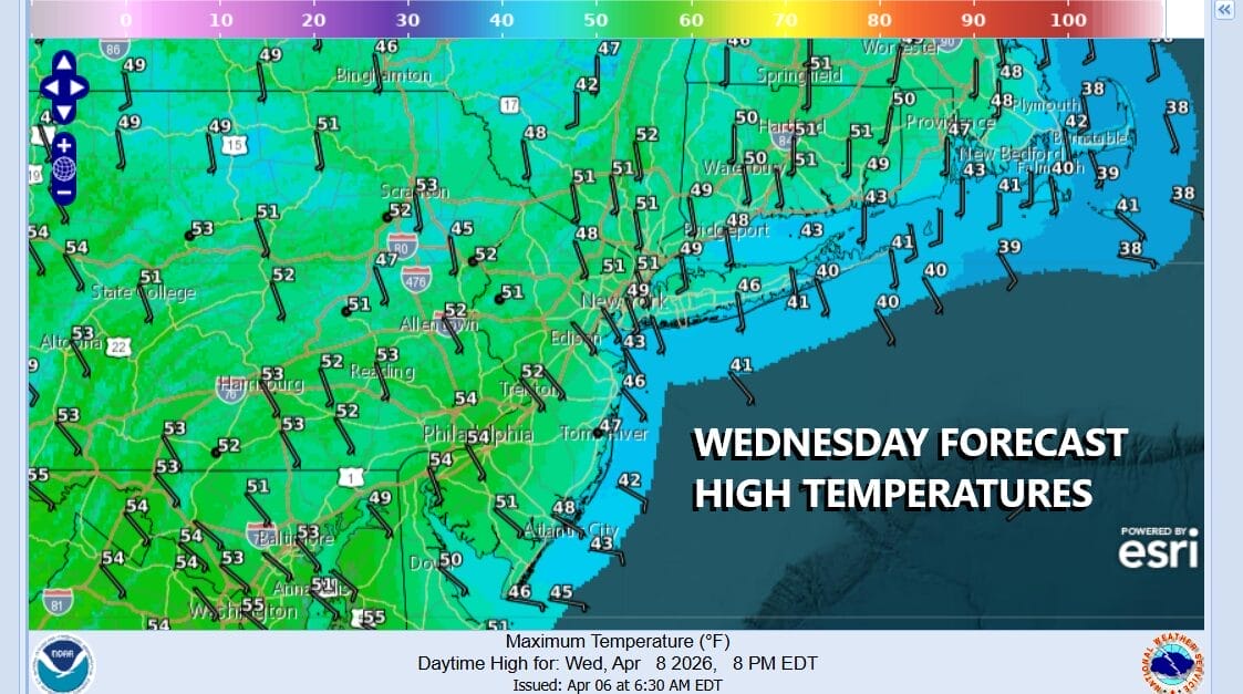
These aren’t the final lows for this morning but we are bottoming in the mid 20s to around 30 degrees and that is creating a destructive freeze for areas where the growing season has begun. The core of this cold air mass will be overhead and moving slowly out to the east today. Satellite loops show clear skies up and down the Eastern Seaboard with an offshore low east of the Carolinas heading eastward. Sunshine will take highs to the upper 40s and lower 50s in most places this afternoon.
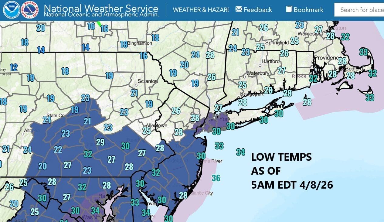
Tonight we will see clear skies and light winds and that will send inland lows down in the 20s while along the coast and in warmer urban areas, lows will be in the low to middle 30s. Once again aeras where the growing season has begun will see frosts and freezes. It always pays to wait until early May before putting down annuals in the garden as well as summer vegetables.
SATELLITE WITH LIGHTNING STRIKES

WEATHER RADAR

There really isn’t much going on in the coming days. We should see temperatures move higher and while we do have a weather front coming through late Friday night into early Saturday morning, it appears to be weak and will have only a minimal amount of shower activity as it goes by. This potentially leaves us mostly dry through the weekend and into early next week.
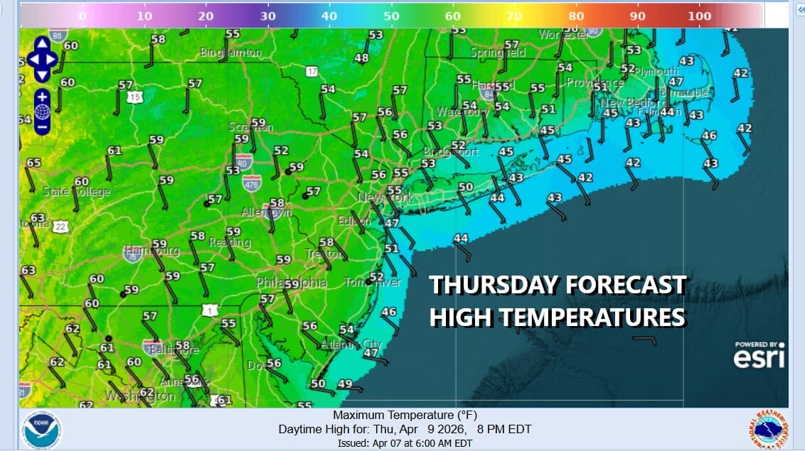
Thursday should be a day of sunshine and just a few passing clouds. Winds off the ocean will limit temperature upside. Highs will be in the middle to upper 50s in areas inland. Along the coast of New Jersey as well as Long Island and South Coastal New England, highs may just be in the 40s to around 50. We should move higher Friday into the 60s to around 70 degrees in warm spots. The weekend will see slightly lower temperatures but highs at least will be in the 60s which is where we should be for this time of year. Other than a couple of showers Friday night, the weekend will be dry.
BE SURE TO DOWNLOAD THE FREE METEOROLOGIST JOE CIOFFI WEATHER APP &
ANGRY BEN’S FREE WEATHER APP “THE ANGRY WEATHERMAN!
MANY THANKS TO TROPICAL TIDBITS FOR THE USE OF MAPS
Please note that with regards to any severe weather, tropical storms, or hurricanes, should a storm be threatening, please consult your local National Weather Service office or your local government officials about what action you should be taking to protect life and property.


