Sunshine Cool Conditions Continue Into Wednesday,
Showery Rains Thunderstorms Over the Weekend

Sunshine Cool Conditions Continue Into Wednesday,
Showery Rains Thunderstorms Over the Weekend
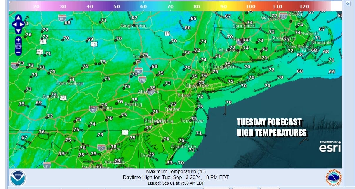
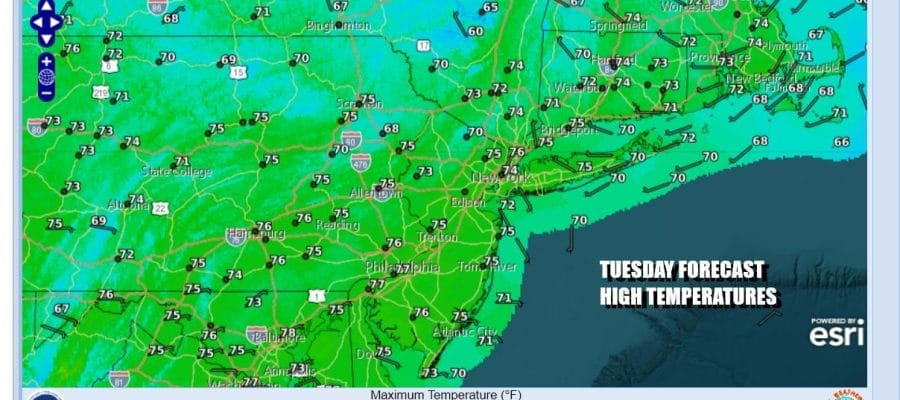
It was certainly a cool start to things this morning across much of the Northeast and Northern Mid Atlantic states as lows were in the 40s in many inland areas and in the 50s in warmer urban centers and along the coast. Satellite and radar loops show quiet conditions with clear skies and this will be a day where we see lots of sunshine. Highs will be mostly in the low to middle 70s and no issues that I can see.
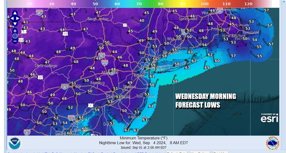
We also see another cool night ahead with once again many areas seeing lows dropping into the 40s especially inland. Coastal lows will be mostly in the 50s and the same holds for warmer urban locations. Skies tonight once again will be mostly clear with no issues to speak of other than a sweat shirt may come in handy from the early autumn like chill.
SATELLITE WITH LIGHTNING STRIKES

WEATHER RADAR

Wednesday dayside is another day of tons of sunshine. High pressure will be centered pretty much right overhead. After a chilly start, temperatures will probably reach the mid to upper 70s during the afternoon and some warm spots might touch 80 degrees, mainly in South Jersey and points southward.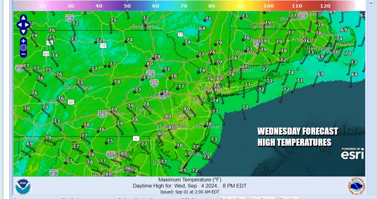
This strong high continues to slide slowly to the east off the coast of New England so it begins to set up an onshore flow Thursday. Initially the onshore flow won’t pose any issues other than perhaps a few clouds Thursday morning along the coast. However as we move into Friday and especially Saturday we will start to see a deterioration of weather conditions.
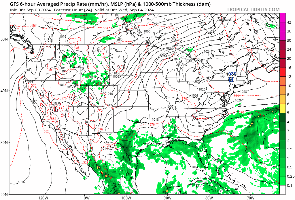
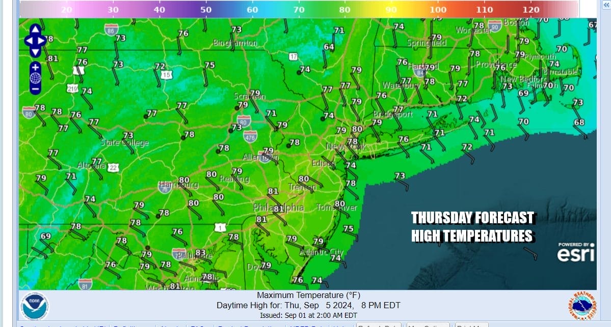
Come Saturday we see a cold front sweeping in from the Great Lakes and Ohio Valley and Gulf Moisture collects in the Southeast US and is drawn northward. Thursday should be no worse than partly sunny with high temperatures in the 70s. Onshore winds will hold temperatures down.
Friday we will probably see some low clouds and patchy fog to start the day and hen dayside we will see anything from cloudy to partly sunny conditions with highs in the 70s. Saturday we start to see rain overspread the area from south to north and there might be a few thunderstorms in the mix late Saturday into early Sunday morning. If this cold front behaves and moves along, we could see improving weather conditions Sunday afternoon and dry weather conditions to start next week.
BE SURE TO DOWNLOAD THE FREE METEOROLOGIST JOE CIOFFI WEATHER APP &
ANGRY BEN’S FREE WEATHER APP “THE ANGRY WEATHERMAN!
MANY THANKS TO TROPICAL TIDBITS FOR THE USE OF MAPS
Please note that with regards to any severe weather, tropical storms, or hurricanes, should a storm be threatening, please consult your local National Weather Service office or your local government officials about what action you should be taking to protect life and property.
(Amazon is an affilate of Meteorologist Joe Cioffi & earns commissions on sales.)


