Sunshine Continues Warm Temperatures Through Wednesday
Oscar Nears Northeast Cuba

Sunshine Continues Warm Temperatures Through Wednesday
Oscar Nears Northeast Cuba

Day 2 of the weekend is much like day one. Nothing has changed as high pressure continues to have a firm grip on the eastern half of the US with no rain anywhere. We will see plenty of sunshine today and the southwest wind will warm temperatures up this afternoon to the mid and upper 70s. It would be no surprise if some warm spots in South Jersey southward into Northern Delaware see highs close to 80 degrees in some places. Nights will be warming up as well as most inland lows tonight will be in the 40s while warmer urban areas will be in the low to middle 50s.
SATELLITE WITH LIGHTNING STRIKES

WEATHER RADAR

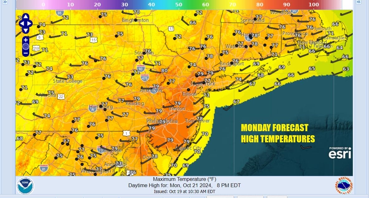
No change in air mass means that Monday will be another sunny day with little in the way of even some passing clouds. Highs will reach the mid 70s to around or just over 80 degrees in the warmest areas like Central and Southern New Jersey. Temperatures will be a little cooler along the shore with local sea breezes taking hold during the afternoon and evening.
The high pressure area in the Eastern US is such a dominant feature that it is not allowing weather systems to move across the country from west to east. Weather systems can move across Southern Canada however and a weakness in that ridge will allow a cold front to pass through the Great Lakes and Northeast Wednesday night and Thursday. However the southern end of that front has little to any moisture with it.

It also effectively blocks Hurricane Oscar which is moving west southwest toward the Northeast Coast of Cuba. Oscar is a very small hurricane with top winds of 80 mph and gales that barely extend outward 40 to 50 miles from the center. It is basically a glorified severe thunderstorm complex. Oscar will linger near Eastern Cuba and the Southern Bahamas for a couple of days but then is forecast to head northeast and weaken thanks to increasing winds in the upper atmosphere creating hostile conditions for further development.

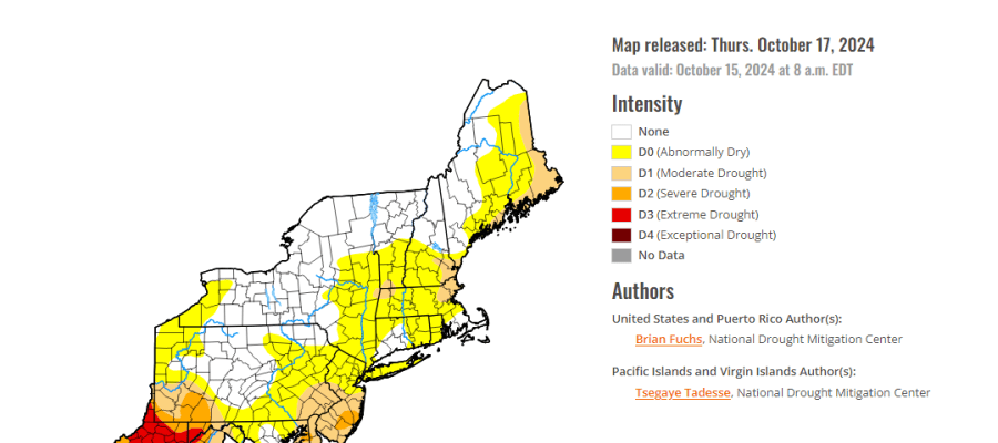
This all leaves Eastern Pennsylvania to Southern New England high dry and warm through at least Wednesday. Sunshine will take highs both Tuesday and Wednesday into the upper 70s and lower 80s with temperatures a little lower along south and east facing shorelines. Thursday the cold front will pass and we will throw in the chance that there could be a passing shower though the highest changes will be to the north in Upstate NY and New England and even here the rain doesn’t amount to much. Once it passes it is back to dry and cooler for later Thursday and Friday with developing sunshine. Next weekend sees another weak front passing probably sometime late Sunday so the weekend looks good with above average temps. San Diego weather likely continues in the long range with no break in the very dry pattern through the end of the month. The dry conditions are growing more serious with each passing day as moderate drought conditions continue to develop across Southern New England southward,

Southern New Jersey south to Delaware and Eastern Maryland are in moderate drought conditions with abnormally dry conditions from Eastern Pennsylvania and Northern New Jersey northeast to Maine. Extreme drough covers a large portion of West Virginia and that has been going on there for the better part of the last 6 months. Long range models out to the next 2 weeks show little change in this overall dry pattern for the Eastern US.
BE SURE TO DOWNLOAD THE FREE METEOROLOGIST JOE CIOFFI WEATHER APP &
ANGRY BEN’S FREE WEATHER APP “THE ANGRY WEATHERMAN!
MANY THANKS TO TROPICAL TIDBITS FOR THE USE OF MAPS
Please note that with regards to any severe weather, tropical storms, or hurricanes, should a storm be threatening, please consult your local National Weather Service office or your local government officials about what action you should be taking to protect life and property.


