
Snow Inland, Snow to Rain Coast Christmas Eve & Christmas Day Look Good
More Snow Possible Later Friday
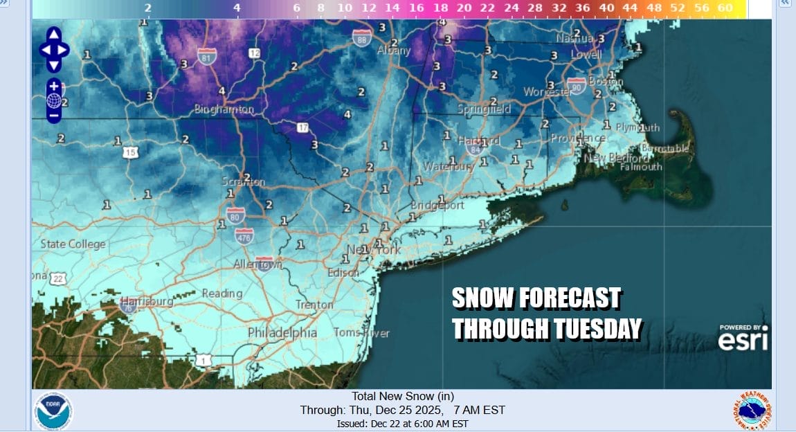
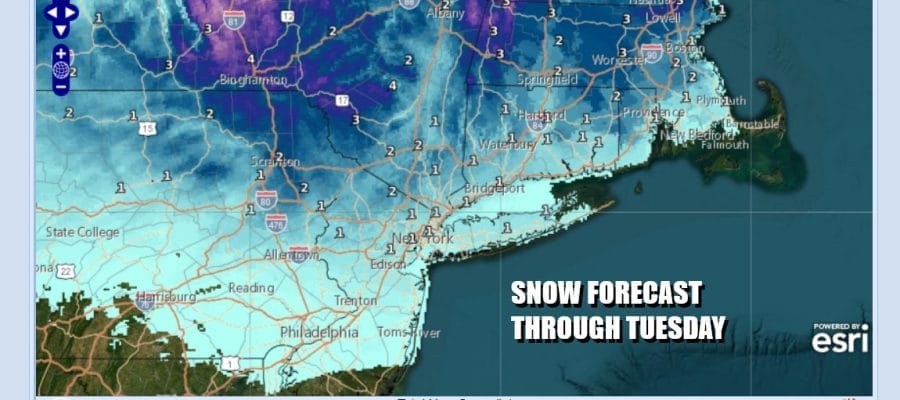
A northeast-southwest warm front is producing some snow this morning north of the frontal boundary. Coastal areas go to rain before it ends. Inland areas see mostly snow or a mix. Borderline temperatures means that accumulations are likely to more on colder surfaces than main roads. Winter Weather Advisories are up for inland counties of Northern New Jersey and the Lower Hudson Valley north of Interstate 287 and Southwest Connecticut. Snow amounts will range from a coating to an inch or maybe 2. Perhaps some isolated 3 inch amounts are possible well inland in Southeast New York but this to mean remains a minor event and I’m not expecting any surprises.
SATELLITE WITH LIGHTNING STRIKES

WEATHER RADAR

Much of the precipitation on the radar is streaking and while it will fill in some, there isn’t a lot of upside here. Most of this should come to an end midday to early afternoon and we might even see some breaks of sunshine later today. Temperatures are borderline while it is snowing and late today highs should reach the upper 30s to lower 40s so what falls should not be a big issue.
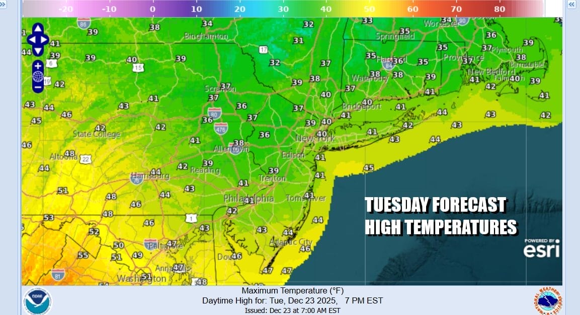
Most lows tonight will be in the low to mid 30s under some partially clearing skies. Im not expecting much of a refreeze issue with temperatures not falling much. Christmas Eve and Christmas Day overall should be good days for the most part with no weather issues. We have weak high pressure overhead Wednesday and skies should be no worse than partly sunny with highs in the low to middle 40s.
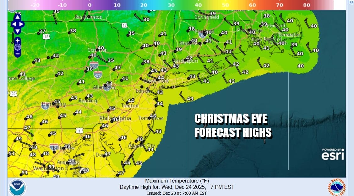
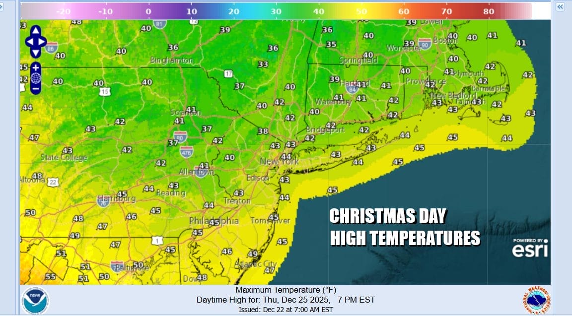
It will turn a little colder Wednesday night but I expect skies to be mainly clear and Christmas morning lows will be in the mid to upper 20s. Christmas Day we have a cold front that will move through and there isn’t much with it. A little disturbance might bring clouds and perhaps a few scattered midday & afternoon showers or sprinkles as it goes by. Otherwise clouds on either side of any sprinkles and highs Christmas Day will be in the low to mid 40s.
Cold high pressure will be building into Eastern Canada and southward into New England and the Northern Mid Atlantic so by Friday morning under clear skies we will see lows in the upper teens to mid 20s. This sets us up for the next storm system that will be moving across the Ohio Valley and then forced southeast to the Virginia coast Friday night into Saturday morning where it will redevelop. This is going to set us up for some snow developing later Friday afternoon lasting into Saturday morning. Friday temperatures will only top out in the upper 20s to mid 30s from north to south as clouds increase and snow arrives late in the day.
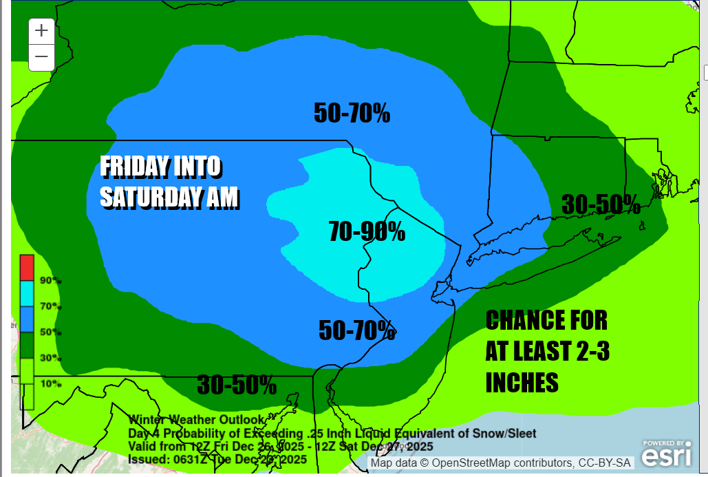
The Weather Prediction Center in their Day 4 long range outlook has a very bullish forecast for snow. Probability for at least a few inches is running high, over 50 percent in most areas across Eastern Pennsylvania to Southeast New York, Connecticut and Long Island. We think the cold air wedges in and holds thanks to the developing North Atlantic block. We still are not close enough to the event to speculate on snow amounts but there seems to be a good chance for at least several inches of accumulation to occur as we head into the weekend between Christmas and New Year’s Eve. We will be monitoring model developments in the coming days and we will also have all the latest on this tonight on the Joe & Joe Weather Show Podcast on Youtube.
BE SURE TO DOWNLOAD THE FREE METEOROLOGIST JOE CIOFFI WEATHER APP &
ANGRY BEN’S FREE WEATHER APP “THE ANGRY WEATHERMAN!
MANY THANKS TO TROPICAL TIDBITS FOR THE USE OF MAPS
Please note that with regards to any severe weather, tropical storms, or hurricanes, should a storm be threatening, please consult your local National Weather Service office or your local government officials about what action you should be taking to protect life and property.


