Snow Ice Possibility Friday 12222017

Snow Ice Possibility Friday 12222017
I have often observed that in winters where it snows a lot, it seems to find away to do it even in situations that don’t often show up obvious. We had that happen last Friday and we may see it happen for parts of the area this Friday.
GFS FRIDAY 1PM 12/22/2017
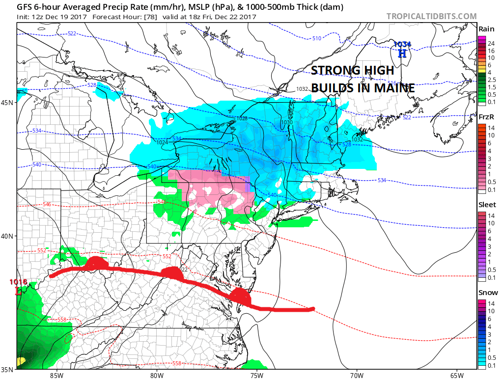
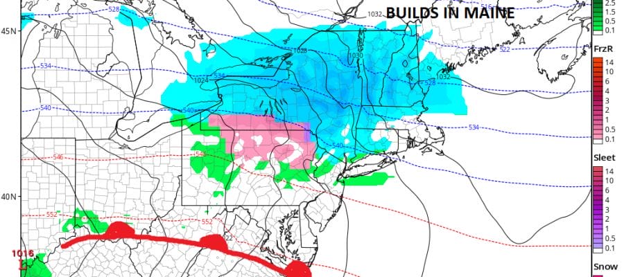
What is happening is that the North Atlantic Oscillation is going negative briefly at the end of this week. This is allowing a strong high to build in Maine. A lead piece of moisture is going to be moving across the Great Lakes southeastward to our area as a warm front sets up to our south. Weather models have been trending south with this and temperatures are shown to be much colder Friday morning as many areas from Central New Jersey northward will be in the 20s to near 30 for lows and slow to rise on Friday.
GFS SNOW FORECAST FRIDAY 12/22/2017
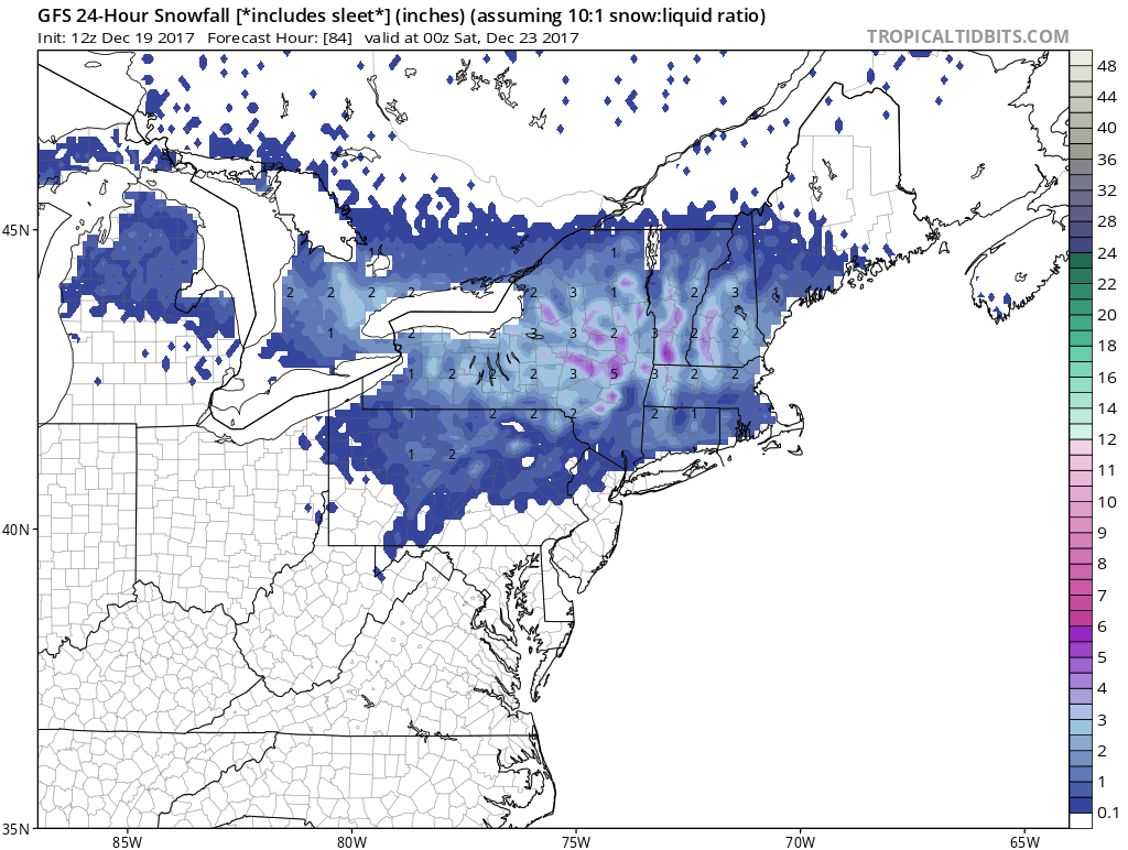
Right now this would seem be an issue for New Jersey & Eastern Pennsylvania north of Route 80 and in the Hudson Valley north of 287 and in Connecticut north of Route 15. The European is actually a little bit colder and a bit further south with measurable snow and ice. We will wait until this evening to put out a snow ice forecast should late day models continue the colder southward trend. Regardless of what happens we will see the warm front go by overnight Friday and early Saturday with rain coming Saturday and highs in the 50S. The European model has also shifted east and lines up with the GFS on the idea of a White Christmas for us. We will also talk more about that later today.
MANY THANKS TO TROPICAL TIDBITS FOR THE WONDERFUL USE OF THE MAPS

GET JOE A CIGAR IF YOU LIKE!
FiOS1 News Weather Forecast For Long Island
FiOS1 News Weather Forecast For New Jersey
FiOS1 News Weather Forecast For Hudson Valley
NATIONAL WEATHER SERVICE SNOW FORECASTS
LATEST JOESTRADAMUS ON THE LONG RANGE
Weather App

Don’t be without Meteorologist Joe Cioffi’s weather app. It is really a meteorologist app because you get my forecasts and my analysis and not some automated computer generated forecast based on the GFS model. This is why your app forecast changes every 6 hours. It is model driven with no human input at all. It gives you an icon, a temperature and no insight whatsoever.
It is a complete weather app to suit your forecast needs. All the weather information you need is right on your phone. Android or I-phone, use it to keep track of all the latest weather information and forecasts. This weather app is also free of advertising so you don’t have to worry about security issues with your device. An accurate forecast and no worries that your device is being compromised.
Use it in conjunction with my website and my facebook and twitter and you have complete weather coverage of all the latest weather and the long range outlook. The website has been redone and upgraded. Its easy to use and everything is archived so you can see how well Joe does or doesn’t do when it comes to forecasts and outlooks.
Just click on the google play button or the apple store button on the sidebar for my app which is on My Weather Concierge. Download the app for free. Subscribe to my forecasts on an ad free environment for just 99 cents a month.
Get my forecasts in the palm of your hand for less than the cost of a cup of Joe!