
Showers Thunderstorms Saturday Through Monday,
Hurricane Warning Bermuda From Ernesto

Showers Thunderstorms Saturday Through Monday,
Hurricane Warning Bermuda From Ernesto

We are still holding on to relatively dry and and relatively low dew points in the mid to upper 50s. That is still keeping things rather comfortable and it is certainly better than dew points in the low 70s and temperatures in the 90s. We will see sunshine today. There have been upper troughs rotating around an upper low in Eastern Canada and you can see it clearly on the satellite loop but most of the clouds with this are well to the northeast so we should be no worse than partly sunny today and at times mostly sunny. High temperatures will be in the low to middle 80s;
SATELLITE WITH LIGHTNING STRIKES

WEATHER RADAR

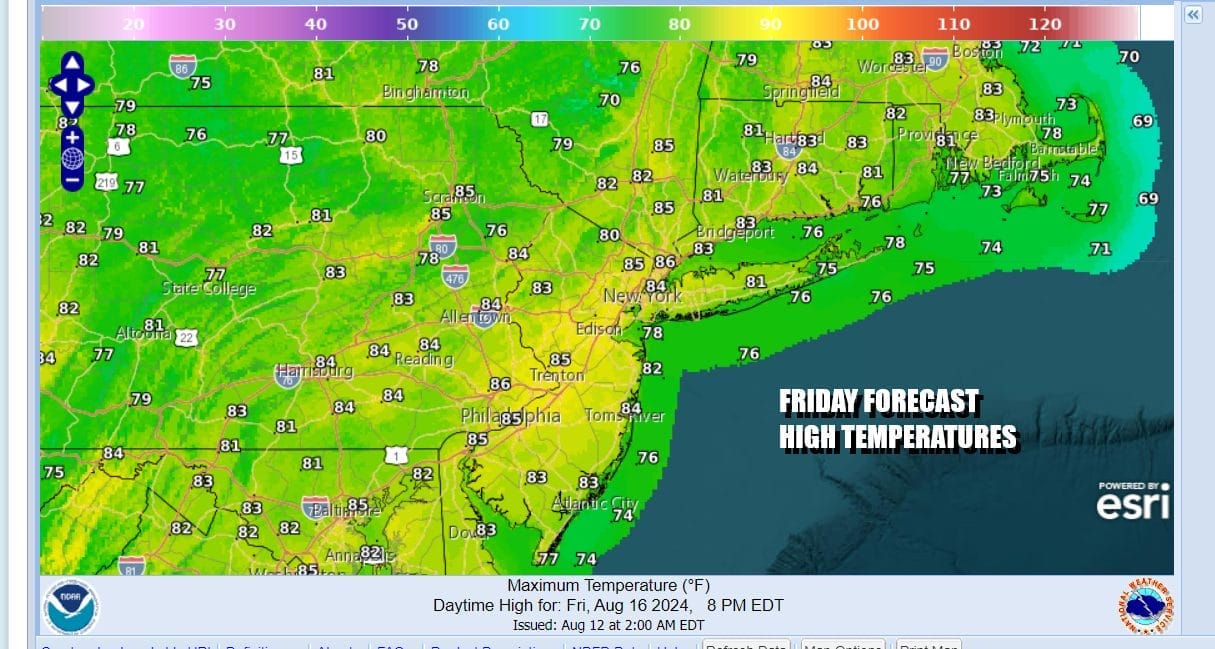
Radar action should be minimal today and skies will be clear tonight with lows in the upper 50s to middle 60s Friday will be the last day of decent dew points. Skies should be sunny or no worse than partly sunny for most of the day. Highs again will be generally in the low to middle 80s. Getaway day for the weekend features no rain in the forecast.
This is not going to be the best of weekends. We have Hurricane Ernesto on the weather maps and it heading northward. Ernesto has been strengthening and it will likely become a major hurricane briefly as it nears Bermuda. Hurricane Warnings are up for the Island of Bermuda and the center could possibly pass directly over the island midday Saturday.
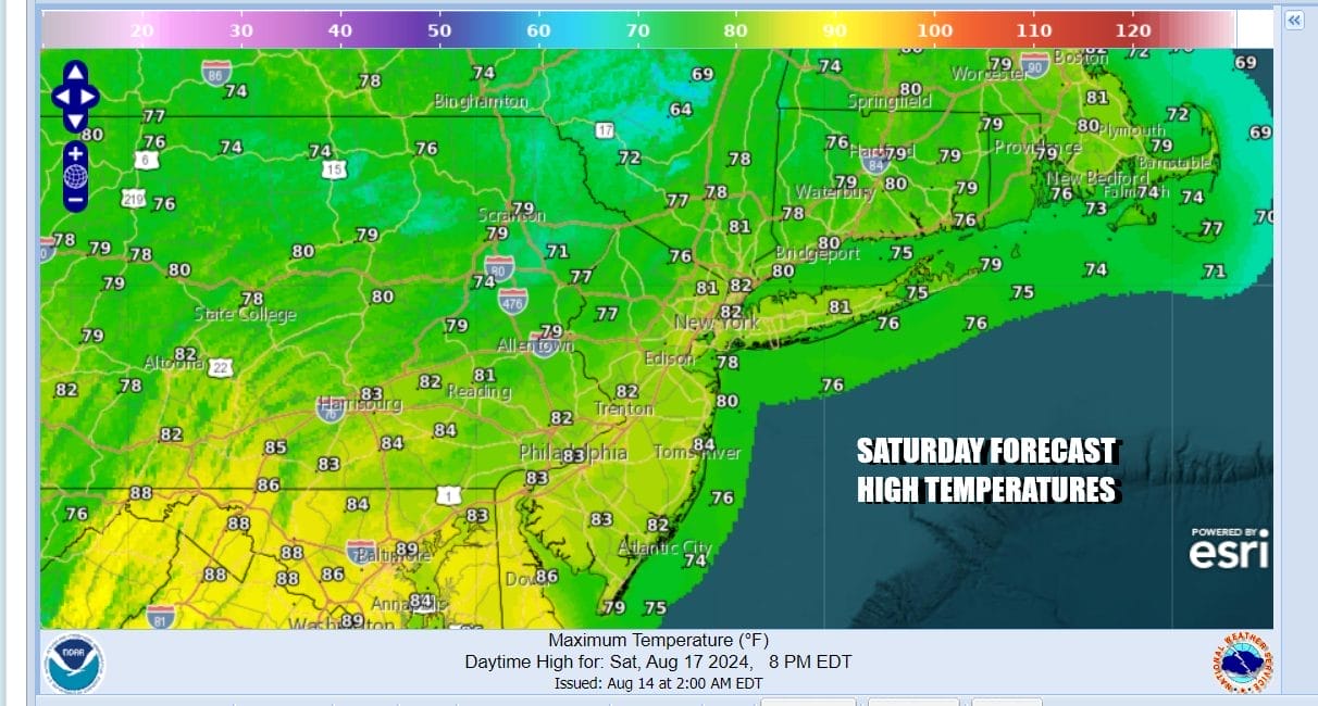
While Ernesto is moving northward, it is effectively slowing down the next cold front that is moving eastward across the Great Lakes and Ohio Valley. It will likely come to a grinding halt for awhile in the Northeast and Northern Mid Atlantic states and this sets up for showery rains and thunderstorms over the weekend and possibly into early next week. This system won’t be able to move out until Ernesto turns eastward out to sea, which it will do by Monday.
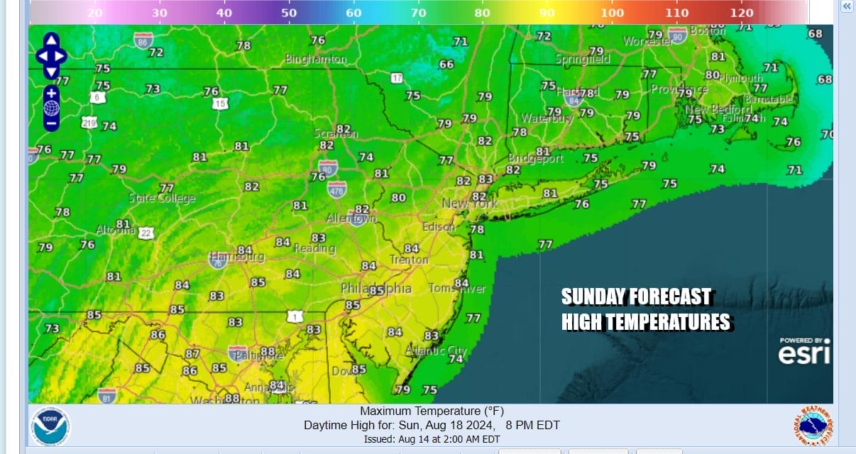
The front will still be around Monday and even for a time Tuesday of next week so the chance for showers and thunderstorms will continue. Obviously humidity levels will be up all weekend and into early next week. Weather conditions should start to improve as early as later Tuesday but more than likely Wednesday.
BE SURE TO DOWNLOAD THE FREE METEOROLOGIST JOE CIOFFI WEATHER APP &
ANGRY BEN’S FREE WEATHER APP “THE ANGRY WEATHERMAN!
MANY THANKS TO TROPICAL TIDBITS FOR THE USE OF MAPS
Please note that with regards to any severe weather, tropical storms, or hurricanes, should a storm be threatening, please consult your local National Weather Service office or your local government officials about what action you should be taking to protect life and property.
(Amazon is an affilate of Meteorologist Joe Cioffi & earns commissions on sales.)


