
Severe Weather Risk Saturday

MENTION JOE CIOFFI AND GET A 5% DISCOUNT
Thunderstorms Friday & Saturday
Severe Weather Risk Saturday
We have 2 cold fronts coming through over the next 3 days. The first one comes through later on Friday and Friday evening. The second one comes through later Saturday and Saturday evening. It is the second front that I think has the potential to produce severe weather here.
Severe Weather Risk Saturday Storm Prediction Center

There are several reasons why the second front will be more supportive for severe weather than the first. Tonight into Friday we will see some marine influence coming into the area which always does a good job cutting back thunderstorms especially along the coast. The second reason is that the dynamics with the the second front are far more impressive. We have a very strong short wave trough approaching with a strengthening jet and steep lapse rates (temperatures fall rapidly as you go higher) creating a very unstable atmosphere with no marine layer influence.
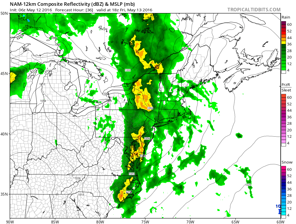
Severe Weather Risk NAM MODEL FRIDAY LATE AFTERNOON
Severe Weather Risk Saturday NAM MODEL LATE SATURDAY
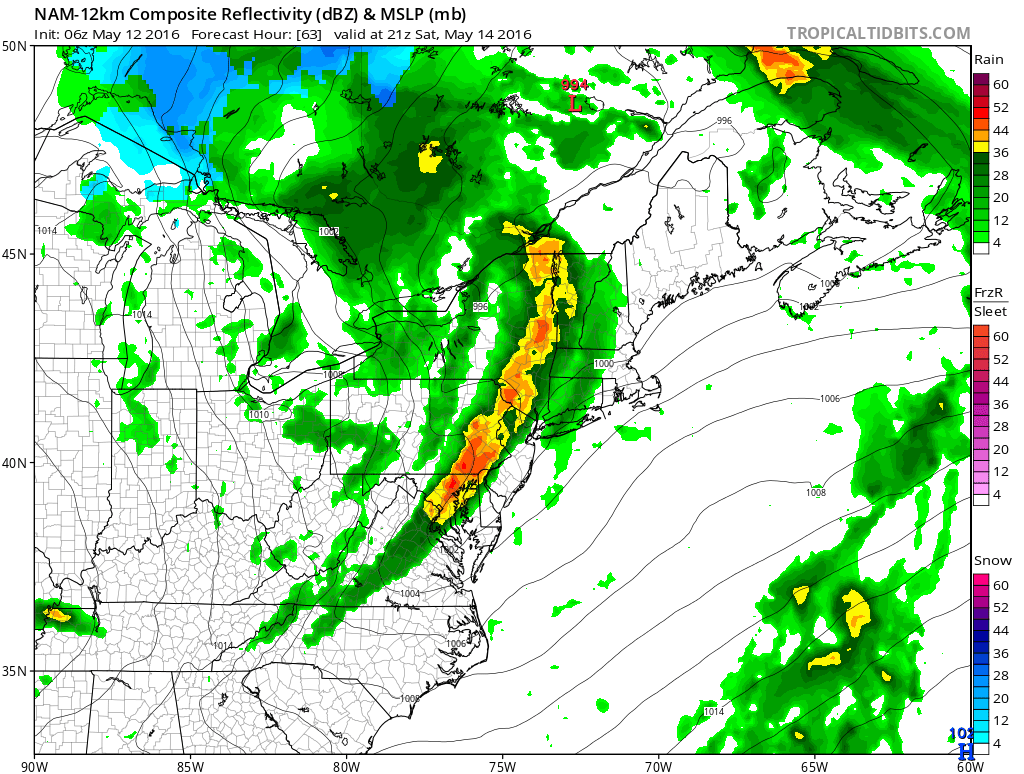
Here are the nam depictions with the two fronts and the model is definitely more impressive with the second line than the first. Other weather models are on the same page with this. Very chilly air follows Sunday and Monday with highs just in the upper 50s to lower 60s both days.
FiOS1 News Weather Forecast For Long Island
FiOS1 News Weather Forecast For New Jersey
FiOS1 News Weather Forecast For Hudson Valley
NATIONAL WEATHER SERVICE SNOW FORECASTS
LATEST JOESTRADAMUS ON THE LONG RANGE

NOMINATED FOR AN APPY AWARD FOR BEST WEATHER APP!!
Weather App

Don’t be without Meteorologist Joe Cioffi’s weather app. It is really a meteorologist app because you get my forecasts and my analysis and not some automated computer generated forecast based on the GFS model. This is why your app forecast changes every 6 hours. It is model driven with no human input at all. It gives you an icon, a temperature and no insight whatsoever.
It is a complete weather app to suit your forecast needs. All the weather information you need is right on your phone. Android or I-phone, use it to keep track of all the latest weather information and forecasts. This weather app is also free of advertising so you don’t have to worry about security issues with your device. An accurate forecast and no worries that your device is being compromised.
Use it in conjunction with my website and my facebook and twitter and you have complete weather coverage of all the latest weather and the long range outlook. The website has been redone and upgraded. Its easy to use and everything is archived so you can see how well Joe does or doesn’t do when it comes to forecasts and outlooks.
Just click on the google play button or the apple store button on the sidebar for my app which is on My Weather Concierge. Download the app for free. Subscribe to my forecasts on an ad free environment for just 99 cents a month.
Get my forecasts in the palm of your hand for less than the cost of a cup of Joe!
![]()

