

USE THE COUPON CODE “SPRING2026” AND GET 10 PERCENT OFF ON ANY PURCHASE

Severe Thunderstorm & Tornado Risks Rise Along With Flash Flood Potential
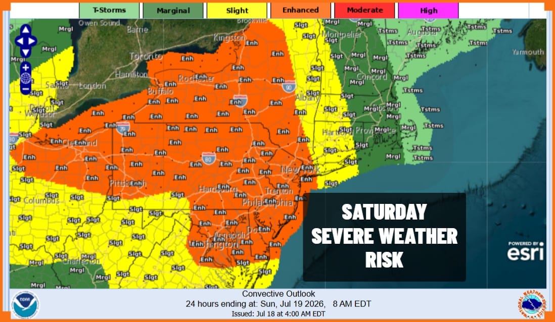
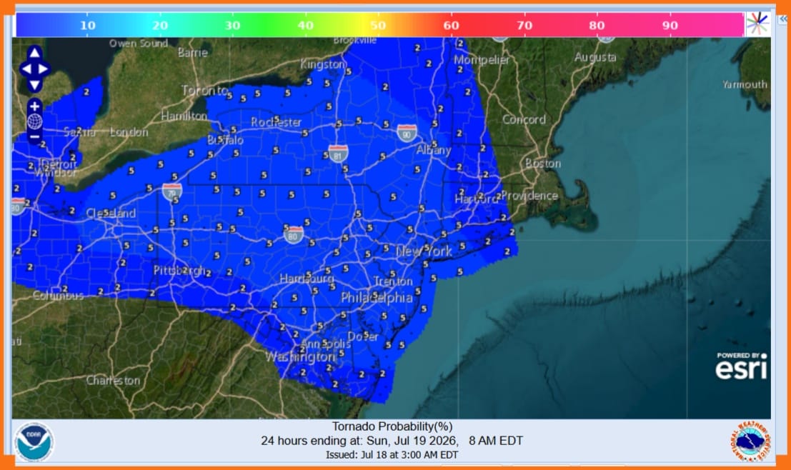
This is not going to be a pretty day across Eastern Pennsylvania to Southern New England. The Storm Prediction Center increased the risk to enhanced or a 30 percent chance for severe storms and it expanded the area eastward to New York City and much of the Hudson Valley. In addition we have elevated tornado risk with a 5 percent chance of a few spin ups developing.
Clouds have moved in from overnight and radars are already showing showers and thunderstorms developing to the west and south and they are heading eastward. It will not rain continuously however when it does it could be heavy or even torrential given the upper air trough coupling with abundant tropical moisture. Most areas will see an inch to an inch and a half of rain however in thunderstorms, local amounts could be 50 to 100 percent higher. Flash flood risks are elevated across the entire region.
SATELLITE WITH LIGHTNING STRIKES

WEATHER RADAR

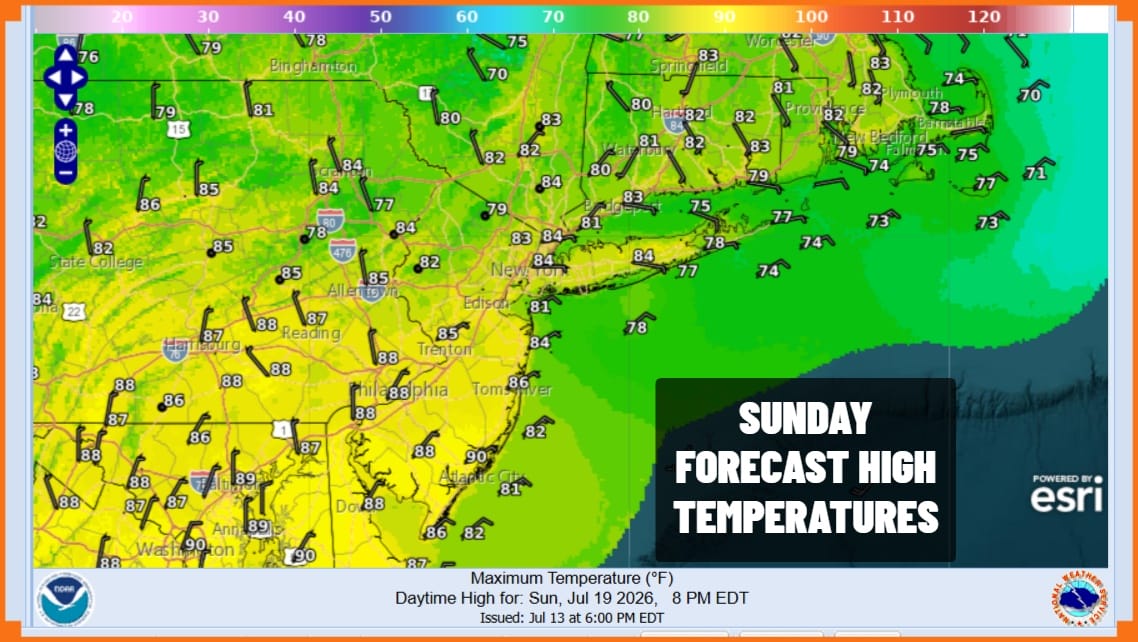
Radars are already revving up to the south and west. The worst of this will be this afternoon into tonight as the cold front nears. We will likely see severe thunderstorm and/or tornado watches going up for parts of the area. Once the front passes offshore tonight the showers and storms end and we are setting up for improving weather conditions for Sunday. Look for sunshine and lower humidity with Sunday highs in the low to middle 80s.
The weather pattern next week remains active. Look for a dry nice Monday of sunshine and highs again in the low and mid 80s. Then we do it all over again Tuesday with low pressure to our west and north and another warm front/cold front combination. That means we could see developing showers and thunderstorms along with the risk for severe weather and flash flooding.
DOWNLOAD THE UPSIDE APP & EARN CASH AT GAS STATIONS, RESTAURANTS, & SUPERMARKETS

BE SURE TO DOWNLOAD THE FREE METEOROLOGIST JOE CIOFFI WEATHER APP &
ANGRY BEN’S FREE WEATHER APP “THE ANGRY WEATHERMAN!
MANY THANKS TO TROPICAL TIDBITS FOR THE USE OF MAPS
Please note that with regards to any severe weather, tropical storms, or hurricanes, should a storm be threatening, please consult your local National Weather Service office or your local government officials about what action you should be taking to protect life and property.
