

USE THE COUPON CODE “SPRING2026” AND GET 10 PERCENT OFF ON ANY PURCHASE

Dry Monday But Another Round of Heavy Thunderstorms
& Severe Weather Risk Tuesday
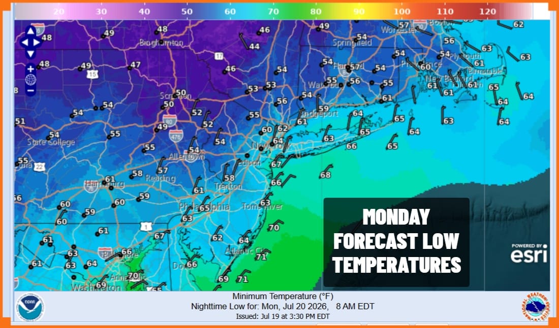
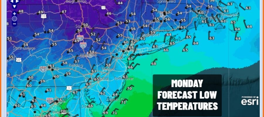
Certainly the second half of the weekend wound up being much better than the first. Satellite and radar loops show the frontal boundary lying across the Central Mid Atlantic states and we can see showers and thunderstorms to the south of that boundary. To the north there was low humidity and sunshine today and tonight looks to be a nice clear and comfortably cool night with most lows in the middle 50s inland to the lower 60s along the coast and in warmer urban locations.
SATELLITE WITH LIGHTNING STRIKES

WEATHER RADAR

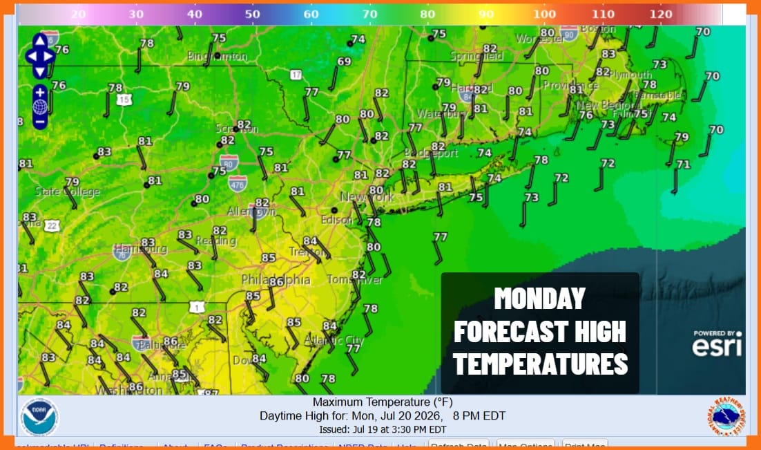
There are no weather issues for Monday which is shaping up to be a very nice day. We are looking at plenty of sunshine for much of the with reasonable temperatures and reasonable humidity levels. Most highs will reach the low and middle 80s, slightly lower at the beaches. Dew points will remain in 50s all day long.
The current weather pattern of strong troughs wanting to drop into the Eastern US and this poses issues once again for Tuesday. Warm tropical air will be surging northward ahead of another cold front and this is going to set us up for another round of showers, thunderstorms and the risk for severe weather. The Storm Prediction Center is indicating a slight risk for severe weather with enhanced risk to the west.
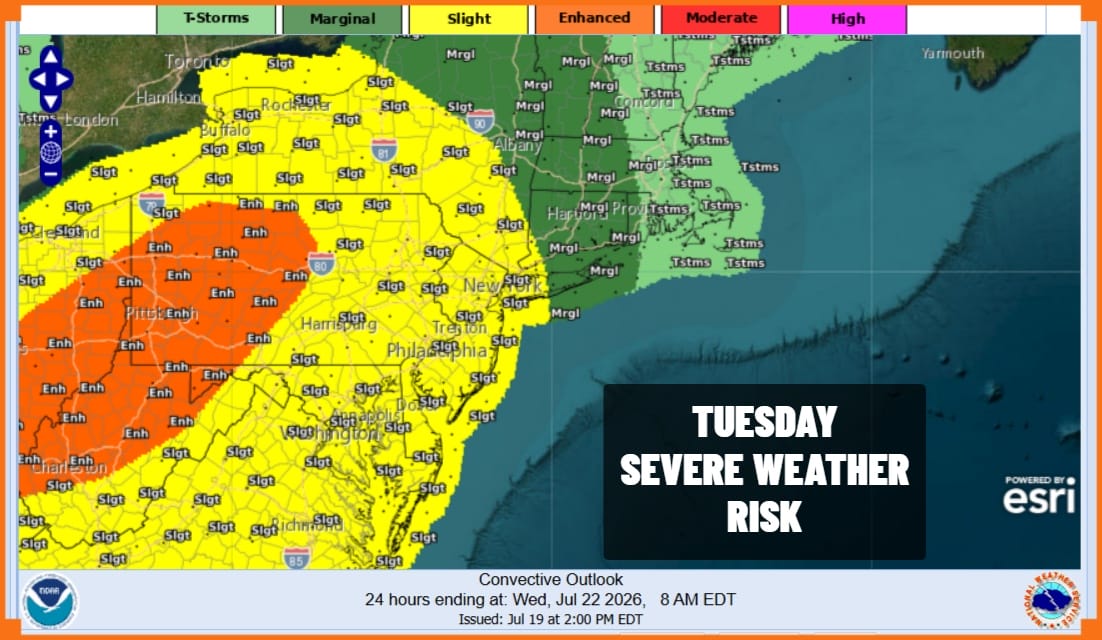
This is an early forecast outlook and since this system sets up in a similar fashion to what happened Saturday, we expect to see risk areas to be raised and extended by the time we get to Tuesday. Pennsylvania and New Jersey as well as Southeastern New York will be in the thick of it. You can expect flash flood risks to be elevated as well and the Weather Prediction Center is indicating a marginal risk for flash flooding for much of the region from Pennsylvania to Southern New England and Long Island.
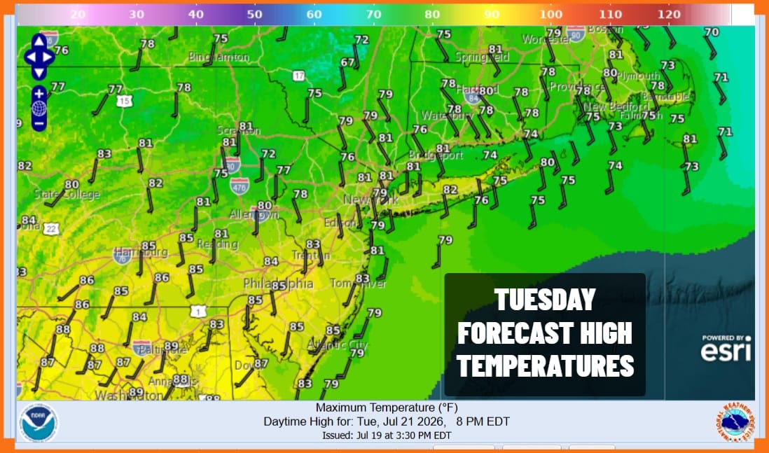
Tuesday high temperatures will be in the upper 70s and lower 80s with much higher humidity. This next cold front will probably not push through until sometime Wednesday so showers and thunderstorms could continue into Wednesday morning before weather conditions improve. By the time we reach Thursday and Friday we will see dry conditions, sunshine and low humidity returning with reasonable temperatures for this time of year.
DOWNLOAD THE UPSIDE APP & EARN CASH AT GAS STATIONS, RESTAURANTS, & SUPERMARKETS

BE SURE TO DOWNLOAD THE FREE METEOROLOGIST JOE CIOFFI WEATHER APP &
ANGRY BEN’S FREE WEATHER APP “THE ANGRY WEATHERMAN!
MANY THANKS TO TROPICAL TIDBITS FOR THE USE OF MAPS
Please note that with regards to any severe weather, tropical storms, or hurricanes, should a storm be threatening, please consult your local National Weather Service office or your local government officials about what action you should be taking to protect life and property.
