

USE THE COUPON CODE “summer2026” AND GET 10 PERCENT OFF ON ANY PURCHASE

Severe Thunderstorm & Flash Flood Risk Thursday As Front Approaches
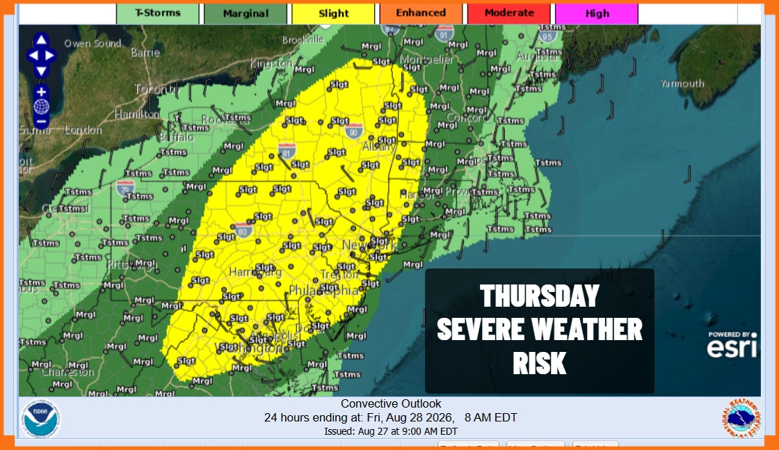
Another cold front and another upper trough are on their way to the Northeast and Mid Atlantic states. Risk areas per the Storm Prediction Center have been expanded to cover areas from Northern Virginia to Northern New England. This includes almost all of Pennsylvania, New Jersey, New Yor State, Western Connecticut, and Long Island. We have been through this many times this summer and with these storms will come random areas of heavy rain and flash flooding. Flood watches are posted for Eastern Pennsylvania, almost all of New Jersey, New York City, Western Long Island and the Lower Hudson Valley.
SATELLITE WITH LIGHTNING STRIKES

WEATHER RADAR

The warm sector of the low pressure area in Southeastern Canada is setting up and radars are showing some slow moving thunderstorms at midday but we will also see additional showers and thunderstorms fire up during this afternoon and lasting into this evening. Remember the randomness of these storms means that some get more than others, and some may miss out. Tornado risk exists as well and one or two tornadoes spinning up would not be a surprise.
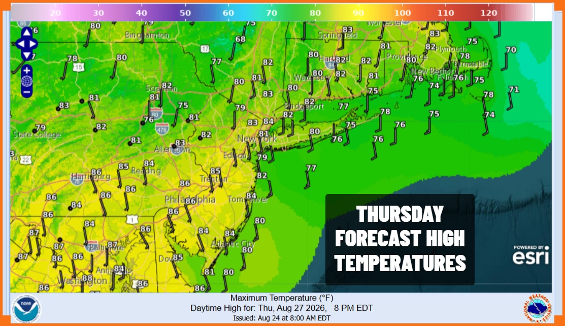
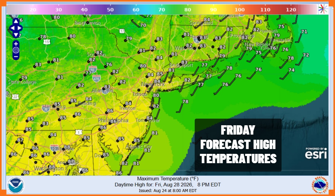
Temperatures will reach into the 80s and then settle back once rain falls. It all moves out this evening and then we will have leftover clouds overnight with lows in the mid 60s to lower 70s. The front is going to stall overhead Friday so it remains humid and there could be another round of scattered showers and storms Friday mainly along the coastal plain. This likely happens from late morning to late afternoon. Highs Friday will reach into the 80s. An upper trough will sweep showers to the east late in the day.
We will get a slight break in the humidity Saturday especially from New York City northward. Saturday will be a rain free day with sunshine taking highs into the low and middle 80s Sunday will be very warm and humid with some sunshine and the chance for afternoon and evening scattered showers and thunderstorms. Sunday highs will be in the middle to some upper 80s.
MANY THANKS TO TROPICAL TIDBITS FOR THE USE OF MAPS
Please note that with regards to any severe weather, tropical storms, or hurricanes, should a storm be threatening, please consult your local National Weather Service office or your local government officials about what action you should be taking to protect life and property.
