
Rain Overnight Into Monday Another System Brings Rain
Tuesday Night Into Wednesday
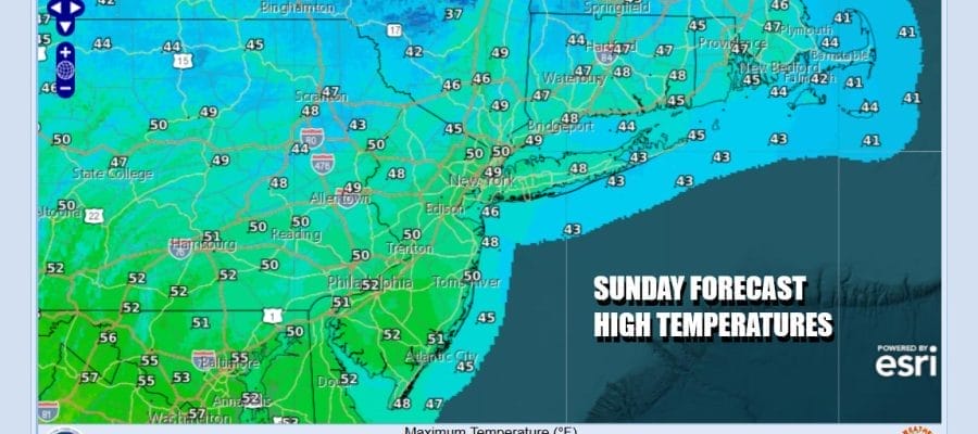
It is a chilly Sunday across the Northeast & Middle Atlantic states but we do seem to be still in that sweet spot. Satellite loops show little in the way of clouds for now but we do have an approaching cold front to the west. Much of today though should feature sunny skies but temperatures will be on the chilly side of normal. Most highs will be in the upper 40s to lower 50s. Radars are nice and quiet and should remain so right through this evening.
SATELLITE WITH LIGHTNING STRIKES

WEATHER RADAR

Low pressure is over the Great Lakes and it will be heading eastward into Southeastern Canada. The trailing cold front extends southward from the low through the Great Lakes and into the Lower Mississippi Valley & Deep South. There will be an area of snow that will develop across Northern NY and Northern New England tonight as a warm front moves northward. Eastern Pennsylvania to Southern New England will see some rain showers overnight into the first part of Monday.

Temperatures overnight will be in the mid 30s to around 40 or so. The warm front should push to the north Monday morning and then the cold front moves to the east. Rain should end from west to east around midday and then we will have leftover clouds Monday afternoon with perhaps some breaks of sunshine. Afternoon highs Monday will range from the mid 50s northern areas to lower 60s South Jersey & points southward.

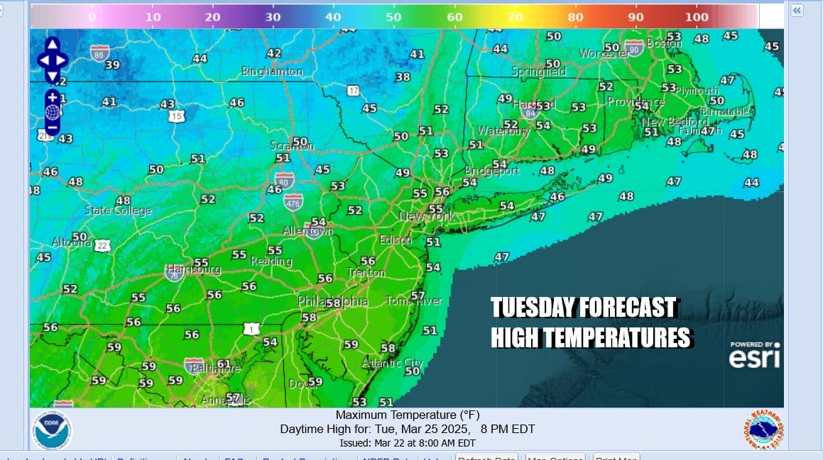
Slightly cooler air comes in Tuesday which overall should be a dry day with sunshine giving way to some arriving clouds. Temperatures Tuesday will be topping out in the 50s. Weak low pressure will be diving southeast into the Middle Atlantic and track northeastward from there. Some rain is possible Tuesday night into Wednesday morning as the low goes by. It is a weak system and the rain won’t amount to much. Later Wednesday will be a chilly day with clouds giving way to sunshine. Highs will just be in the upper 40s and lower 50s.

A dry weather pattern takes hold for Thursday and Friday with near seasonal temperatures. Action late this week and next weekend will be to our west as a storm develops in the Central Plains and this will likely lead to severe weather returning to areas across the Midwest and Deep South. Here in the East it looks to remain quiet weather wise probably through next weekend.
BE SURE TO DOWNLOAD THE FREE METEOROLOGIST JOE CIOFFI WEATHER APP &
ANGRY BEN’S FREE WEATHER APP “THE ANGRY WEATHERMAN!
MANY THANKS TO TROPICAL TIDBITS FOR THE USE OF MAPS
Please note that with regards to any severe weather, tropical storms, or hurricanes, should a storm be threatening, please consult your local National Weather Service office or your local government officials about what action you should be taking to protect life and property.


