
Perfect Weather For Mothers Day Rain Arrives During Tuesday

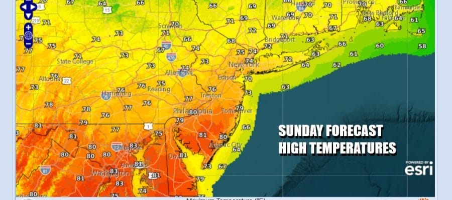
You couldn’t ask for better weather for Mother’s Day. High pressure in Southeastern Canada is holding firm today. Dry air covers the Northeast and Northern Mid Atlantic states and it will likely hold on into Monday. We are going to see lot of sunshine today. Temperatures are going to have a bit of a range though from the 60s over Southern New England and Eastern Long Island, the 70s across the Lower Hudson Valley, NYC and Northern New Jersey, and highs in Southern New Jersey and points south will reach the upper 70s and lower 80s. Radars are nice and quiet and there are no weather issues at all today or tonight when skies will be clear and most lows wiil be in the 50s.
SATELLITE WITH LIGHTNING STRIKES

WEATHER RADAR

Low pressure is over the Gulf States today and tonight. It is spreading bands of downpours and thunderstorms from Alabama east to Georgia and then northeast to the Carolinas. The northwest flow over New England is keeping this system away Monday but the moisture will start advancing into the Middle Atlantic states and it will eventually reach Southern New England Tuesday.

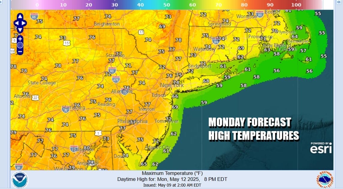
This system will only get so far north before it hits the northwest flow over New England so the heaviest rain likely will stay to the south of Eastern Pennsylvania to Southern New England. Also the rain may struggle at least initially as it tries to push north of New York City and into Southern New England. Monday we will see sunshine giving way to some arriving clouds later in the day. Most highs will be in the 70s.
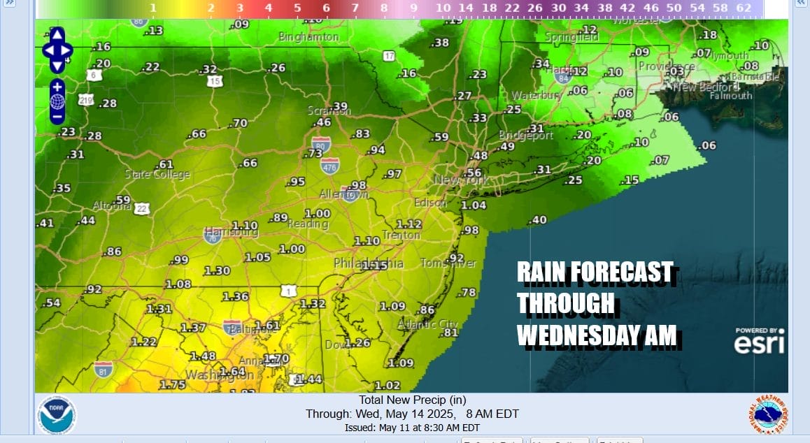
Monday night and Tuesday we will see cloudy skies with rain pushing northward. Tuesday highs will be in the upper 60s and lower 70s. We will likely see a repeat performance Wednesday. The rain will likely not be continuous so there will be dry periods in between Rainfall forecast amounts through Wednesday as much lower as you go north and a bit more robust as you head south.
Give the slow moving nature of this system we may still be dealing with occasional showers Thursday and Friday though it will be dry most of the time. Temperatures will like edge into the 70s for the end of the week. Shower risks could continue into next weekend as a weather front approaches from the northwest.
BE SURE TO DOWNLOAD THE FREE METEOROLOGIST JOE CIOFFI WEATHER APP &
ANGRY BEN’S FREE WEATHER APP “THE ANGRY WEATHERMAN!
MANY THANKS TO TROPICAL TIDBITS FOR THE USE OF MAPS
Please note that with regards to any severe weather, tropical storms, or hurricanes, should a storm be threatening, please consult your local National Weather Service office or your local government officials about what action you should be taking to protect life and property.


