

Clouds Start Moving In Ahead of Some Showery Rains Tuesday & Wednesday
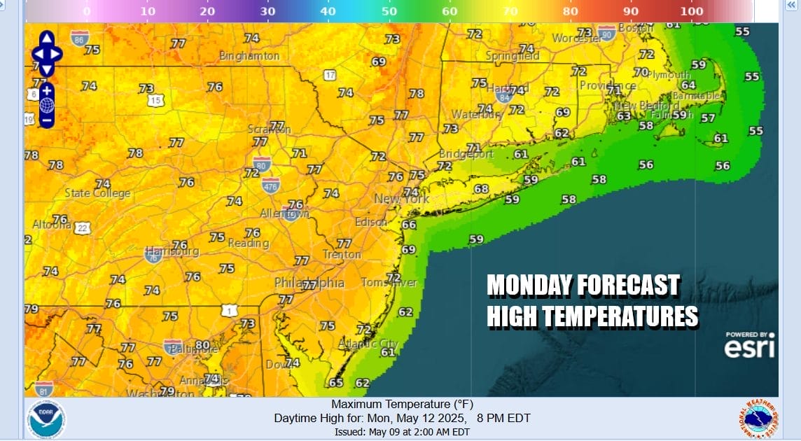
We begin the new work week nice dry and sunny but it won’t last long. Satellite loops and radars show lower pressures over the Mid Atlantic and Southeastern States. Moisture is slowly crawling northward so we will see sunshine slowly giving way to arriving afternoon clouds. Most highs today will be in the 70s except a little cooler along south and east facing shorelines. No rain is forecast today. Clouds will continue to increase overnight and some rain will spread northward through Eastern Pennsylvania and New Jersey during the overnight hours into daybreak Tuesday.
SATELLITE WITH LIGHTNING STRIKES

WEATHER RADAR

When we look at what is happening in the upper atmosphere, we have a northwest flow across New England while the upper trough in the Deep South lifts northward into that northwest flow. This means that the southern weather system and the moisture associated with it will only make it so far north before it gets pushed the east. The northern limits appear to be the Hudson Valley and Connecticut.

Heavy rains of several inches or more are forecast for much of the western half of Virginia as well as Central and Western North Carolina. We will avoid those larger amounts and for most areas, rainfall Tuesday through Thursday morning will be in a range of a half inch to an inch. Spread out over a 60 hour period from midnight tonight to Thursday morning it means that probably much of the time it won’t be raining.

Showery rains will be around Tuesday through Wednesday. Some dry periods will occur from time to time. If you are north of NYC it may actually wind up being dry most of the time. i’m not expecting much in the way of sunshine. There might actually be some breaks in the cloud cover but will tend to self destruct. Highs Tuesday and Wednesday will be mostly in the upper 60s and lower 70s.


We will likely see the risk for showery rains continue Thursday and Friday though they are more likely to occur during the afternoon and evening hours. We might even through in a thunderstorm or two in the mix. Right now the weekend appears somewhat unsettled as a storm heads for the Upper Midwest and a cold front pushes eastward.
BE SURE TO DOWNLOAD THE FREE METEOROLOGIST JOE CIOFFI WEATHER APP &
ANGRY BEN’S FREE WEATHER APP “THE ANGRY WEATHERMAN!
MANY THANKS TO TROPICAL TIDBITS FOR THE USE OF MAPS
Please note that with regards to any severe weather, tropical storms, or hurricanes, should a storm be threatening, please consult your local National Weather Service office or your local government officials about what action you should be taking to protect life and property.


