
Onshore Flow Friday Leads to Showers Thunderstorms Later Saturday Dry Sunday
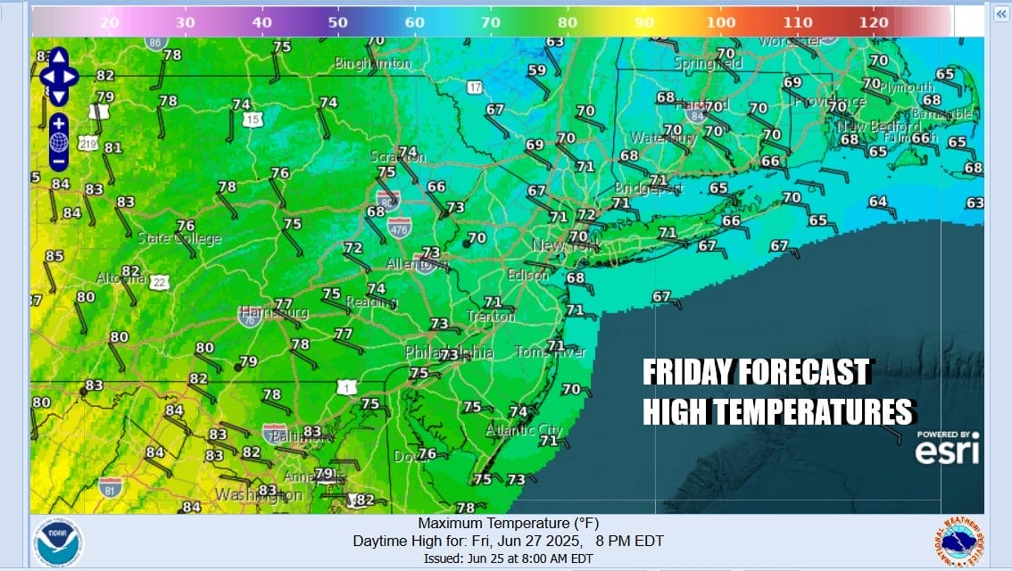
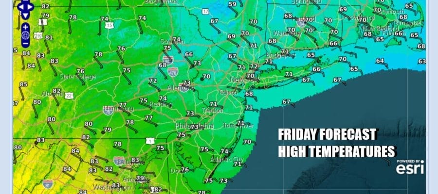
We have a frontal boundary lying across the Middle Atlantic states for one more day and that puts us in an easterly flow of air today. Lots of clouds will keep daytime heating to a minimum and temperatures today across Eastern Pennsylvania to Southern New England will have a tough time getting out of the 60s. Areas in South Jersey and points southward will see highs reaching the lower 70s. The influence of the ocean will keep the atmosphere rather stable today so no thunderstorms are expected but some light rain or drizzle is certainly a possibility from time to time and from place to place.
SATELLITE WITH LIGHTNING STRIKES

WEATHER RADAR

Heading into the weekend we are going to see the onshore flow relax tonight as winds turn from east to south. Clouds and some patchy fog will be around overnight with most lows in the 60s to near 70. Saturday we will see a cloudy to partly sunny type of day and with winds going from east to south and eventually southwest, temperatures should be able to recover back into the 80s in most places away from the ocean.

We do have a cold front that is going to be approaching from Western Pennsylvania and Western New York in the afternoon and evening and that opens the door for the chance for thunderstorms and the possibility of severe weather. The Storm Prediction Center is forecasting a marginal risk for isolated severe thunderstorms from Upstate New York all the way south into Virginia and everyone in between.

Once the cold front passes a slightly drier air mass will move in for Saturday night and Sunday but it will not be much of a cooler air mass. We should see partly to mostly sunny skies for Sunday with high temperatures reaching the mid 80s to around 90 degrees in most places. Local sea breezes will likely keep the beaches and coastal areas a little cooler during the afternoon and evening hours.

Next week the highlight is the 4th of July holiday on Friday so it is a big vacation week. It does appear that we will be in summer mode with very warm to hot days and very warm and humid nights through Wednesday. At the moment much of the week will be on the dry side especially the second half of the week. There are shower and thunderstorm and possibly some severe weather risks on the agenda for Tuesday July 1st but the end of next week looks right now to be sunny and dry with reasonable temperatures and humidity.
BE SURE TO DOWNLOAD THE FREE METEOROLOGIST JOE CIOFFI WEATHER APP &
ANGRY BEN’S FREE WEATHER APP “THE ANGRY WEATHERMAN!
MANY THANKS TO TROPICAL TIDBITS FOR THE USE OF MAPS
Please note that with regards to any severe weather, tropical storms, or hurricanes, should a storm be threatening, please consult your local National Weather Service office or your local government officials about what action you should be taking to protect life and property.


