
Heatwave Broken As Onshore Flow Takes Hold Through Friday
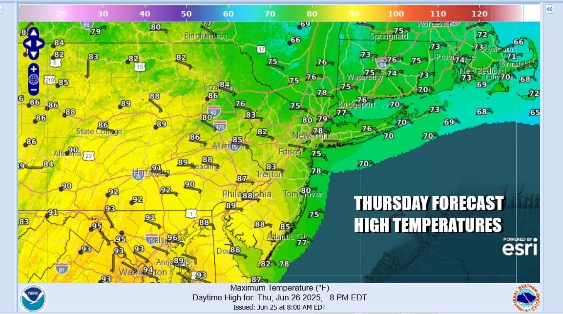
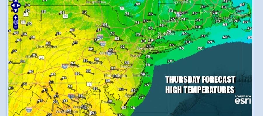
We speak often about the “curse of the onshore flow” but this may be the “blessing of the onshore flow” as a back door weather front continues to crawl its way southward. Winds have shifted in many places to the northeast and east and that sets up for a 20 degree or higher temperature change in some areas. Northern New Jersey to New York City, and Long Island will see temperatures 20 to 25 degrees lower than yesterday. Instead of upper 90s to over 100 degrees, most temperatures today will be in the 70s. South Jersey and Southern Pennsylvania southward will be a little higher with temps in the upper 70s to lower 80s for highs.
SATELLITE WITH LIGHTNING STRIKES

WEATHER RADAR

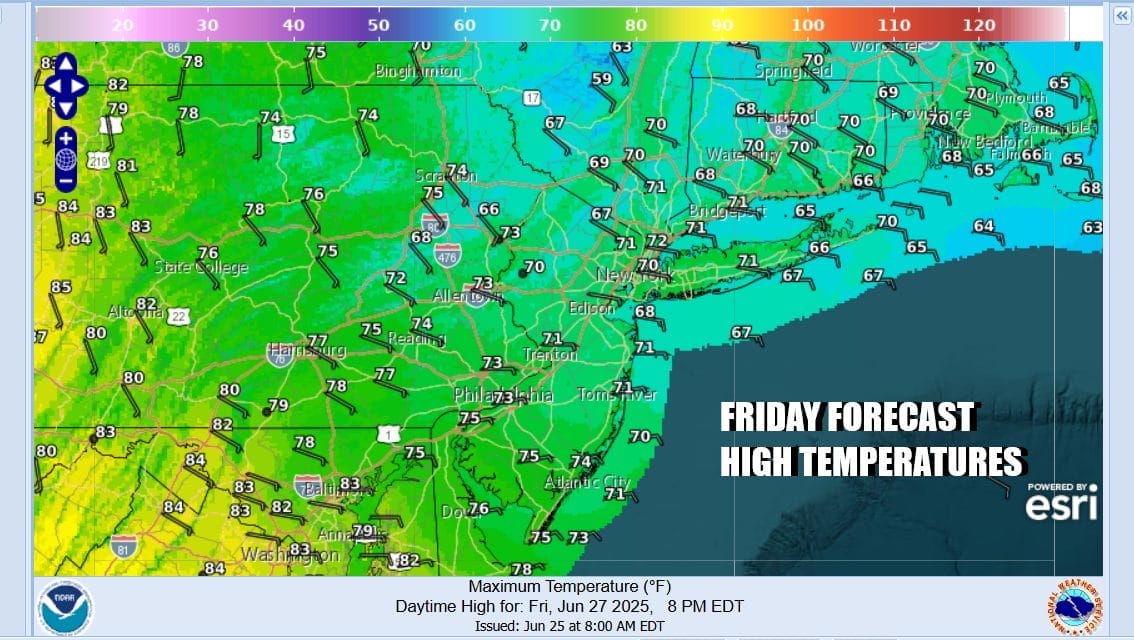
There could be some scattered showers and thunderstorms that develop later this afternoon and tonight. Highest risk will likely be in areas across Southern Pennsylvania and Southern New Jersey southward though we can’t rule it out for other areas. The east wind will increase tonight as temperatures drop to the 60s and even some upper 50s inland. Friday we see lots of clouds around, an east wind and highs in the upper 60s to lower 70s at best. We will throw in the chance for some patchy light rain or drizzle especially at the coast.
Friday night and Saturday we will see winds turn from east to south and that will allow temperatures to rise Saturday. We also have a cold front that will be moving southeast from the Great Lakes. Look for sunshine and clouds Saturday with highs in the low to mid 80s. There is the chance we could see some showers and thunderstorms move through during the afternoon and evening hours.

This front should pass offshore and right now it seems that Sunday could be a nice sunny very warm day with highs in the mid to upper 80s. Next week looks rather summery but not crazy hot. We will likely see temperatures make a run for 90 degrees again and the risk for thunderstorms for the first half of the week but it may turn nice and dry for the second half with a little bit of luck.
BE SURE TO DOWNLOAD THE FREE METEOROLOGIST JOE CIOFFI WEATHER APP &
ANGRY BEN’S FREE WEATHER APP “THE ANGRY WEATHERMAN!
MANY THANKS TO TROPICAL TIDBITS FOR THE USE OF MAPS
Please note that with regards to any severe weather, tropical storms, or hurricanes, should a storm be threatening, please consult your local National Weather Service office or your local government officials about what action you should be taking to protect life and property.


