

USE THE COUPON CODE “summer2026” AND GET 10 PERCENT OFF ON ANY PURCHASE

Onshore Flow Curse This Week &
Nor’easter Potential Continues Friday & The Weekend
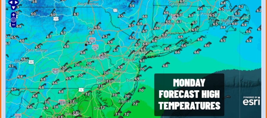
We have a lot happening this week. First off is today is the last full day of summer with autumn arriving Tuesday. Then we have the approaching full moon which is Saturday September 26th. This isn’t good news because we also continue to struggle with the possibility of a nor’easter developing late this week and bringing wind, rain, and coastal flooding. First things first is that we have to get there from here and today we are seeing the beginnings of a blocking high building in Eastern Canada. It seems the high is a little stronger and that is good news in that we can take the rain forecast for tonight and Tuesday and minimize it just some spotty light rain or drizzle as the rain area shifts southward into the Mid Atlantic states. Today we will see mainly cloudy skies with an ocean wind, some spotty light rain or drizzle and temperatures mostly in the 60s.
SATELLITE WITH LIGHTNING STRIKES

WEATHER RADAR

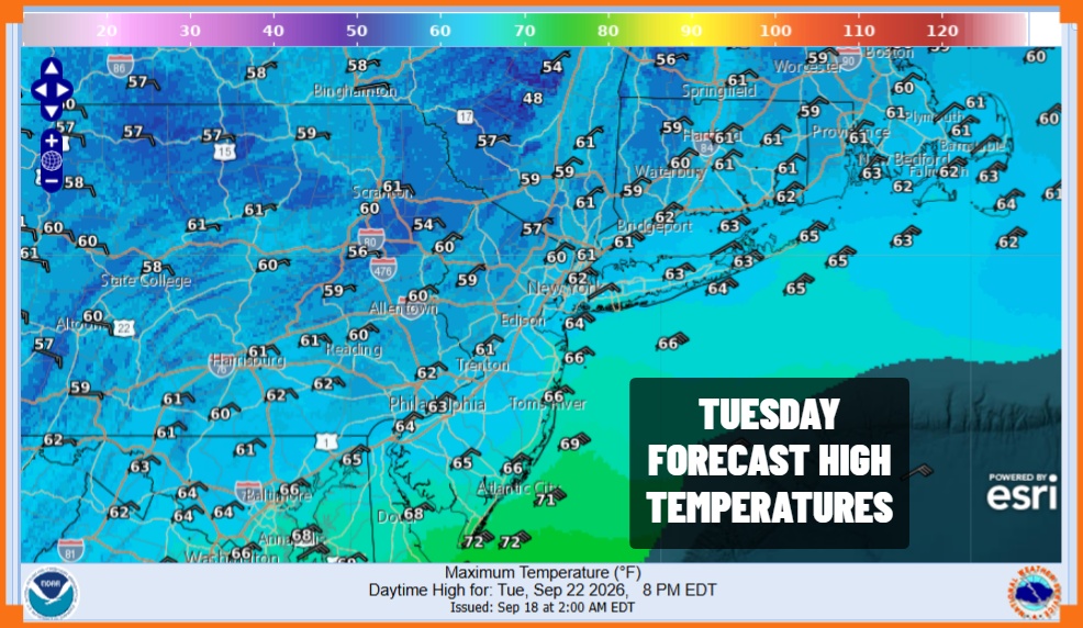
The onshore flow strengthens tonight into Tuesday. Cloudy skies will continue Tuesday and there is the chance for light rain or drizzle overnight as well as during the day Tuesday but we do expect any precipitation to be on the patchy side. Lows tonight will be in the 50s to near 60 and highs Tuesday will be mostly in the 60s coupled with a northeast to east wind off the ocean.
The strong high in Eastern Canada will force some drier air southward Wednesday so we may see clouds give way to some breaks of sunshine but the best chances for this to happen will be from Northern New Jersey and New York City north and east. The same holds for Thursday with highs generally in the 60s.
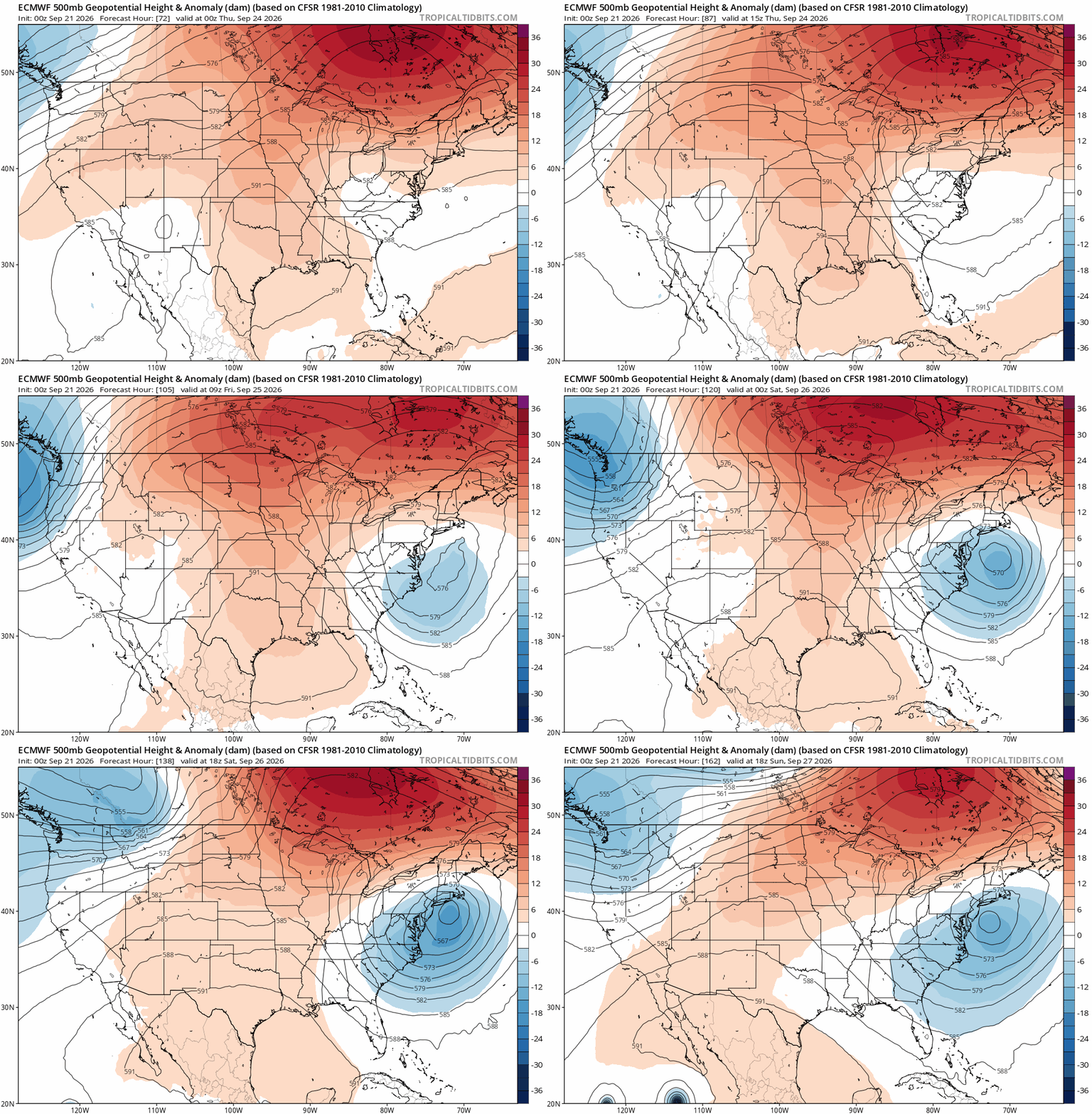
Energy from the Plains will undercut the strong ridge in Eastern Canada forcing a storm to develop off the North Carolina and Virginia coast to the east. Depending on the strength of that upper ridge to north acting as a block, the storm will be forced northward and possibly northwestward but there is still quite a bit of uncertainty regarding the block strength. A weaker ridge could allow the low to move more to the east than north. For now we will forecast weather conditions to deteriorate Friday and into the weekend. Depending on the block, this could be a long duration event lasting through the weekend. In any case, the northeast to east wind off the ocean is going to create rough ocean seas and eventually higher than normal tides late this week and into the weekend creating coastal flooding issues. We also have a full moon Saturday so tides will be rising in response to this. Models will start to settle in over the next day or two regarding this storm and we will adjust and zero in on forecast implications accordingly.
MANY THANKS TO TROPICAL TIDBITS FOR THE USE OF MAPS
Please note that with regards to any severe weather, tropical storms, or hurricanes, should a storm be threatening, please consult your local National Weather Service office or your local government officials about what action you should be taking to protect life and property.
