
One Last 90 Degree Day Inland Before Temps Ease
Cold Front Flips To Colder Pattern Sunday
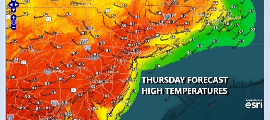
The launching pad to a third day of highs reaching above 90 degrees was set this morning when lows in many areas couldn’t even break below 60 degrees. We continue to see a frontal boundary lying across Upstate New York through Central New England. Thunderstorms and severe weather are possible along the I-90 Corridor from west to east. However to the south across Eastern Pennsylvania to Southern New England it will be a mainly sunny hot day with highs once again reaching the upper 80s and lower 90s. Temperatures at the shore will be cooler but even coastal areas will probably reach the upper 70s to around 80 degrees before local sea breezes come in. No showers or thunderstorms are in the forecast for today.
SATELLITE WITH LIGHTNING STRIKES

WEATHER RADAR

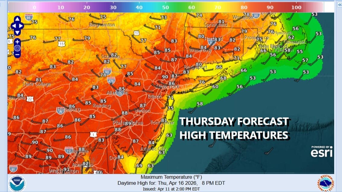
Temperatures these last 3 days have been running 20 to 25 degrees above average with some record highs being set. Today however will be the last day running this hot as we will see an upper trough approach tonight and Friday. There likely will be more clouds around later tonight and on Friday. We could see a shower or thunderstorm overnight in one or two spots but this trough is week. Friday we will probably go back and forth from clouds to sun. Highs will reach the 80s inland and 70s along the coast.
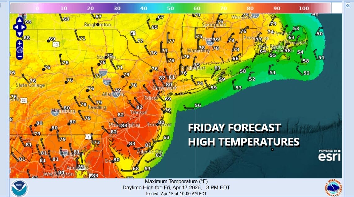
A major change in the weather pattern will get underway over the weekend. A cold front is moving eastward from the Mississippi Valley and Great Lakes and it will put an end to the above average temperatures we have been experiencing and flip the pattern to colder, and blockier for next week. Instead of 80s to near 90, we may be struggling early next week to get temperatures back to the 50s for highs.

Ahead of this Saturday we will see winds turn onshore from the southeast. That is going to create a wide range for high temperatures. Along the immediate coast it likely will be in the 50s. Work your way inland you start to see temperatures climb through the 60s and 70s. Well inland in Western New Jersey into Pennsylvania is where we could see highs in the upper 70s to around 80 degrees or so.

Skies should be generally partly sunny with some areas seeing more clouds than sun, and others the other way around for Saturday. Then Sunday it is all about a cold front and we will see showers come in during Sunday morning lasting through midday. Temperatures will be in the 60s and then front passes. Much colder air will come in on gusty northwest winds Sunday night and by Monday morning we will be down in the 30s and lower 40s. Monday will be a day of some sunshine but highs will only be in the upper 40s and lower 50s.
BE SURE TO DOWNLOAD THE FREE METEOROLOGIST JOE CIOFFI WEATHER APP &
ANGRY BEN’S FREE WEATHER APP “THE ANGRY WEATHERMAN!
MANY THANKS TO TROPICAL TIDBITS FOR THE USE OF MAPS
Please note that with regards to any severe weather, tropical storms, or hurricanes, should a storm be threatening, please consult your local National Weather Service office or your local government officials about what action you should be taking to protect life and property.


